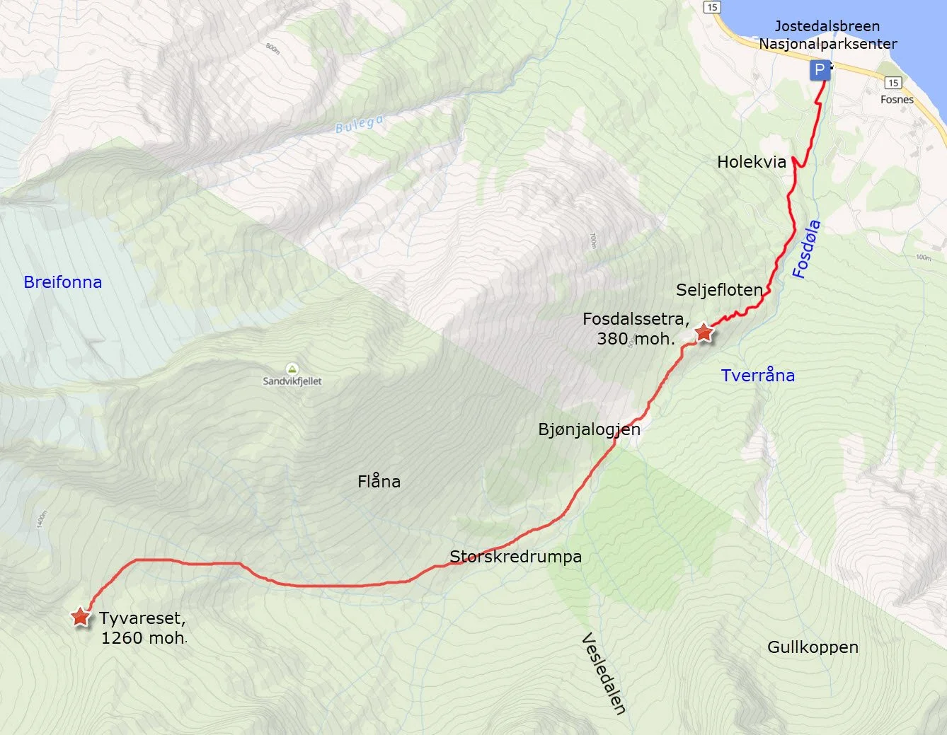
Hikes in Fosdalen
Fosdalen stretches approximately 4.5 kilometres southwest from Fosnes and ends near Stryneskåla (1848 m.a.s.l.). The hike into the valley begins close to the Jostedalsbreen National Park Centre.
The trail to Fosdalssetra is fairly steep in places, but it has been cleared and is generally easy to follow. Further into the valley, there may be a risk of avalanches in early summer, and rockfalls can occur during periods of heavy rainfall.
The valley has a fascinating history, including an ancient hunting and trapping system beneath Tafsehyrna and an old route across Tyvareset to Loen.
Parking is easily accessible. You can park beside Highway 15 above the National Park Centre at Fosnes, or in the National Park Centre's parking area on the opposite side of the road.
-
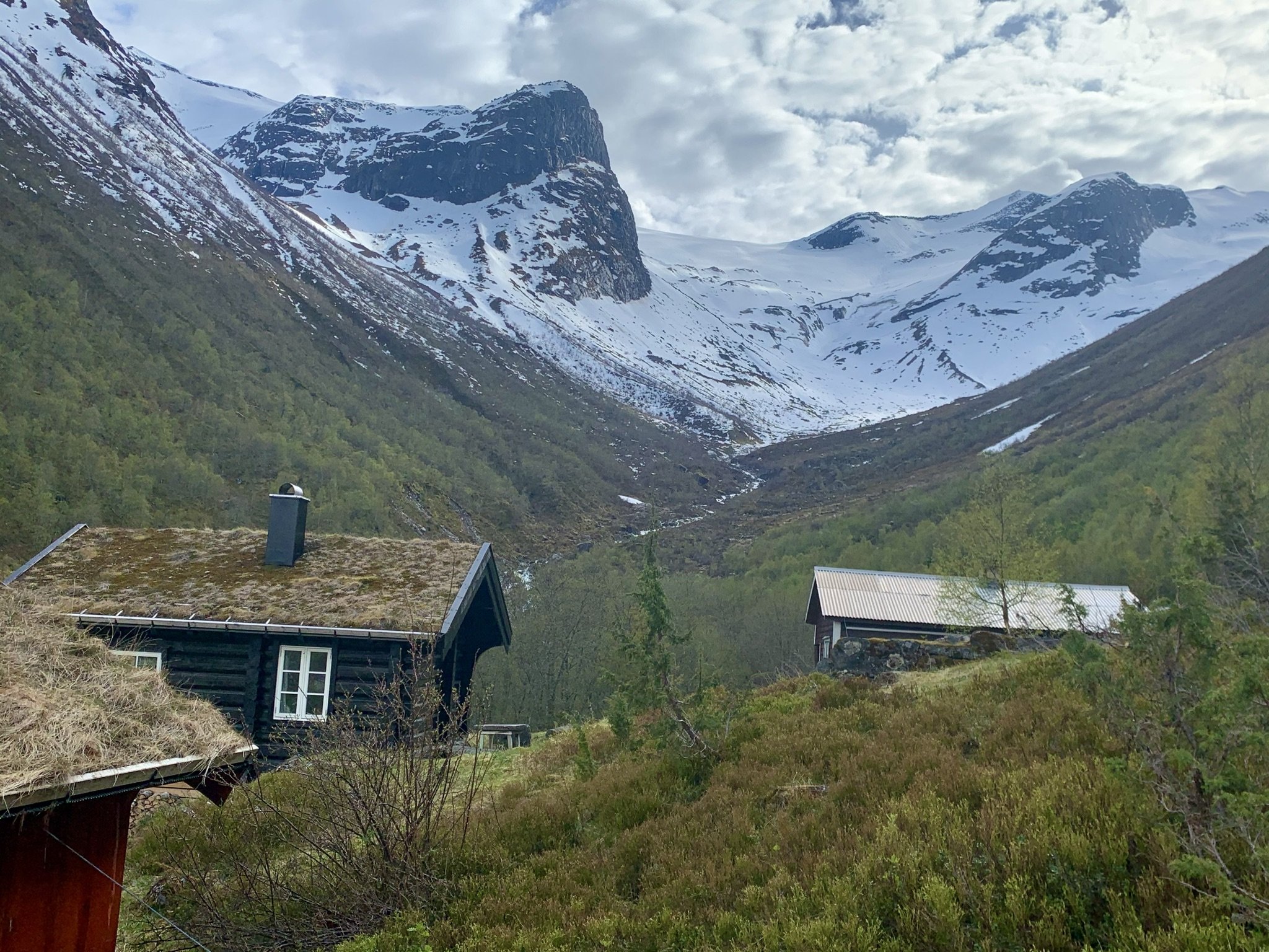
Hike to Fosdalssetra
Fosdalssetra is situated at only 380 metres above sea level, making it the lowest of our mountain summer farms. However, the hike is still demanding because it starts down by Lake Oppstrynsvatnet.
-
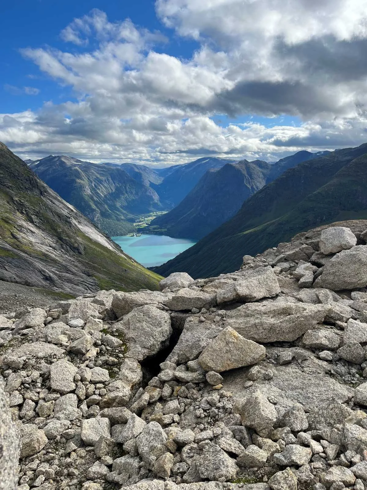
Hike to Tyvareset
The Tyvareset hike carries historical significance, following an old route between Oppstryn and Loen. It is a demanding hike through partly landslide-prone terrain.
Kart over turalternativ i Fosdalen