

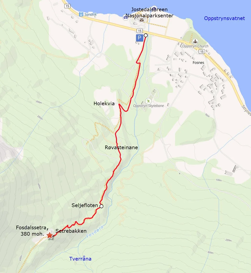
Hike to Fosdalssetra

Fosdalen seen from Glomnesnakken
Fosdalssetra is situated at just 380 meters above sea level, making it the lowest of all the mountain farms in Oppstryn. However, the hike can be somewhat challenging, as you will ascend approximately 350 meters in relatively steep terrain.
Fosdalen offers beautiful nature and fascinating cultural heritage from ancient times. The mountain farm was abandoned before World War II, and today, only sheep graze in the valley.
Grading: Moderate difficulty. The trail is somewhat challenging in certain areas.
Length: 1.7 km one way.
Elevation gain: 350 meters.
Duration: 2.5 hours round trip.
Season: Spring – Autumn.
Parking: You can park at the parking lot by Rv.15, near the Jostedalsbreen National Park Center.
Note: It is safe to walk to the mountain farm, but deeper into the valley, there may be a risk of snow and rock avalanches early in the summer.
Remember to keep your dog on a leash!
Culture and nature trail: You can find it here.
Hike description
From the parking lot, follow the tractor road along the Fosdøla river. The road passes a gravel pit and continues up to Holekvia.
From Holekvia, a forest road leads further up a relatively steep hill on the left. A short way up, you will pass an old barn. Further along, you have the option to take a shortcut through the spruce forest on the right.
If you stay on the forest road, you will pass two large boulders called Røvasteinane. In the past, this was the first resting spot on the way to Fosdalssetra. The stones likely got their name because foxes once had dens her. Fox is pronounced "røv" in the Oppstryn dialect.
Where the forest road makes a sharp right turn, the mountain farm trail continues straight ahead. For a short distance, the trail follows the edge of the gorge above Fosdøla. Spruce trees were planted here to prevent livestock from falling off the edge during the seasonal migrations to the farm. Before that, a brushwood fence had to be repaired each spring.
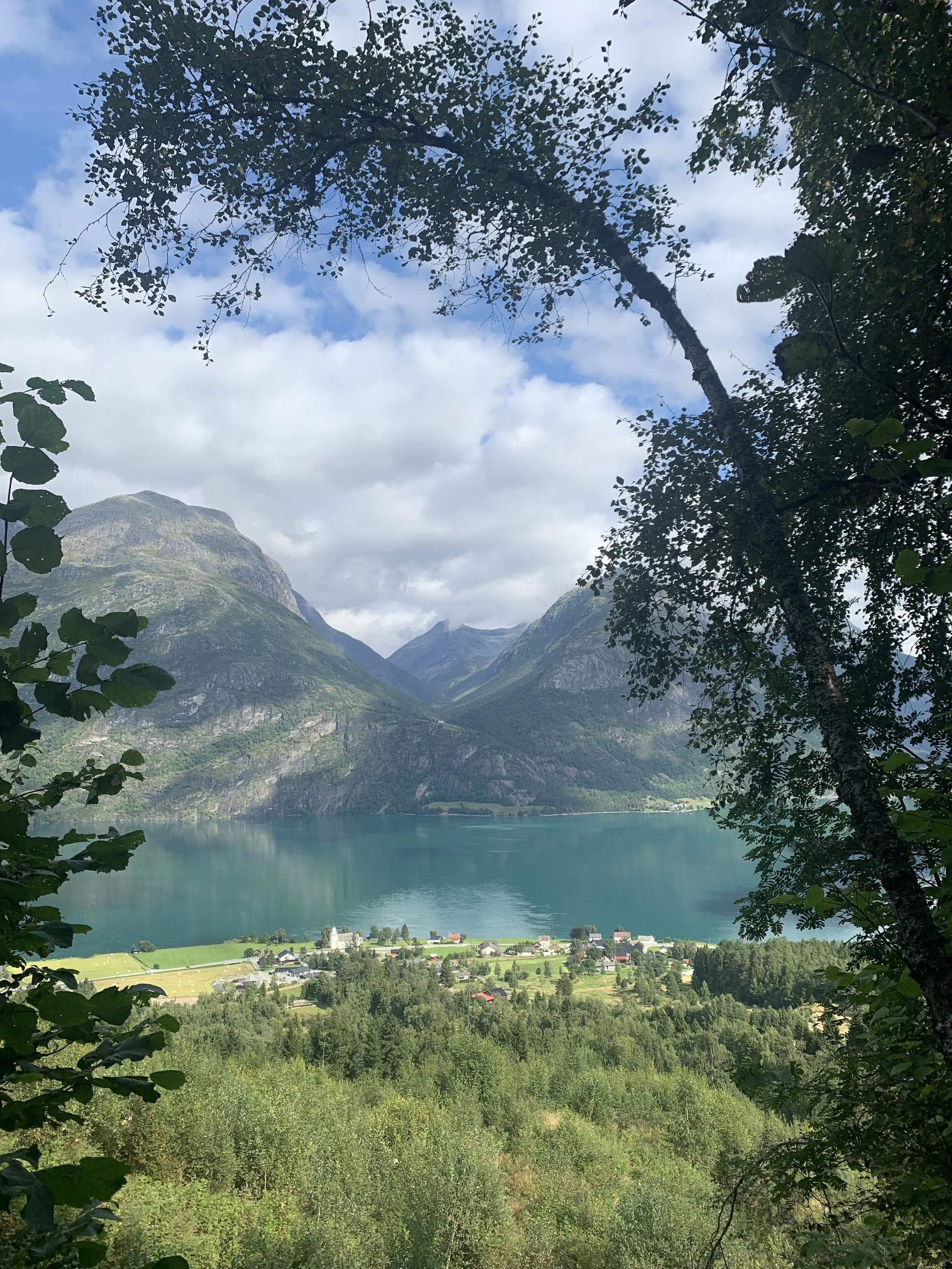
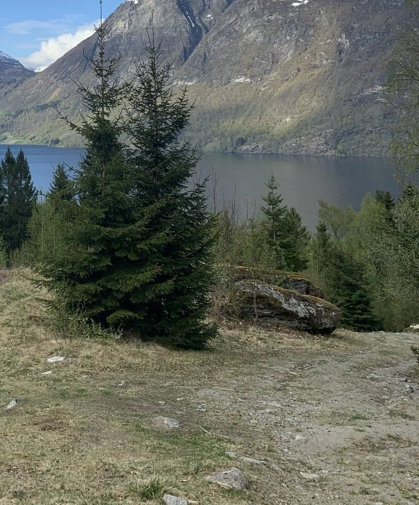
Once past the spruce-lined section of the gorge, you will soon reach the second resting place on the route, Seljefloten. Here, the terrain levels out slightly, opening up a view towards Oppstrynsvatnet, Glomsdalen, and Hjelledalen on the opposite side.
The name "Seljefloten" comes from "selje" (willow) and "flot," meaning a flat or open area. However, today, alder, birch, and rowan dominate the vegetation.
After Seljefloten, you will arrive at Setre-
bakken, the steepest part of the trail. Along the path, you will see some old, uniquely shaped birch trees—take a closer look.
At the top of Setrebakken, you will see the huts of Fosdalssetra.
Fosdalen is a short valley shaped by glaciers and rivers. Snow and rock avalanches are common in the steep mountainsides.
Fosdalssetra (summer farm) lies at the edge of an avalanche-prone area, and over the years, some of the huts have succumbed to the strong winds accompanying avalanches. Originally, there were six huts – three belonging to Sandvik and three to Fosnes.
Cows were milked at the mountain farm until 1935. Until 1970, cattle grazed in Fosdalen, but since then, only sheep have roamed the valley.
The valley is rich with alder forests, along with some rowan and birch trees. Fosdalen is one of the few places in Strynedalen where monkshood and foxglove grow together.

Monkshood , Aconitum Septentrionale

Foxglove , Digitalis Purpurea
The Hike in Pictures
View from the trail to Fosdalssetra. Looking towards Fosnes and Glomsdalen.

Holekvia
This area was once a hayfield. Today, it serves as pasture for sheep.
Holekvia is a terrace formed by loose sediments carried by the Fosdøla river during the melting of the great inland ice more than 10,000 years ago. These sediments were deposited into the sea, which at that time was 75 meters higher than today and reached all the way up to Folven and Guddal in Hjelledalen.
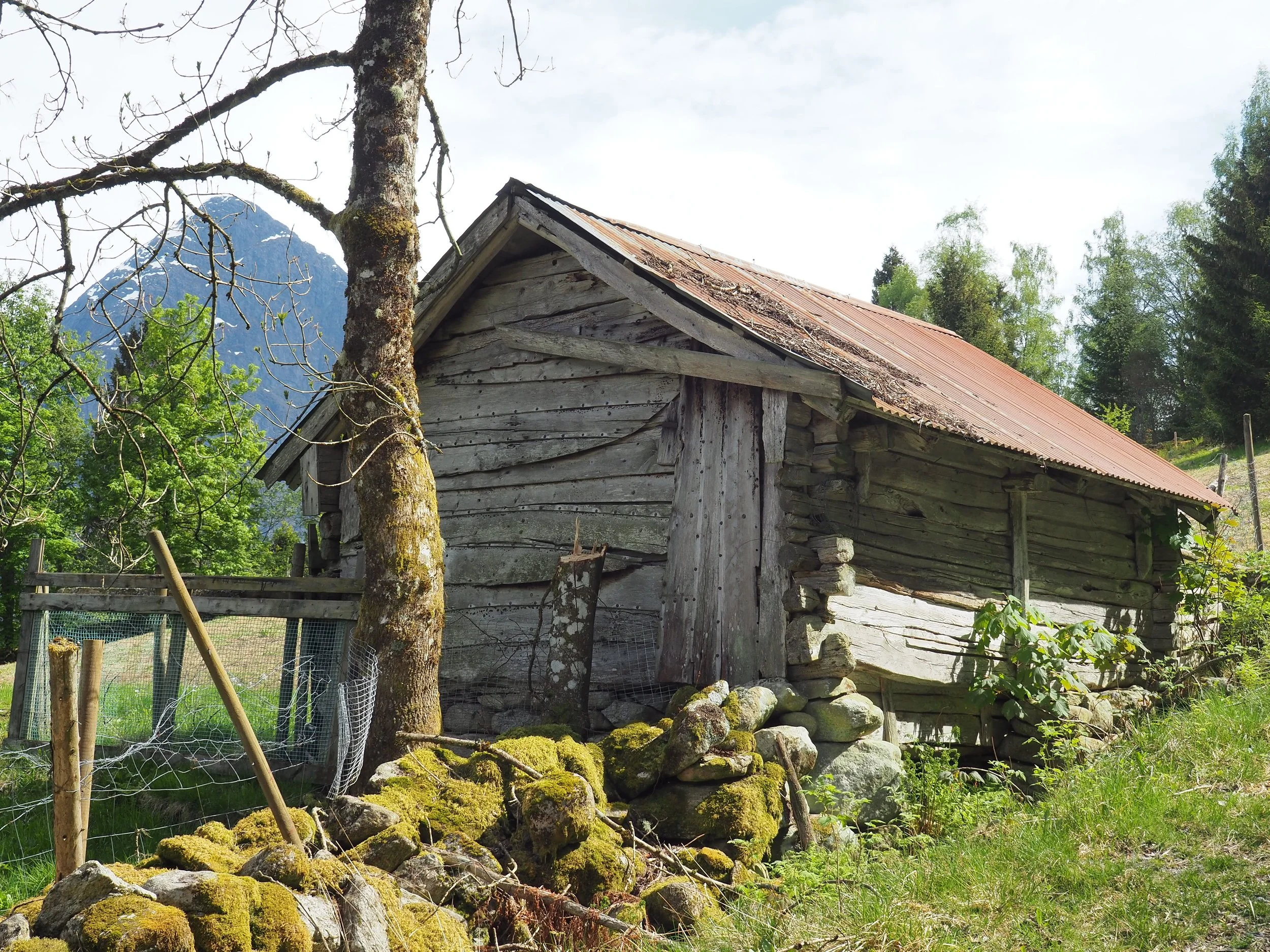
Holekvia. We see an old barn belonging to the Sandvik farm, owned by Per Ivar Skåre. In the foreground, part of an old stone wall is visible.
Stone walls are now recognized as valuable features of the traditional agricultural and cultural landscape in rural areas.
Røvasteinane
One of the stones was the perfect height to sit on when returning from the mountain farm with heavy milk pails on their backs. It was common on all mountain farm trails to have a specific resting stone – or sometimes several – that they called "Kvile" (Rest).

Spruce trees were planted along the edge of the gorge to prevent livestock from falling off.

The gorge that Fosdøla has carved out.
Fosdalen, much like Glomsdalen, has a steep and deep gorge at the mouth of the valley. This gorge was formed during the melting of the great inland ice more than 10,000 years ago.
At that time, Fosdøla was very large and turbulent, carrying enormous amounts of loose material that the glacier had eroded from the mountains further up the valley. In the steep section at the mouth of the valley, the rock was worn down by the powerful, sediment-laden river. This process took place over thousands of years, even while the glacier was still in the valley.

The gorge in the foreground. We are looking towards Hjelle and Hjelledalen.

Seljefloten. We are looking towards Glomsdalen and Hjelledalen.


Setrebakken
Just off the path we can see an old birch tree where fungi grow densely on
the lower part of the trunk. Fungi are a large group of mushrooms that primarily grow on old trees. They are parasites that break down the wood. Many of these
fungi play an important role in the ecosystem.

In the upper part of Setrebakken, the area opens up, and we get a view of the huts at Fosdalssetra.
A landowner has been diligent in clearing the forest and keeping the terrain open around the huts and along the trail. Due to the lack of grazing animals, new shoots (root shoots from trees) are gradually growing in.
From the summer farm, you can see all the way to the end of Fosdalen. If you turn around, you have a view over a large part of Oppstrynsvatnet, Hjelledalen and Gloms-
dalen, with the mountain farm Segestad.
The three summer farm huts belonging to the farms at Fosnes were called Ivaselet, Andersselet, and Oppigardselet. Ivaselet and Andersselet collapsed on their own, while Oppigardselet was taken by a snowstorm.
The huts belonging to Sandvik were Kristianselet, which collapsed on its own during the war, Toreselet, which has now been torn down, and Monsselet. Monsselet was built in 1889. In 1968, it burned to the ground, but one year later, a cabin was built on its foundation.

Foto: Ståle Sunde
Fosdalssetra Around 1990
To the left, we see Toreselet. The owner was Ivar Guddal. It has now been torn down. Monsselet is on the right. The owner is Per Ivar Skåre. In the foreground to the left are the ruins of Oppigardselet.

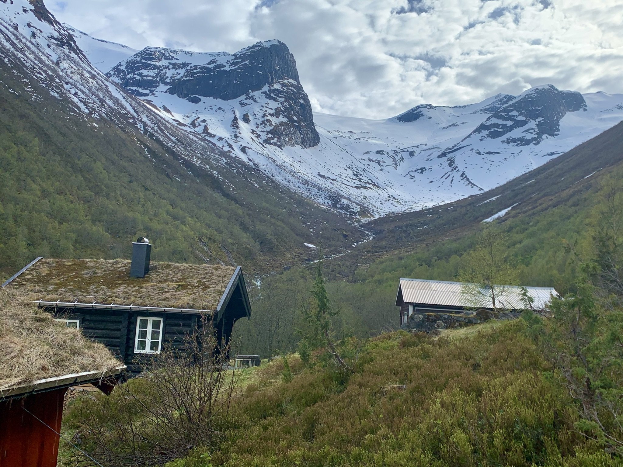
The cabins at Fosdalssetra today
1 – Monsselet. Owner: Per Ivar Skåre
2 – Ivaselet. Owner: Amund Mork
3 – Toreselet. Owner: Magnus Guddal

The cabins at Fosdalssetra seen from the opposite direction. In the background are Tafsehyrna (1300 m) and Fosdalskyrkja (1773 m).
Just east of the huts at Fosdalssetra, the Tverråna stream flows, a ravine originating from Gullkoppen. Gullkoppen is a bowl-shaped hollow in the mountain Kampen.
The summer farm path from Fosnes crossed this ravine, but the area is prone to water accumulation and avalanches. Therefore, the path has not been maintained.

Jostedalsbreen Nasjonalparksenter
Blueberry

In Fosdalen, there are plenty of blueberries. In earlier times, it was common to pick blueberries to earn extra income.
Today, blueberries are an underappreciated resource. This is unfortunate, as they are rich in antioxidants.
Read more about the history and geology of Fosdalen here.
The starting point for the hike to Fosdalssetra is located close to the Jostedalsbreen National Park Centre. It is well worth a visit if you would like to learn more about the area's natural environment, cultural heritage, and geology.
Text: Asbjørn Berge, 2025
Photos: Marit and Asbjørn Berge