


Hike to Skjerdingsdalsbotnen
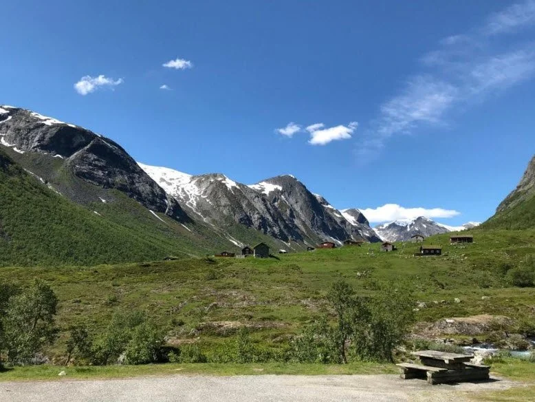
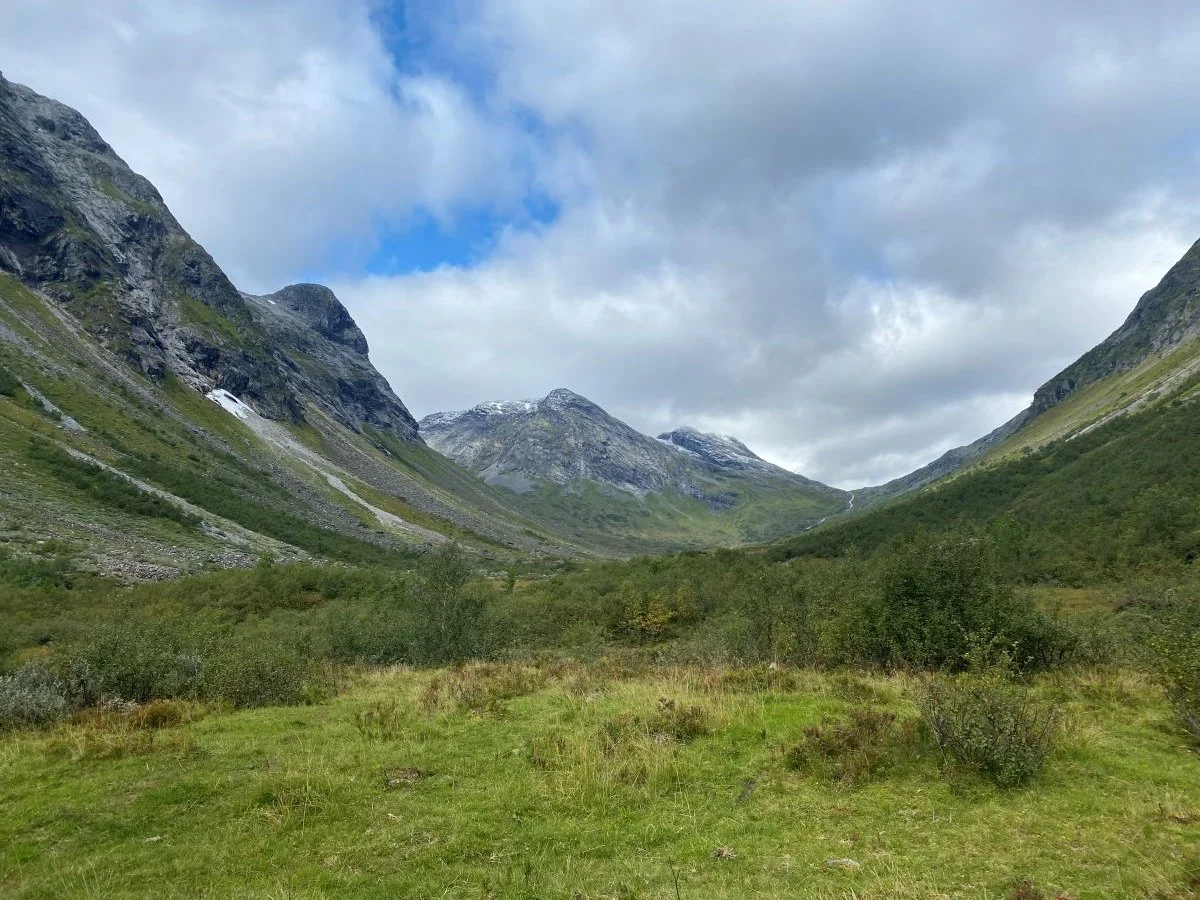
The photo shows a resting place with a fine view towards Skjerdingdalssetra
and Skjerdingsdalen.
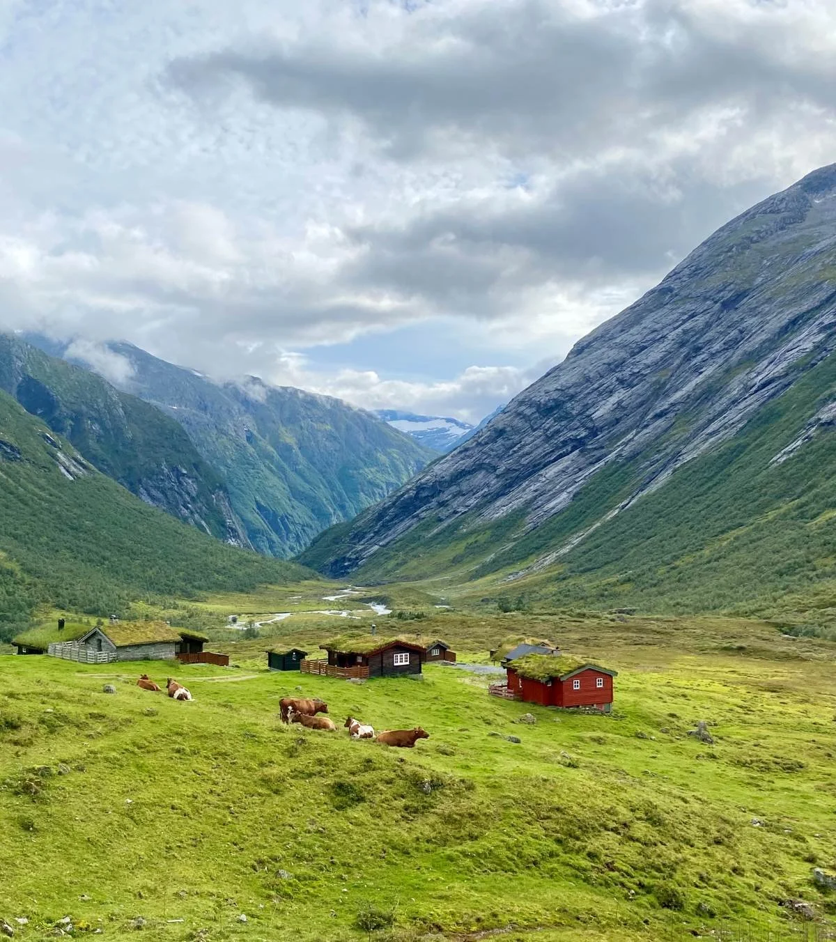
Skjerdingsdalen is a good grazing valley for cattle, and many cows graze here, helping to keep the vegetation down.
The summer farm is idyllically situated on a small ridge not far from Rv 15 (Strynefjellsvegen). Above the summer farm there is a turn-off leading to a large parking area, which serves as the starting point for the hikes in Skjerdingsdalen.
Skjerdingsdalsbotnen, the destination of this hike, lies at the end of the valley. Along the route, you will see majestic mountains and glaciers, and gain a small insight into the history of this summer farming valley.
Heimste Sandskaret and Fremste Sandskaret are popular areas for ski touring enthusiasts using randonnée skis.
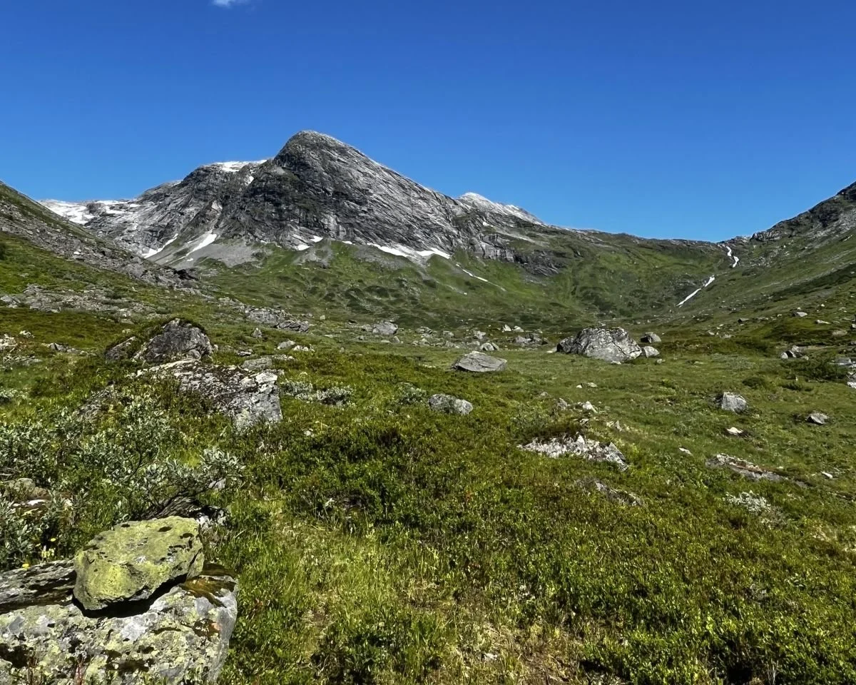
It is the mountain ridge shown in the picture that gave the valley its name. It resembles a skjerding, a traditional tool once used over the open hearth to adjust the distance between the fire and the cooking pot.
Difficulty: Moderate.
Distance: 4.5 km one way.
Elevation gain: 200 metres.
Duration: Approximately 3.5 hours return trip.
Season: Spring to autumn.
Parking: Parking is available at Skjerdingsdalssetra.
Note: The trail can be wet in places. The trail is not marked.
There is no mobile phone coverage along the hike.
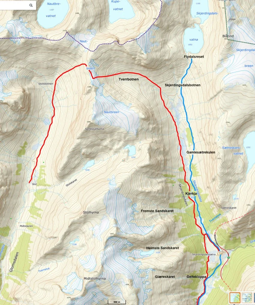
The blue line shows the trail towards Skjerdingsdalsbotnen and Flydalsreset. The red line shows the old mountain pasture route across Nautebreen.
Skjerdingsdalssetra — looking towards Glæra.
Hiking Description
From the parking area above Skjerdingsdalssetra, a narrow trail descends diagonally downhill until it reaches the flatter valley floor. From there, the trail continues along the eastern side of the Skjerdingsdøla river further into the valley.
After walking approximately 600 metres, you will pass a relatively new and solid bridge crossing Skjerdingsdøla. You should not cross the bridge, but continue along the eastern side of the river.
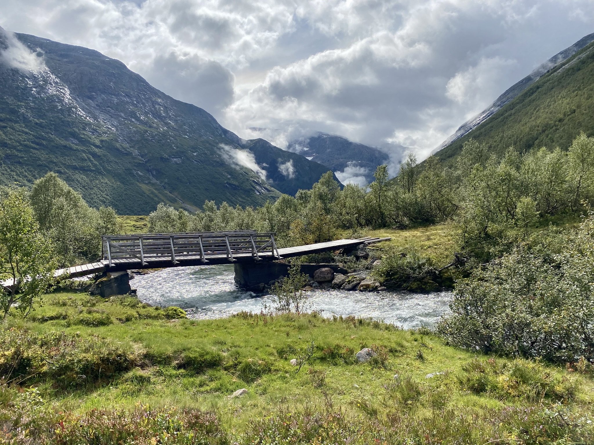
New bridge over the Skjerdingsdøla River
It is only a short distance further to Tverrelva. Here, the trail turns uphill towards the mountain and crosses a small bridge. It may be difficult to cross Tverrelva without getting wet feet if you do not find the bridge.
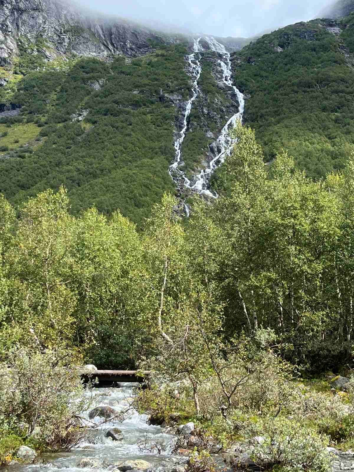
Here you can see the small bridge crossing Tverrelva
Tverrelva flows from Lake Setreskarvatnet (1,252 metres above sea level), and it can become quite large during the snowmelt season and during periods of heavy rain.
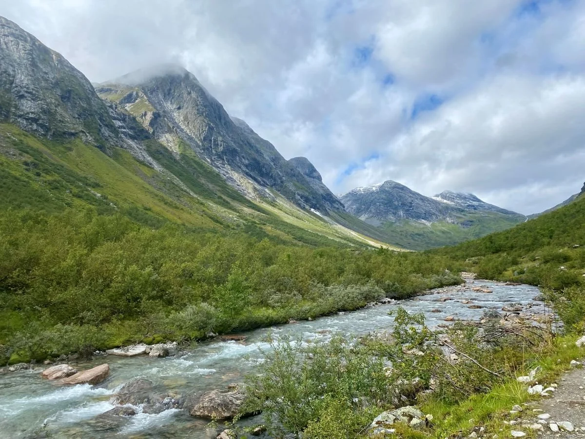
The trail towards Skjerdingsdalsbotnen follows the river for long stretches.
In the photo above, we can see Flydalsreset at the far end of the valley on the right-hand side. In the background to the left, we can see Tverrbotnen, which leads up to Nautebreen.
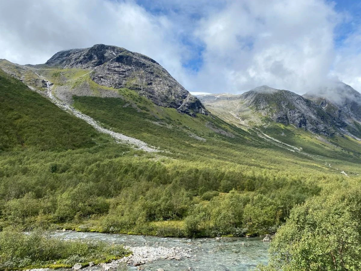
On the way towards Skjerdingsdalsbotnen, you can see these two mountain passes on the western side of the valley. To the left in the photo, we see Heimste Sandskaret. Behind it rises Midtstolhyrna (1,775 metres above sea level). To the right, we see Fremste Sandskaret, which leads up towards Stolshyrna (1,646 metres above sea level).
Both of these mountain passes are popular areas for ski touring enthusiasts on randonnée skis.
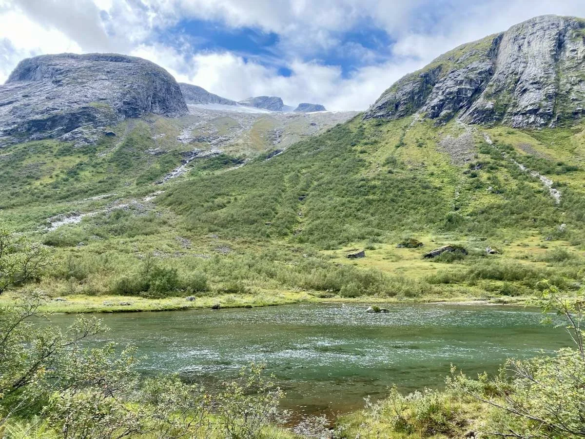
Just before reaching the well-known landmark Kyrkja, you will see this idyllic pond.
In the background, we see Fremste Sandskaret, which leads up to Stolshyrna.

Kyrkja (The Church) in Winter Dress
Kyrkja is a distinctive landmark in the landscape. It is a large upright boulder, and the trail passes right beside it.
The distance from the summer farm to Kyrkja is about two kilometres. It is a beautiful walk both in summer and winter.
View from Kyrkja towards Skjerdingsdalsbotnen. Flydalsreset can be seen to the right and Tverrbotnen to the left in the background
After passing Kyrkja, the terrain opens up somewhat, and the trail is easy to follow further into the valley towards Gamle Setrekulen (approx. 700 metres above sea level).
This was where the summer farm was located in the days when livestock had to be driven across Nautebreen to reach Skjerdingsdalen. Depressions in the ground still reveal traces of the old summer farm buildings.
The trail continues onwards to Skjerdingsdalsbotnen. It is also possible to hike up to Flydalsreset, which lies at around 1,100 metres above sea level. On the plateau there is a small lake, and further in there are two more lakes. At the very end, you can look down into Flydalen in Geiranger.
The terrain is steep and difficult, and it is not recommended to go there without proper safety equipment.
Skjerdingsdalsbotnen Photo: Ane N Grønfur
The river in the photo comes from Flydalsreset. To the left lies the valley leading up to Nautebreen.
Read more about the history of Skjerdingsdalsetra here.
Text: Jørgen Skåre
Photos: Marit and Asbjørn Berge