

Brief history of Skjerdingsdalssetra
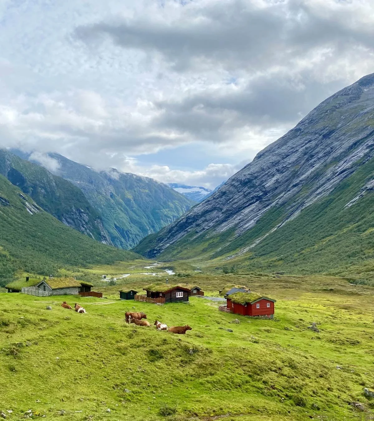
Skjerdingsdalssetra. Glæra in the background
Skjerdingsdalen is a fertile mountain pasture valley which, in earlier times, was difficult to access due to its remote location in the mountains northeast of Oppstryn. The valley stretches with one branch towards Geiranger and another towards Grasdalen and Skjåk.
It is an ancient summer farming valley that was probably in use during both the 15th and 16th centuries, but which became abandoned in the early 1700s because of major climatic changes and the advance of glacier arms.
At the autumn assembly in Stryn on 16 October 1730, the authorities announced the following:
“As everyone knows, several farmers from Grov, Guddal and Skåre in earlier times had summer pastures in the fertile Skjerdingsdalen. For a long period this summer farming has been abandoned. In order that this fertile valley shall not remain unused, but once again be used as in former times, it is hereby proclaimed that all who are willing to help restore the route through Tystigen and make use of the valley shall henceforth own and use the valley, together with its forests, grazing land and all its resources.”
Originally, 13 farmers became owners, but later many more joined, including people from the Strandsida area. Today, farms from Skåre, Grov, Grønfur, Mork, Dårflot and Fosnes have summer pastures here. Following a court ruling in 1988, there are now a total of 37 co-owners, most of them holding only small shares and no longer engaged in active farming. The number of farms still keeping livestock at the summer pasture has declined in recent decades.
In earlier times, reaching Skjerdingsdalen was demanding. Originally, the route probably went from Tystigen via Grasdalen to Skjerdingsdalen. When the pasture valley came back into use after 1730, the summer farm route started from Glomnesstranda, continued through the entire Glomsdalen valley — about ten kilometres long — crossed the Nautebreen glacier and descended into Skjerdingsdalen. At that time, the summer farm buildings were located midway down the valley at Gamle setrekulen, almost one kilometre farther into the valley than the large boulder known as Kyrkja (“The Church”).
The long and strenuous journey to the summer pasture took a couple of days both for those coming from Hjelledalen and from Strandsida. During the return journey in 1851, severe weather and storms struck while crossing Nautebreen, leaving 20 of the finest dairy cows stranded on the glacier. This made the need for a new livestock route urgent.
The following year, work began on repairing and improving the path through Glæra so that livestock could pass there. Before that, people could only manage the passage with the help of ropes.
The livestock route through Glæra was completed in 1853. Dynamite had not yet been invented — it only came in 1866 — so the workers used large drilled holes and blasting powder to carve a narrow ledge along a stretch of nearly 100 metres of cliff. The path became just over one metre wide.
At the same time, the summer pasture was moved several kilometres from Gamlesetra to its present location, where Skjerdingsdalen and Grasdalen meet.
Improved access gradually led to greater use of the valley. Activity peaked in the late 19th and early 20th centuries, with cattle, sheep, goats, pigs and horses all grazing there. For a period, there was even a dairy at the summer pasture.
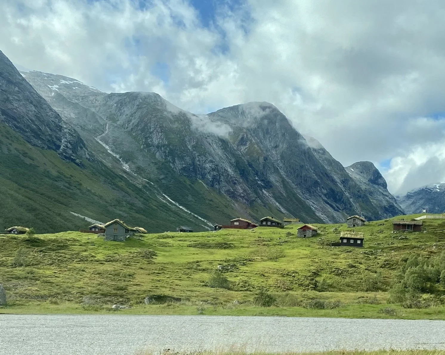
Skjerdingsdalssetra seen from
National Road 15.
During the severe unemployment of the 1930s, government employment funds were granted for improvements to the trail through Glæra. The work did not begin until after the war, but when it finally started, the route was widened to two metres. The path was levelled and made safer for both people and livestock. The work was completed in 1948.
From then on, every spring there was voluntary maintenance work on the route from Jøl Bridge to Skjerdingsdalen in order to keep the summer farm trail open and clear away snowdrifts and rockfalls.
Much changed after the construction of the year-round road across Strynefjellet. National Road 15 opened in 1978. Since then, all cattle and most sheep and goats have been transported to and from Skjerdingsdalssetra by tractor or vehicle.
Farms at Skåre continued to use the old summer farm route for sheep for almost another 40 years.
In later years, the trail through Glæra has mainly become a route enjoyed by off-piste cyclists and hikers.
With climate change and increasingly frequent rockfalls along the mountainside through Glæra, it is no longer safe to walk there during periods of heavy rainfall. After a large boulder blocked the trail through Glæra in 2022, the summer farm owners became involved in securing funding to restore this unique cultural heritage site, which the old summer farm route to Skjerdingsdalen represents. Until the necessary safety measures are completed, warning signs have been put up advising against walking through Glæra.
It is still possible, however, to reach the area from both sides without passing through Glæra itself.
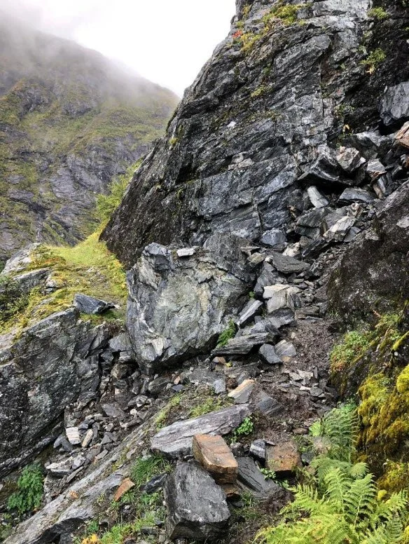
The Glæra trail damaged by rockfall in 2022
Natural Landscape and Botany
Skjerdingsdalen forms part of a coherent glaciological landscape where the processes and deposits created during the period of glacier melting after the last Ice Age (approximately 1500–1920) and up to the present day are especially instructive and clearly visible.
Near the confluence of the rivers Skjerdingsdøla and Grasdøla lies an impressive avalanche embankment with a tarn in the associated avalanche depression. A distinct lateral moraine at Skjerdingsdalssetra was partly destroyed when material was extracted during the construction of National Road 15.
The deep gorge below Glæra stretches all the way down into Hjelledalen and is a clear result of erosion caused by glacial rivers during the period of ice melt.
Both Skjerdingsdalen and Grasdalen have steep mountain sides with extensive avalanche activity. For this reason, in 1982 the board of the Skjerdingsdalen common ownership entered into an agreement with the Norwegian Geotechnical Institute to establish a research embankment (avalanche braking mound) in Ryggfonna, located at the western end of Grasdalen. Measurements of avalanche speed, pressure and related factors have provided valuable knowledge for the design of avalanche protection systems elsewhere, including calculations of size and pressure loads.
The vegetation along the river Skjerdingsdøla through Glæra was surveyed in the early 1980s in connection with proposed hydroelectric developments in Breheimen. The survey documented considerable botanical value, with exceptionally rich plant diversity and unique vegetation shaped by the river and waterfall landscape. Because of the damp and cool climate within the gorge, plants grow there that would normally belong to entirely different geographical regions.
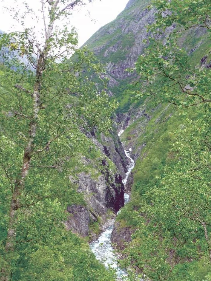
The gorge seen from the trail up Åsen
Text and photos: Berit Wetlesen and Jørgen Skåre, 2025.