


Hike to Skaarfjellet
Skaarfjellet
Skaarfjellet lies right on the border between Oppstryn and Nedstryn. Few hikes offer a better view of the whole Stryn area – both Oppstryn and Nedstryn.
It is well worth walking out onto a ledge in the mountainside that we may call Utsikta – “The Viewpoint”. From here, you have an open view both up towards Oppstryn and down Strynedalen valley.
Turn off road Rv. 15 at Storesunde and follow Flovegen for about 2 km. At Eikeneset, drive about 1.7 km uphill to the farm Skaar. Here you will find a signposted car park.
Difficulty: Demanding. The path has recently been cleared. Some sections are a little steep.
Distance: 3.3 km one way
Ascent: 840 m
Duration: 6 hours return
Season: Summer – autumn
Parking: You can park at the farm Skaar.
NB! There is mobile phone coverage throughout the entire hike.
The route shown on the map is only approximate
Route Description
The hike from Skaar to Skaarsetra is described here.
From the mountain pasture to the summit of Skaarfjellet, there is no established trail. In earlier times, when people were out on errands such as livestock inspection, gathering resources, hunting, or simply travelling through the area, it was common to walk from the pasture diagonally northwards towards the Skaarelva river. From there, they followed the ridge alongside the river up towards the head of the valley and onto Bendelskarreset. This brings you just behind the plateau of Skaarfjellet, where you can choose whether to continue west towards Sundsdalen, north towards Vesleblåfjellet/Grøsvoregga, or out onto Skaarfjellet itself.
Today, most hikers are interested in finding the best and most spectacular viewpoints. In that case, the best option is to follow the edge of the mountain from the pasture to the summit. Whichever route you choose, you will enjoy magnificent views of Oppstryn. If you stay close to the mountain edge, you will also have equally impressive views over Nedstryn and out towards the fjord. The boundary between Oppstryn and Nedstryn runs directly across Skaarfjellet.
At an elevation of 770 metres, there is a fine rocky ledge that we may call The Viewpoint. From here, you have the best views to the west, south, and east. Just above this point, you reach the steepest section of the hike. By moving 100–200 metres to the right, you can find an easier ascent.
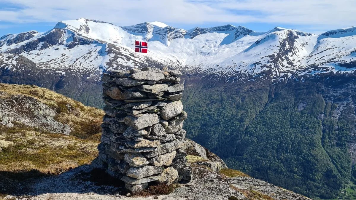
At the summit, there are two cairns, one at the eastern side and one at the western side of the plateau. Several small lakes lie on the mountaintop. They contain no fish, but are suitable for a refreshing swim.
A pair of eagles has nested in this area for several years and may suddenly appear close by as they circle around the mountain. In spring, ptarmigan are often seen here before moving on after spending the winter along the forest edge near the mountain pasture.
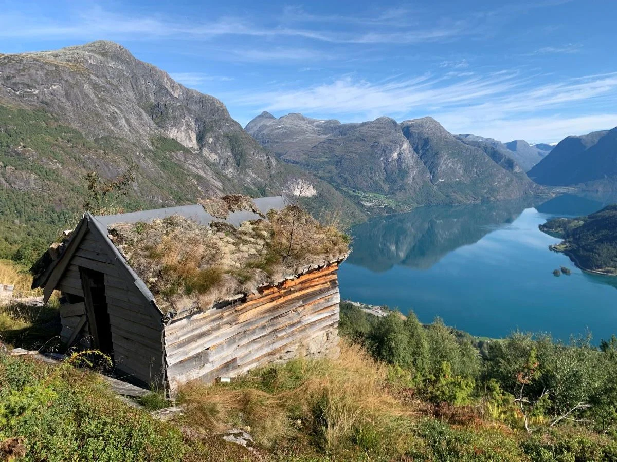
Skaarsetra
Skaarsetra is beautifully located, offering stunning views of Lake Oppstrynvatnet and the mountains beyond.
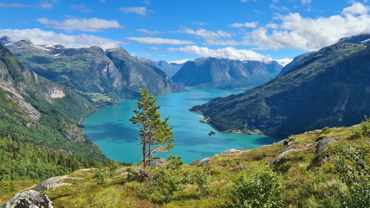
To enjoy the best views of both the upper valley and the fjord, continue along the ridge near the edge of the mountain towards Utsikta (The Viewpoint).

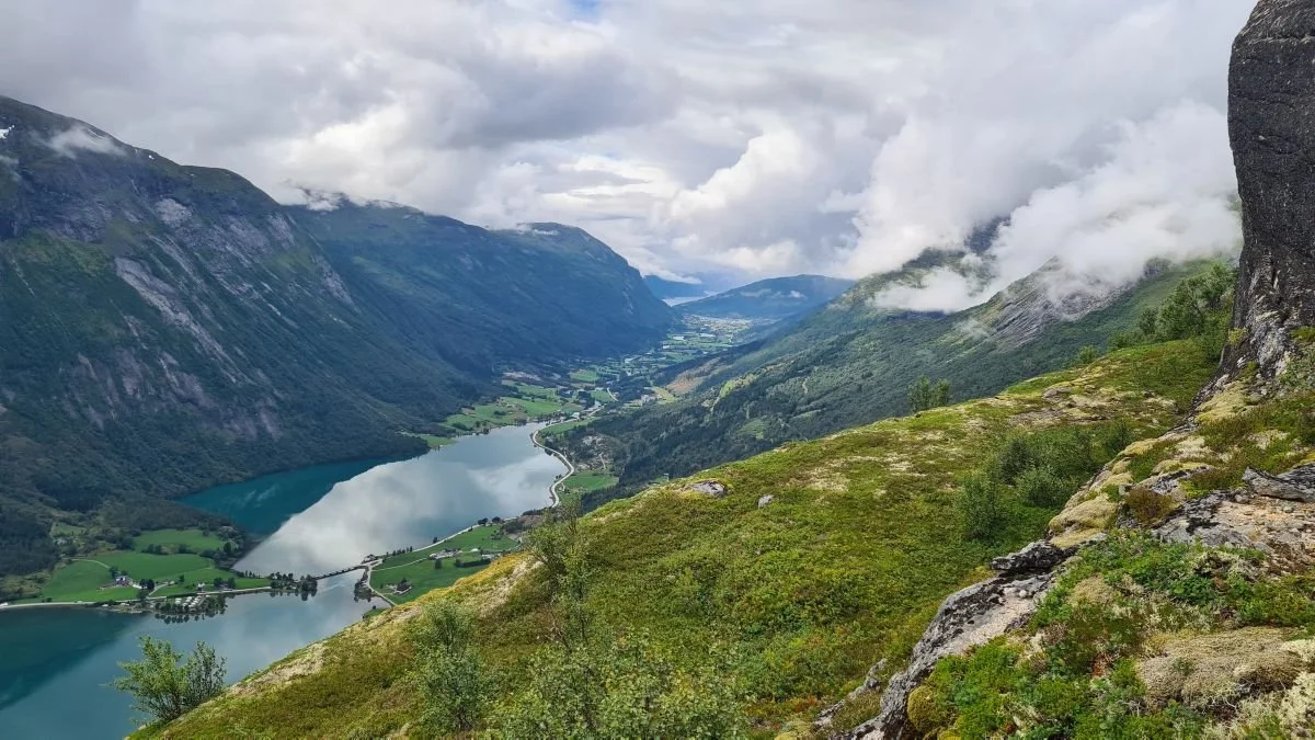
The usual and easiest route to Skaarfjellet follows the ridge beside Skaarelva. The river can be seen in the lower left of the image.

Skaardalen can be seen in the foreground. Skaarsetra ( the summer farm) lies near the right-hand end of the green lake. The spectacular viewpoint known as Utsikta is located at the small notch along the edge of the mountain.
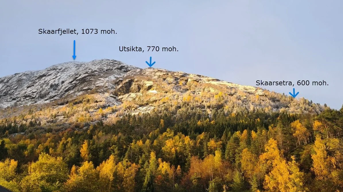
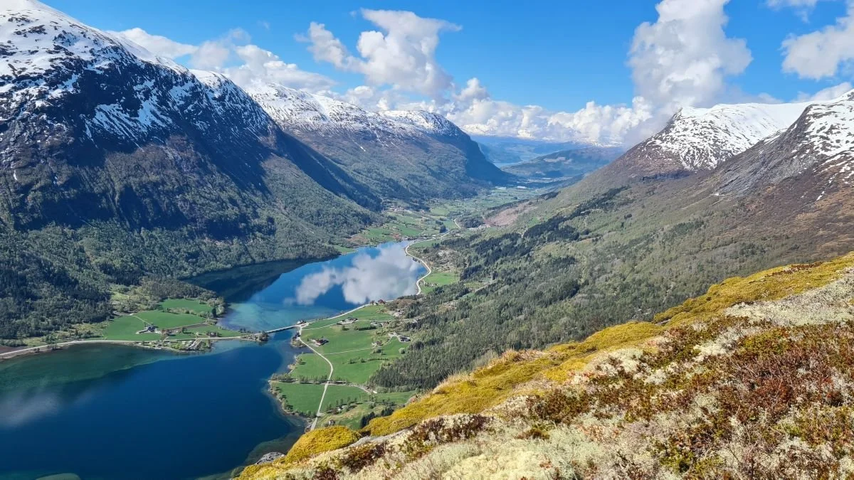
Hiking destinations visible from the farm Skaar.
Utsikta (The Viewpoint)
In the foreground lies the rocky ledge that offers panoramic views both up the valley and down towards the fjord. The rock face visible on the right-hand side of the image provides shelter from the northerly wind.

Utsikta (The Viewpoint)
Even the dog seems impressed by the view.
Utsikta (The Viewpoint)
From here, you can see far out across Nordfjord.

From The Viewpoint, there are two alternative routes to continue towards Skaarfjellet. If you are not afraid of heights and have some experience with easy scrambling, you can follow the route shown in the photograph. A slightly easier ascent can be found by heading 100–200 metres further to the right.

The usual route to Skaarfjellet follows this ridge above Skaarelva.

The ridge along Skaarelva. Looking towards the head of Skaardalen, with Bendelskaret visible on the skyline.
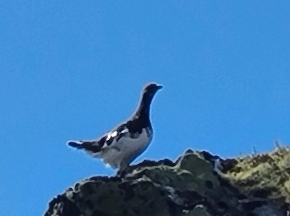
You may encounter both ptarmigan and eagles along the hike.

Skaarfjellet – View from the western cairn

A beautiful tarn for a refreshing swim on warm summer days. Notice its distinctive shape.
Text and photo: Rune Skaar, 2026
