


Hike to Strynekåpa

Strynekåpa is one of the most accessible mountains in Oppstryn. Cairns mark the route you should follow up Kåpesida (Look at the map), and the terrain is fairly manageable for those with some mountain experience. From the summit, you get a majestic view towards Erdalen, Lodalskåpa, and the surrounding glaciers.
Grade: Especially challenging. This is a hike that requires good physical fitness and experience with steep mountain terrain.
Distance: 5.6 km one way from Vesledalssetra.
(9.2 km from the parking area at the end of the toll road.)
Elevation gain: 990 metres from Vesledalssetra.
(1310 metres from the parking area.)
Estimated time: 8 hours round trip from Vesledalssetra.
(11 hours round trip from the parking area.)
Season: Summer and autumn.
Parking: You can park at the designated parking area at the end of the toll road.
Remember to pay the toll fee!
If you park at Greidung, the hike becomes more demanding.
Note: Early in the summer, there may be avalanche risk due to lingering snow near Ulvestigen.
There is no mobile coverage on the trip.

Hike description
The trail from Vesledalssetra to Erdalsbreen is described in the hike “Hike to Erdalsbreen.” See that for details.
When you reach the ridge above Erdalsbreen, you will see a mountain ridge leading toward the summit of Strynekåpa. It’s a good idea to follow this ridge at the beginning. There are some small cairns (stone markers) along the route to guide you.
Erdalsbreen 18.07.2025
Photo: Kenneth Berge-Schøld

This south-facing mountainside gets plenty of sun. That’s why many lush alpine plants grow here.
These mountain plants have short, sturdy stems that can withstand harsh weather, and their flowers are brightly colored and strongly scented to attract pollinating insects.
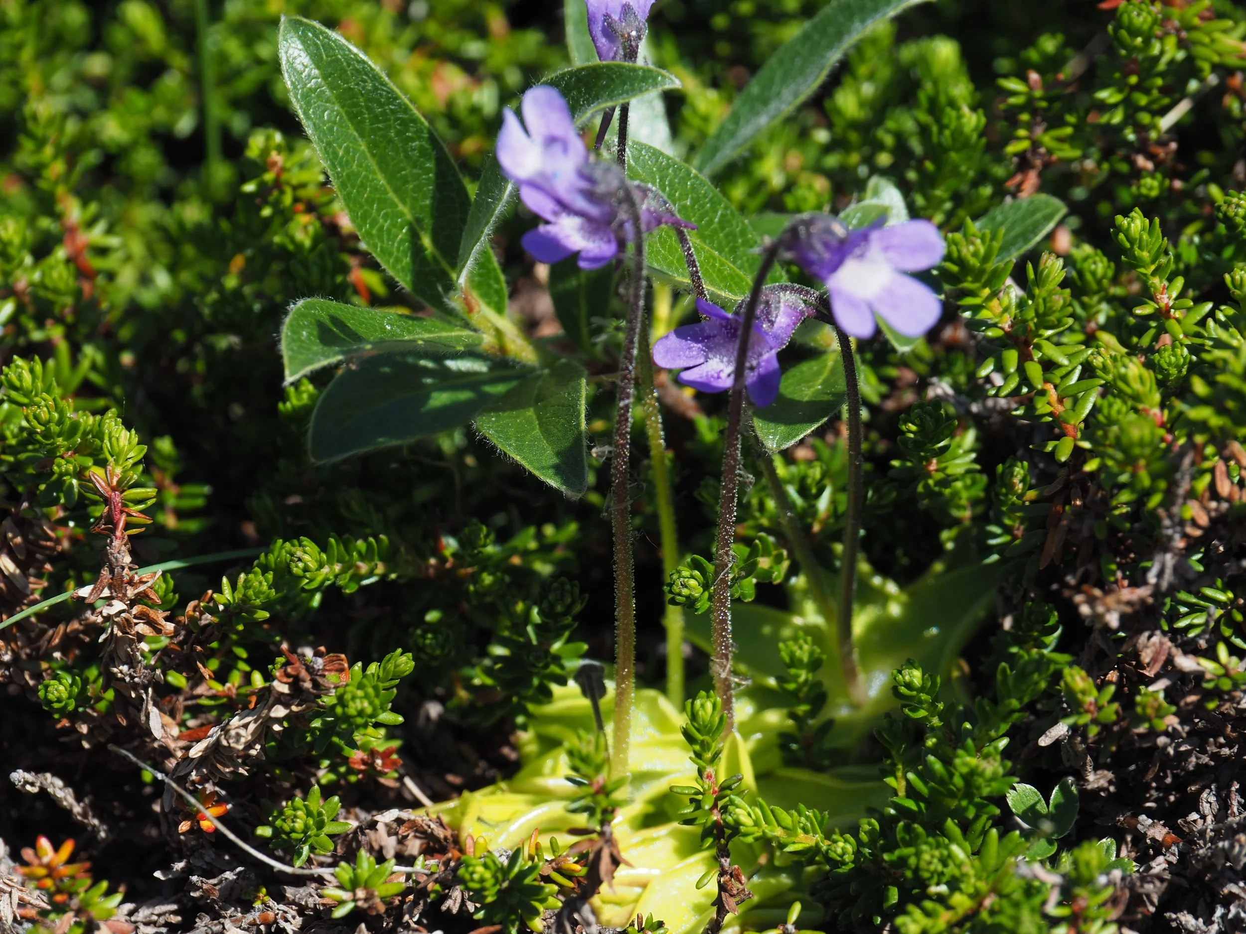
Butterwort, Pinguicula vulgaris

Alpine bartsia, Bartsia alpina
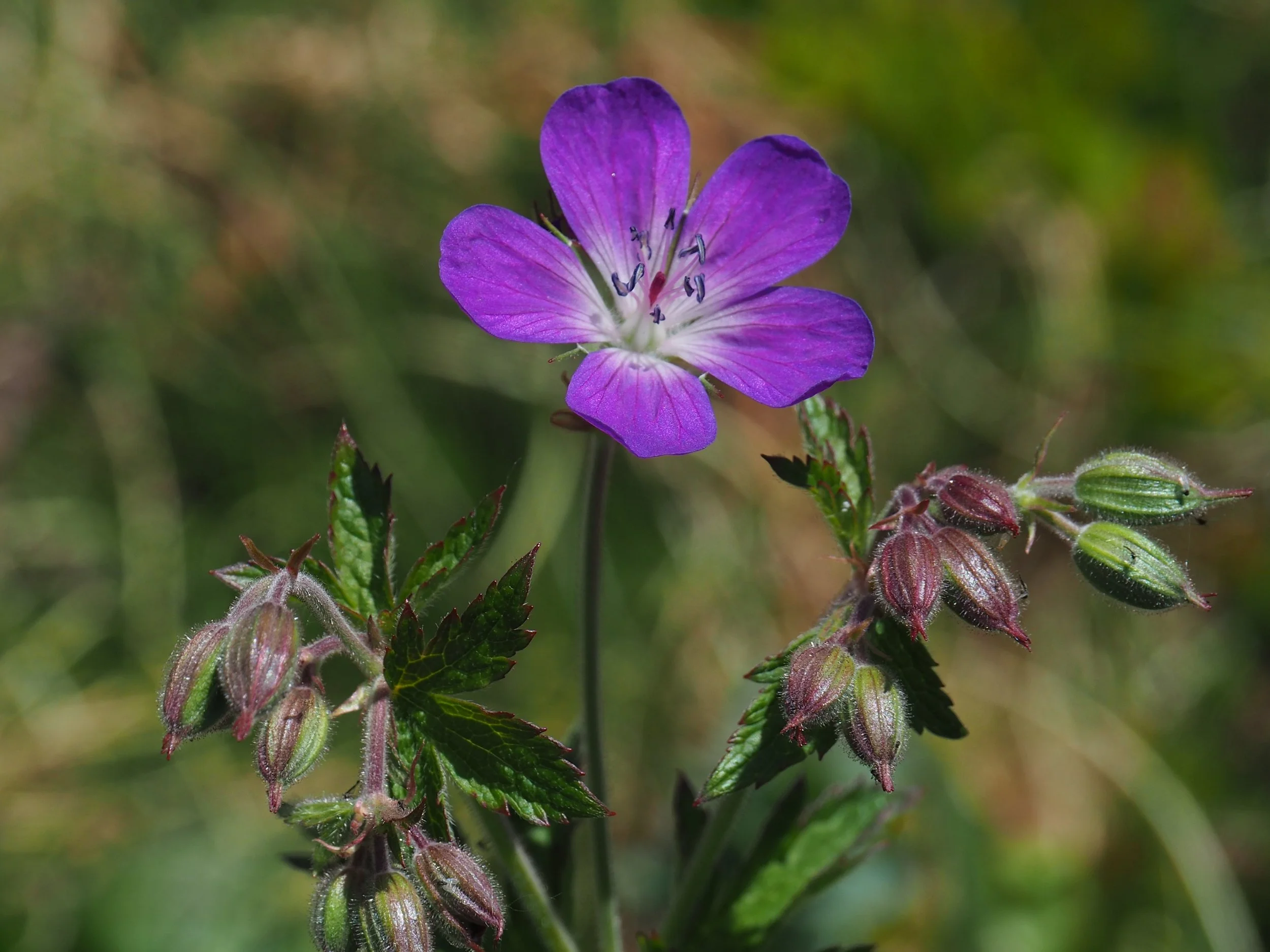
Wood cranesbill, Geranium sylvaticum
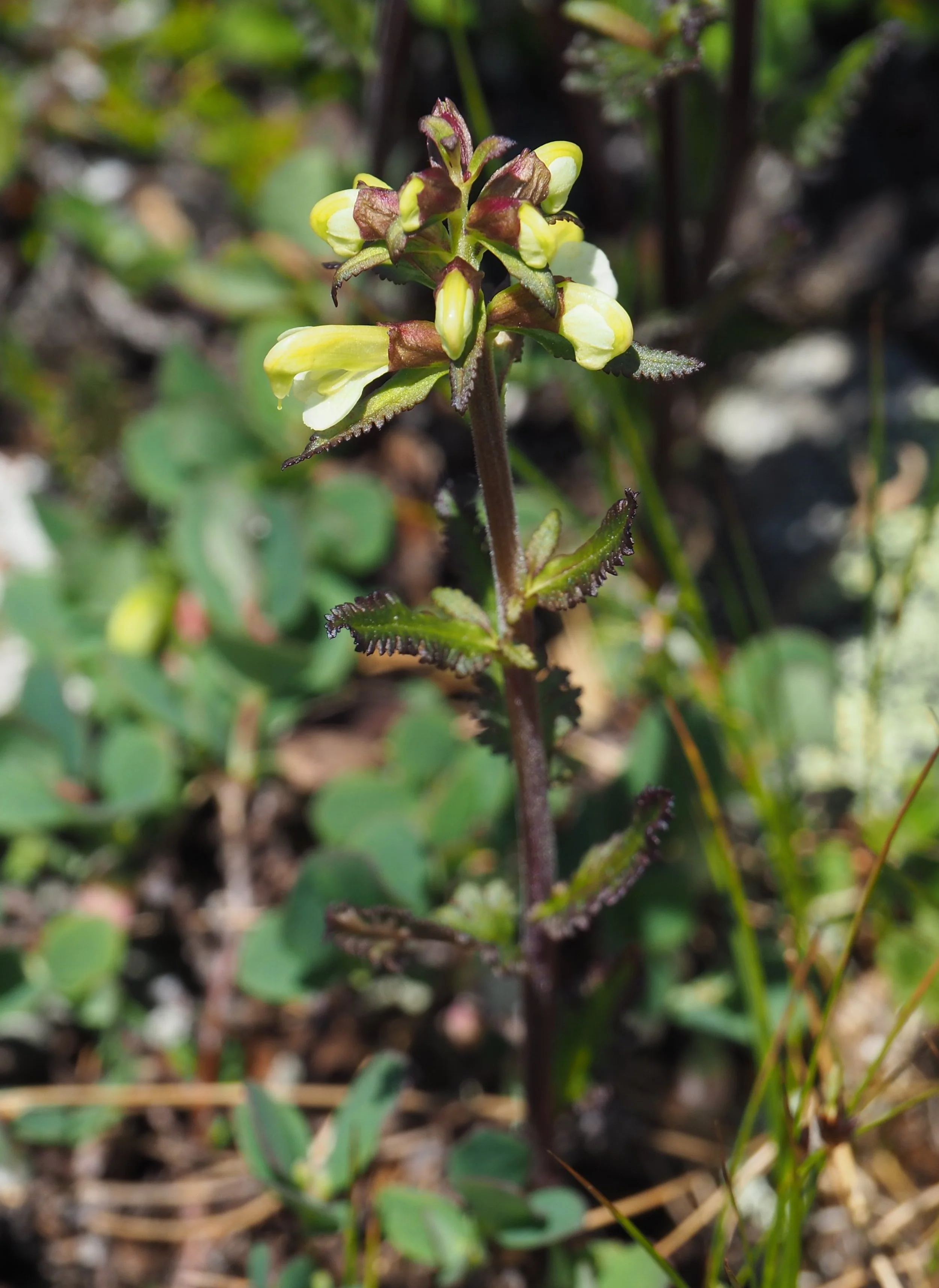
Pale lousewort, Pedicularis lapponica
You can see all these plants along the way to the summit.
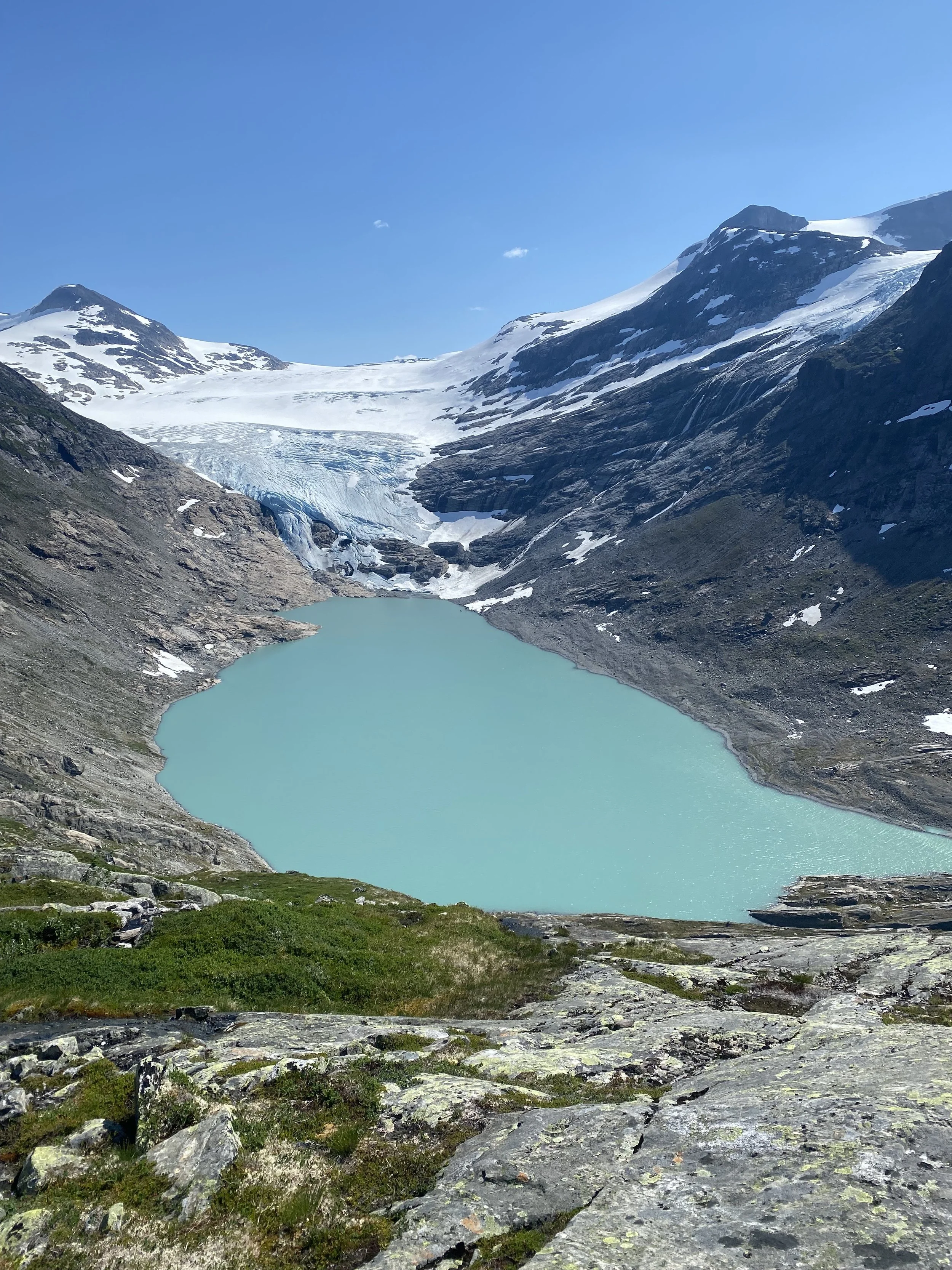
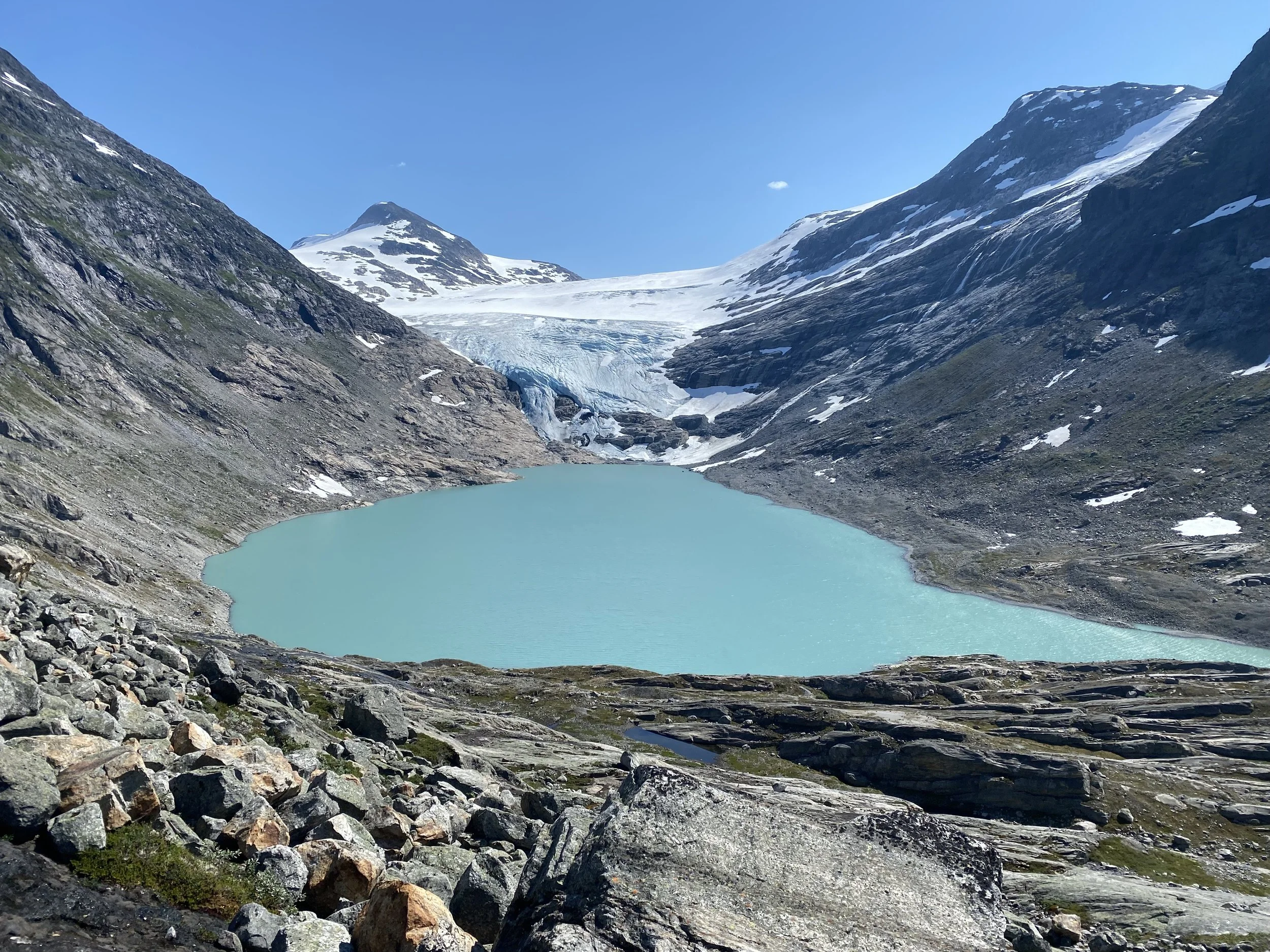
View towards the green glacier lake and Erdalsbreen glacier. The green color comes from the fine rock dust that the glacier grinds off the mountain.
You can see Tverrfjellet (1888 masl.) on the right side of the picture and Storenosa (1809 masl.) on the left.
From the glacier plateau of Erdalsbreen, there is a glacier fall down to the right, behind Tverrfjellet. This glacier fall is called Lodalsbrekka and leads down to Lodalsbreen.
For a long time, drovers herded large cattle herds along this route. They bought animals during the winter. In June, they returned to gather the animals. Vesledalssetra was the last gathering place before they began the strenuous journey across the glacier.
When the weather was favorable, they traveled up Erdalsbreen, down Lodalsbrekka, and Lodalsbreen to Fåbergstølen at the east side of the glacier. The herds mostly consisted of cattle, but horses and sheep were also part of the drift. From there, they headed south toward Bergen or southeast toward Drammen. This was the livestock transport of that time.
View from the summit of Strynekåpa (1530 masl.). We see the recently cleared Bergsflatene (flat area), the green Oppstrynsvatnet lake, and the settlements on the south side of the lake. In the background, you can see Kvitegga (1700 masl.), slightly rounded with snow on its peak. To the left of it stands Hornindalsrokken (1526 masl.), recognizable by its sharp, steep summit.
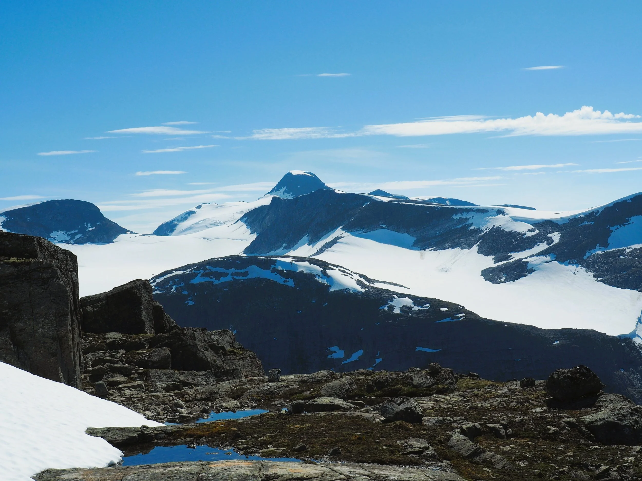
Here you see the mountains on the south side of Strynekåpa. Closest is Teinosa (1578 masl.). Behind it lies Teibreen (glacier). At the far center of the picture is Lodalskåpa (2083 masl.). To the right of Lodalskåpa is a sharp peak, Veslekåpa (1988 masl.), and to the left, just above the glacier, is Brenibba (2018 masl.). On the far left of the picture is Tverrfjellet (1888 masl.).

Here is a zoomed-in view of Lodalskåpa. You can see two large cairns at the summit.
On November 5, 2023, participants in the TV series “71° North – Norway’s Toughest Celebrity” climbed this steep north face of Lodalskåpa. The difficulty level was right at the limit of what the participants were able to manage. They had a tent camp on the glacier just below the mountain face.
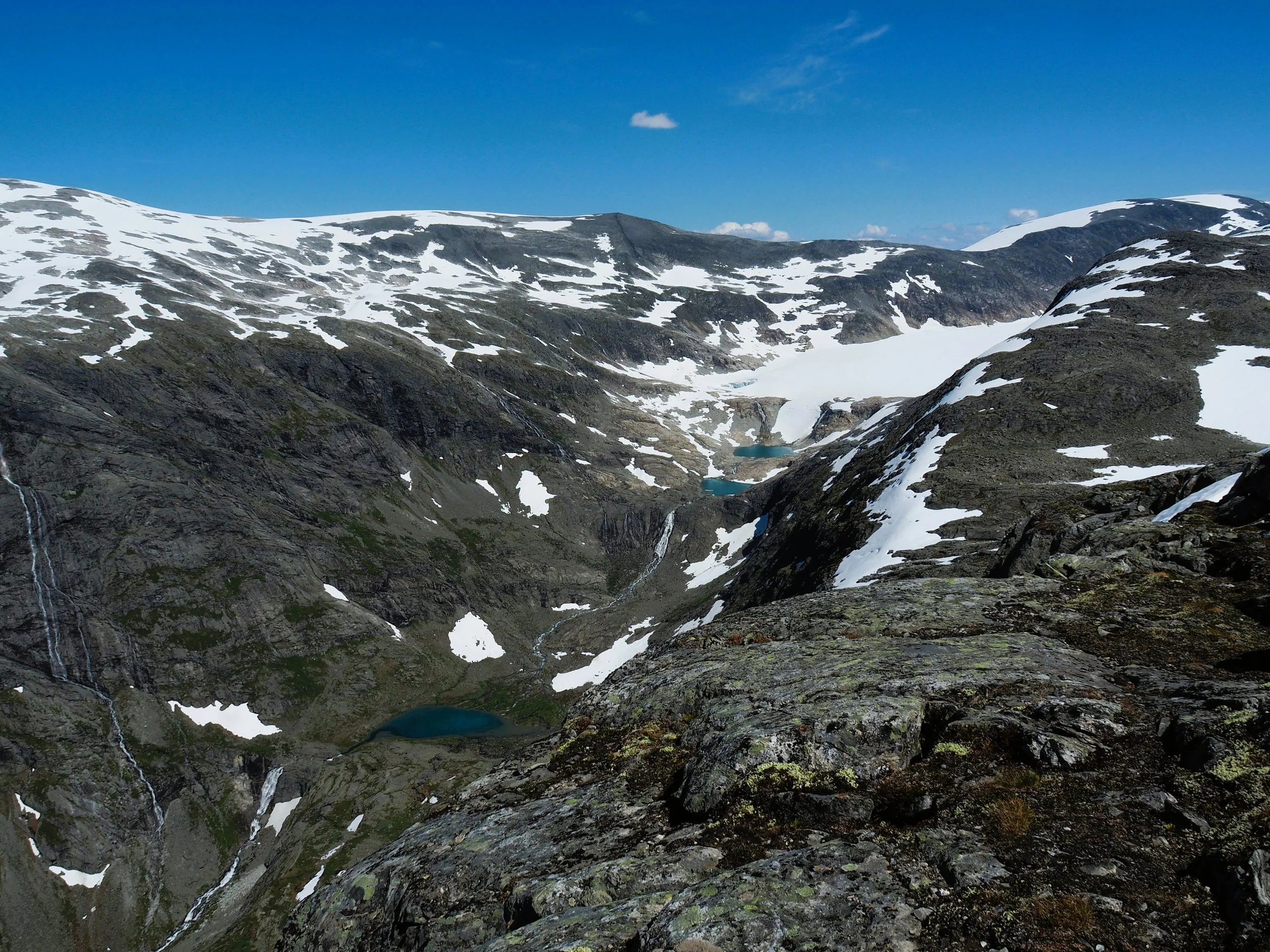
Here you see Vesledalsbreen glacier and Svartefjellet (1809 masl.) in the far right back-
ground. On the far left, you can see the summit of Setrefjellet (1892 masl.).
Thirty years ago, the glacier covered the two uppermost lakes. Today (2025), a fourth lake is beginning to open at the glacier’s edge. All these lakes have been carved out of the mountain by the glacier.
In a few hundred years, all these small lakes will be filled with moraine material carried by the glacier river. Then, there will no longer be lakes here, but flat outwash plains.
In this way, the large plains further down the valley have also formed. They were once lakes that the glacier rivers filled up.
One day in the future, Oppstrynsvatnet will also become a vast, flat landscape.
This is clearly an outstanding textbook on how the landscape has been formed.
Text and photo: Asbjørn Berge, 2025