

Hike to Erdalsbreen

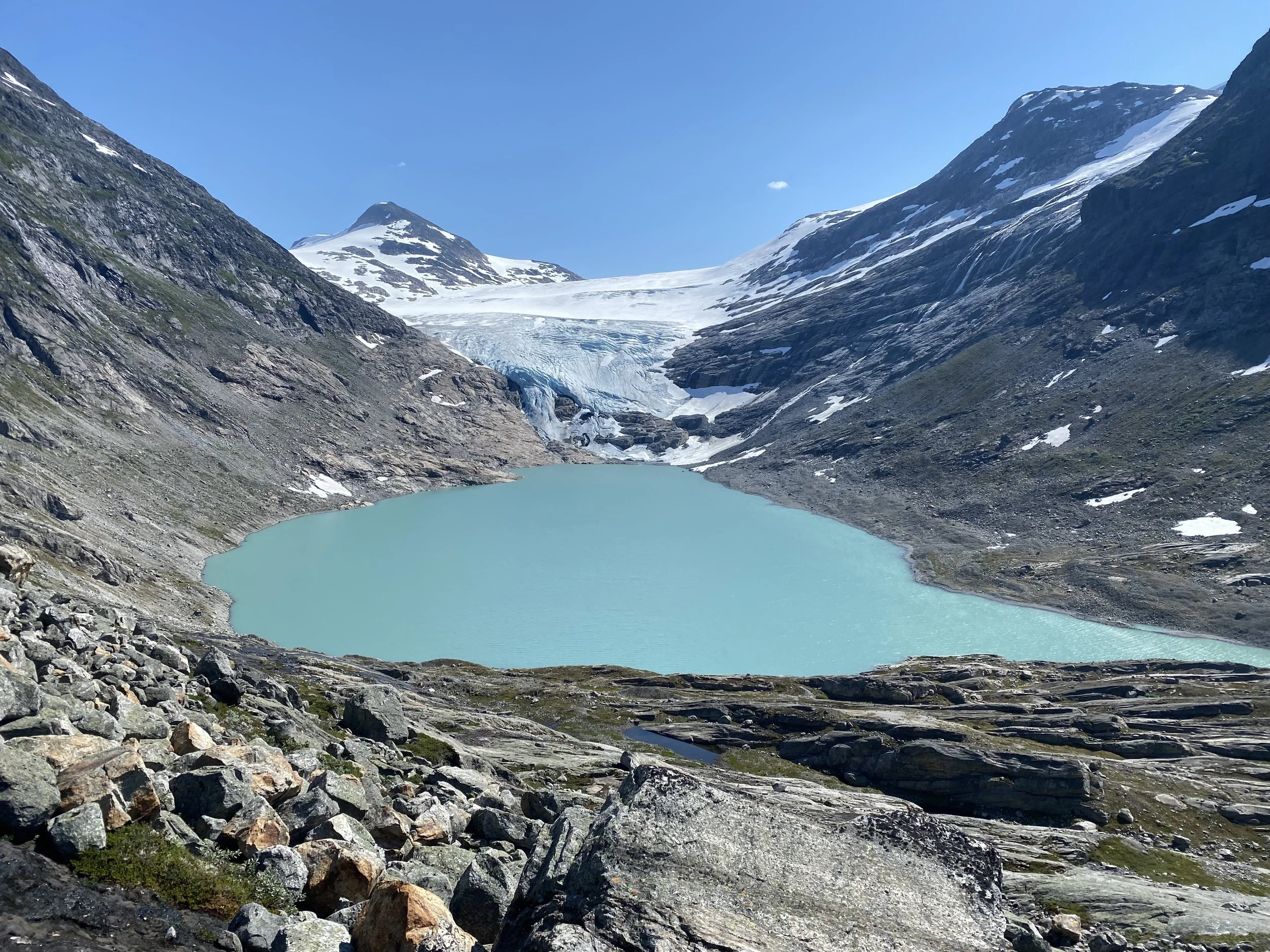
Erdalsbreen is a glacier arm of the Jostedalsbreen. It is beautifully situated by the turquoise glacial lake at the innermost part of Erdalen. The hike is demanding, but the reward is great.
Grading: Challenging. This hike requires good physical fitness and experience with steep terrain.
Length: 4.2 km one way from Vesledalssetra.
(7.8 km one way from the parking area at the end of the toll road.)
Elevation gain: 480 meters (680 meters from the parking lot)
Estimated time: 4.5 hours round trip
(7 hours round trip from the parking lot)
Season: Summer and autumn
Parking: You can park at the lot at the end of the toll road. Remember to pay the fee!
If you park at Greidung, the hike becomes more demanding.
Note: The trail is well-marked with red Ts.
Early in the summer, there may be a risk of avalanches near Ulvestigen.
There is no mobile coverage in the valley.

Hike description
The hike from the parking lot at the end of the toll road to Vesledalssetra is described in the routes “Hike to Erdalssetra” and “Hike to Vesledalssetra.” See those descriptions.
Paying the toll and driving the road saves you significant energy—it's a stretch of 2.1 km and 200 meters of elevation.
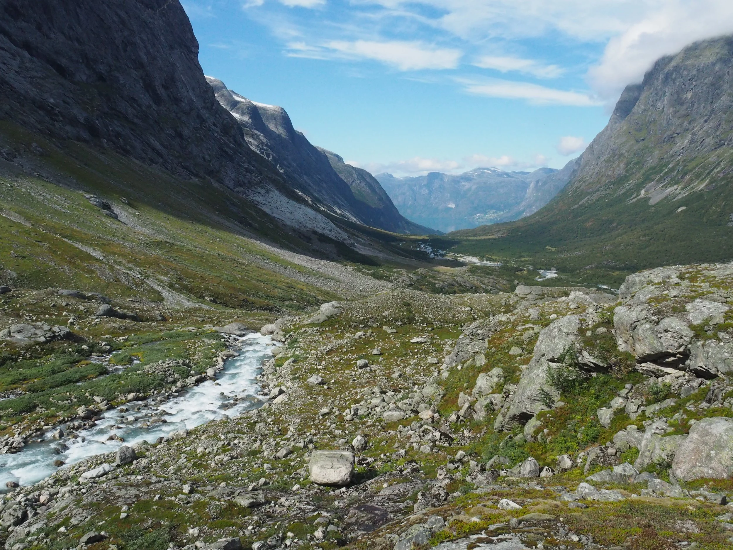
At Vesledalssetra, you’re met by awe-inspiring nature: steep mountain walls rise close around you, and glaciers hang on the slopes, occasionally breaking off snow, ice, and rock with thunderous sound. In the valley, cows graze peacefully.
Two arms of the Jostedalsbreen glacier extend toward the seter (summer pasture): Vesledalsbreen and Erdalsbreen.
Vesledalssetra has a long tradition as a starting point for glacier crossings of Jostedalsbreen.
In earlier times, cattle traders would buy large herds—sometimes including sheep and horses—and gather them at Vesledalssetra. When the weather was favorable, they would drive the animals across the Erdalsbreen glacier into Jostedalen, then continue eastward over the mountains to Drammen or southward to Bergen. This practice ended around 1920.
In more recent years, the glacier trip “Josten på langs” has become popular. This is a very demanding ski tour over 2–3 days, from Vesledalssetra to Flatbrehytta in Fjærland or Flatsteinbu in Olden.
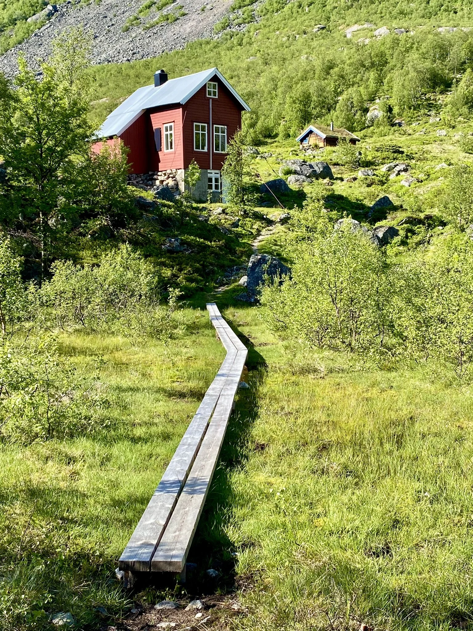
The red tourist cabin at Vesledalssetra was previously owned by glacier guide Tor Greidung. He was one of the last certified glacier guides in the area and led many trips across the glacier—most often from Vesledalsbreen to Styggevasshytta, and later on to Slæom.
Tor Greidung passed away in 1999 at the age of 80. Today, the Indre Nordfjord Trekking Association (INT) manages the cabin. They have a rental agreement with the current owner, and the cabin is in good condition. The key always hangs by the door!

Cows often graze in the pasture around the summer farm. Please show respect and do not disturb them.
In the background, you can see the red tourist cabin restored by INT. The cabin is in good condition, and the loft floor offers plenty of sleeping space.
The hike to Erdalsbreen begins in slightly marshy terrain just beyond the tourist cabin. Recently, wooden footbridges have been installed to cross the wettest sections.
After a short distance, you’ll reach a bridge over the river Vesledøla, which flows down from the Vesledalsbreen glacier.

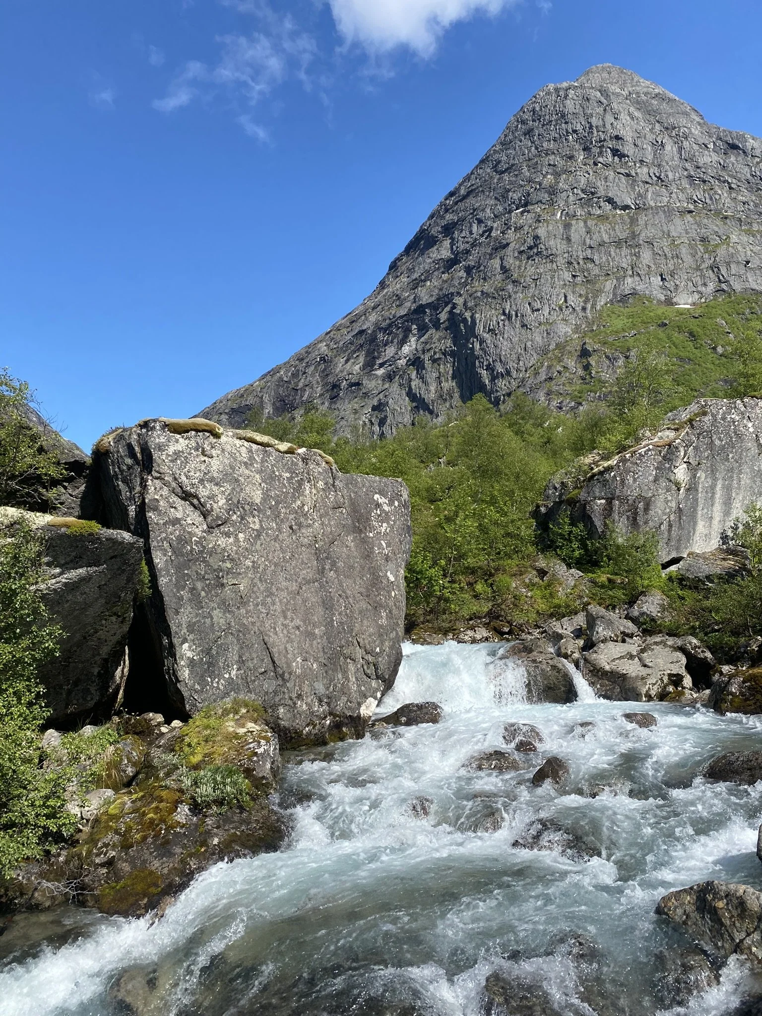
Bridge over Vesledøla
View from the bridge towards Strynekåpa (1530 m.a.s.l)
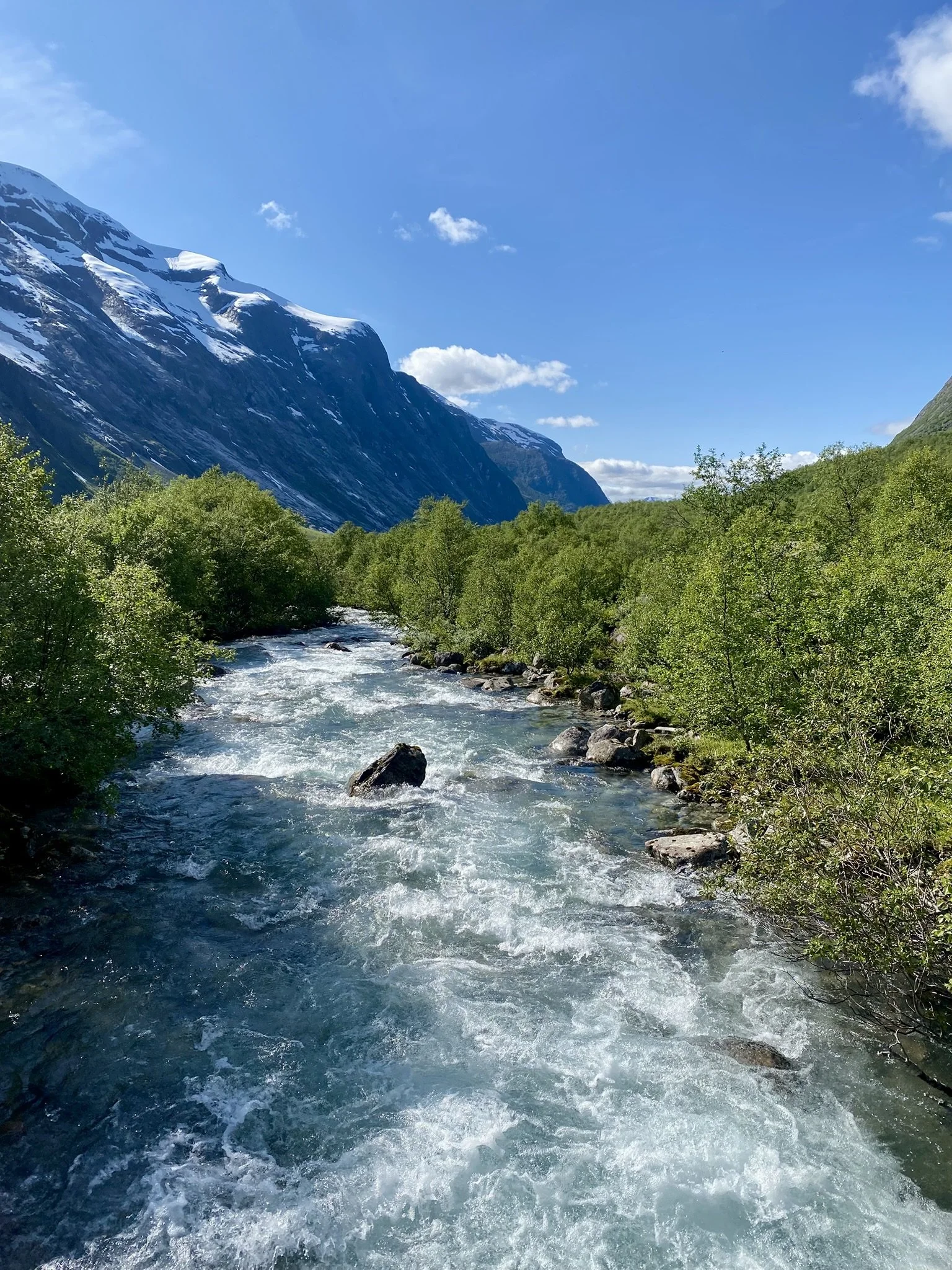
View from the bridge the other way

Beyond the bridge, several wooden footbridges have been installed. The trail continues over a small ridge called Myrahogjen before reaching the Vesledalsgrandane.
Here, the terrain flattens out, and the path winds its way through low-growing willows as you move further into the valley.

If you zoom in on the photo, you can see Vesledalssetra near the right edge of the image. Vesledalsgrandane — the flat area below Ulvestigen — is also visible. The photo is taken from the lower part of Ulvestigen.
Ulvestigen is a mountain ridge that stretches up-
ward toward Strynekåpa. The trail winds its way up along this ridge. At a certain elevation, the path levels out and heads toward the glacier.
This was the route used in olden times to drive large herds of cattle. Back then, the glacier extended down toward Ulvestigen, and the animals were driven onto the ice at the flatter section higher up.
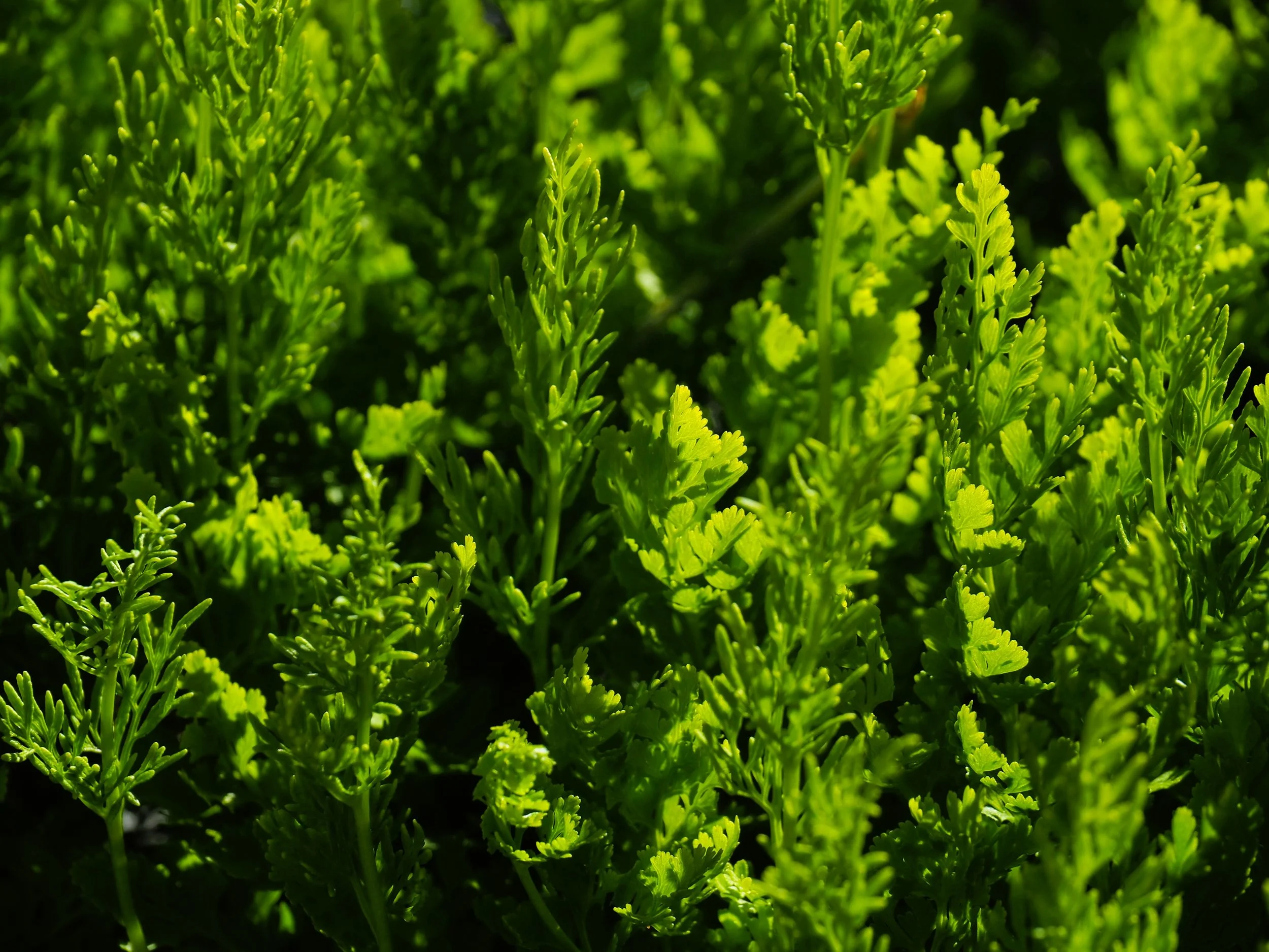
Along the trail to Erdalsbreen, horsetail fern, Cryptogramma crispa, grows in several places. This plant contains a toxin that can cause severe colic, especially in horses but also in cattle.
The cattle drivers were careful to prevent the animals from eating this plant.

Here we see a small group taking a break at Ulvestigen. In the background we see Erdals-
breen, right on the edge where the waterfall cascades down.
Jens Tjellaug b. 1881, who was a well-known local guide, is sitting with a walking stick in his hand and an alpine hat. We do not know the names of the others, but they are probably Americans who are visiting.
The picture was probably taken around 1930.

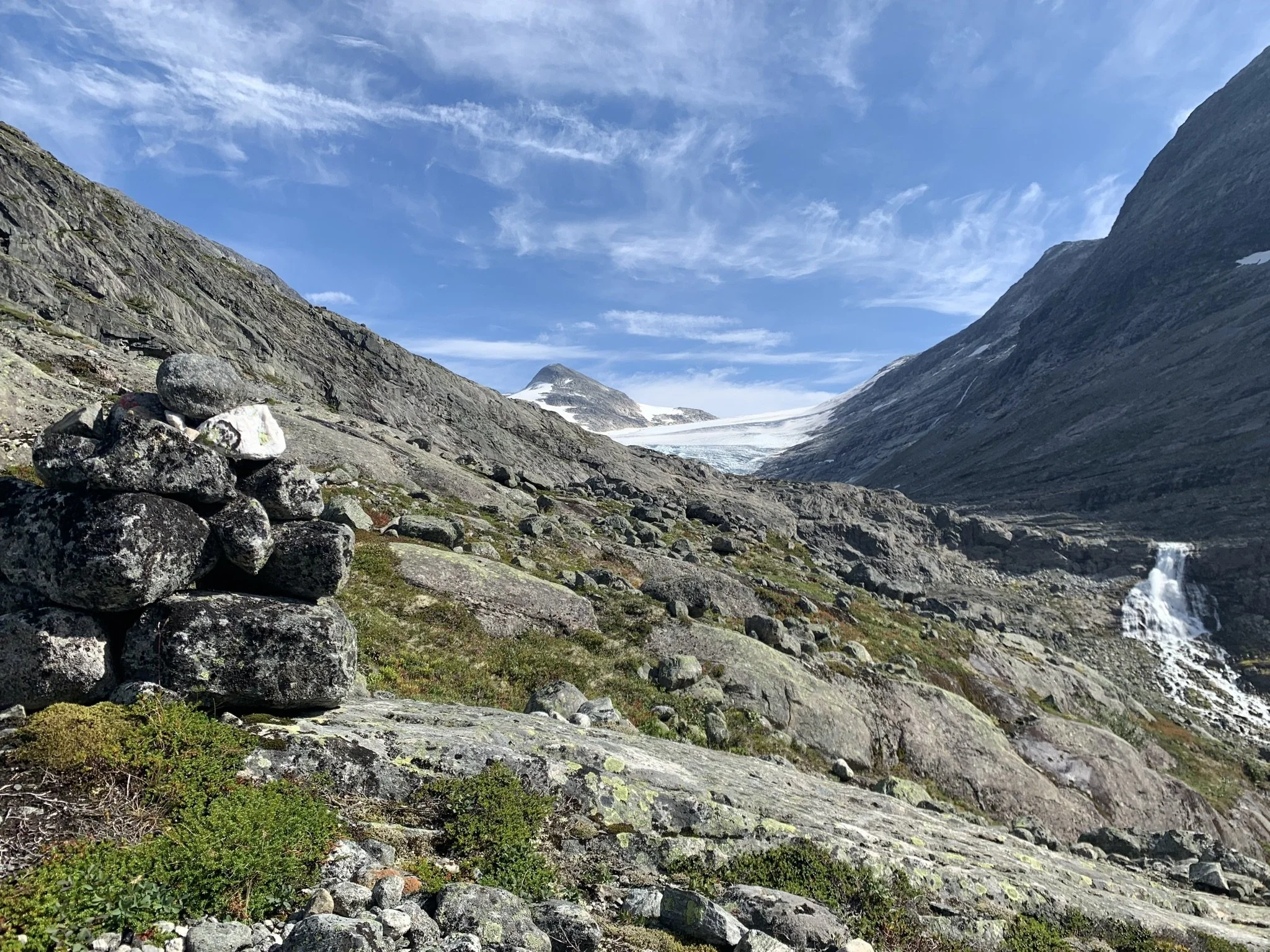
From Ulvestigen, you have a clear view toward a glacier arm that has now almost disappeared, but which, in the early 1900s, extended far down the mountainside.
In the year 1900, the well-known mountaineer and glacier guide Kristian Bing, together with the local glacier guide Ole Hogrenning, descended this glacier arm. It was a dramatic climbing in poor.
From this cairn, the trail angles in toward the glacier. It descends slightly before climbing up to a narrow notch in the mountainside.
Take care here—it's a steep drop if you were to fall.
The final part of the hike crosses smooth bedrock. In wet weather, some sections can be challenging to climb.
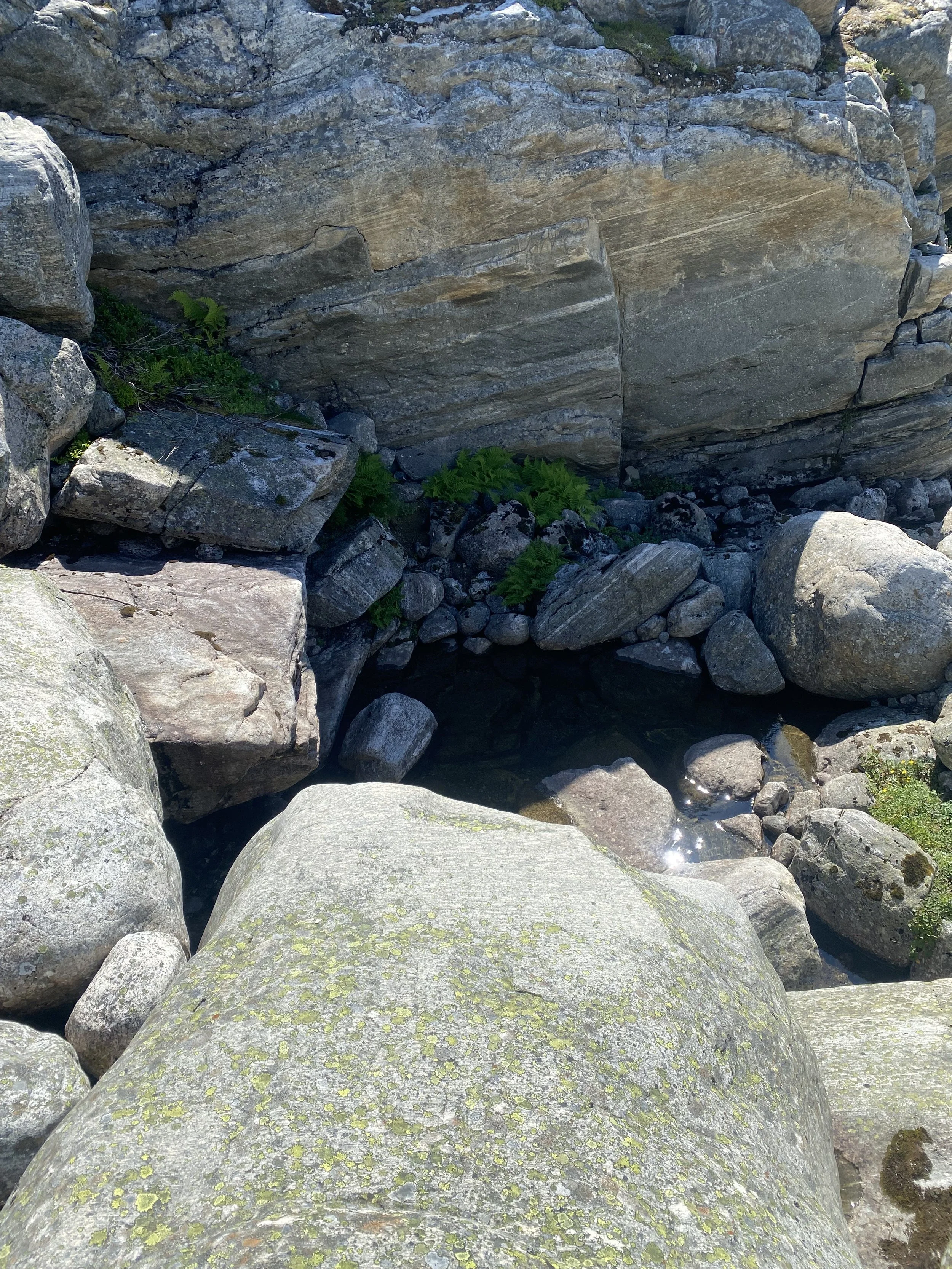
Just before reaching the height above the glacier lake, the trail follows a short stretch along a narrow gorge. Water usually flows here, and it is generally safe to drink.
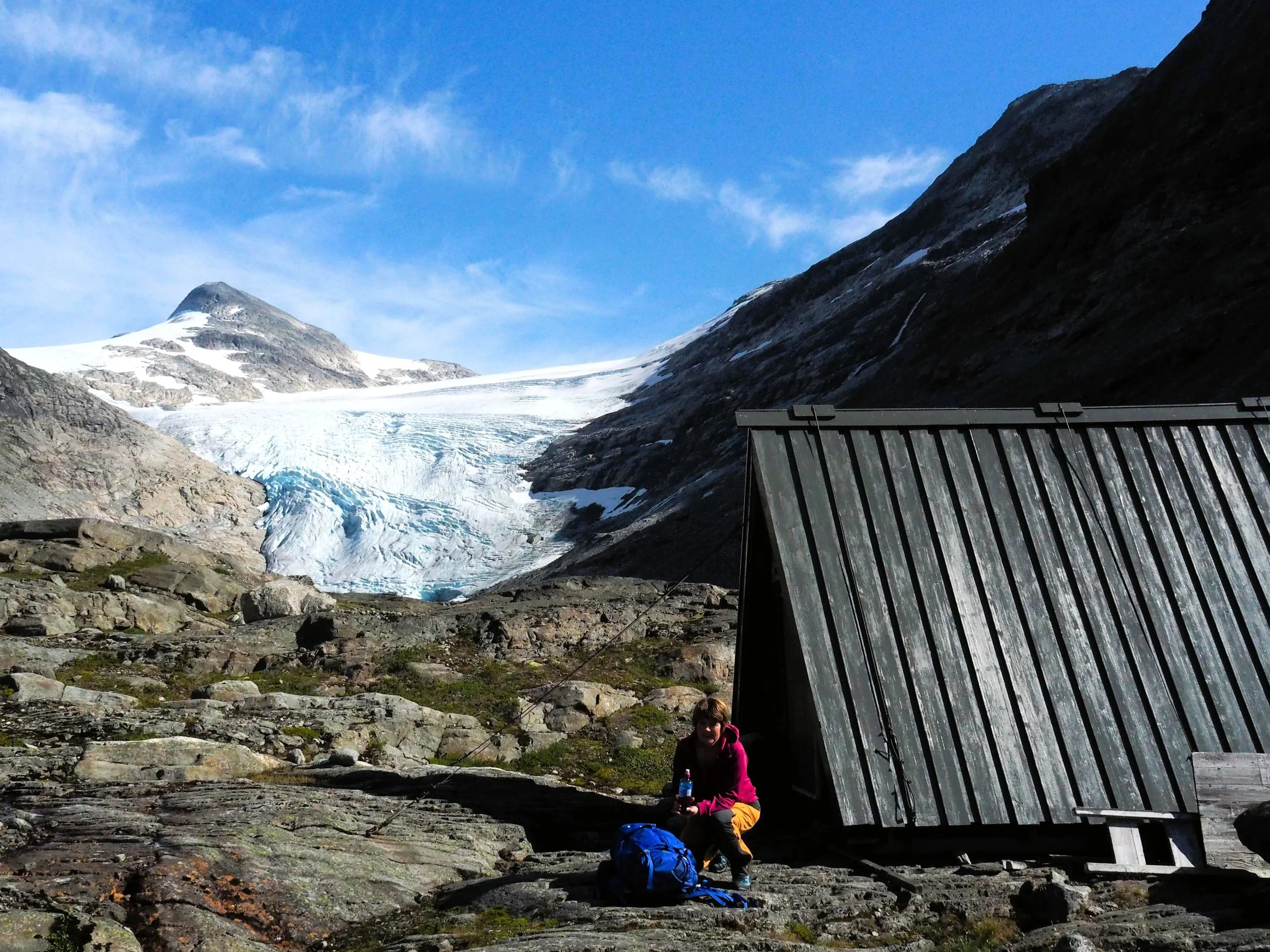
Once you’ve crossed the gorge, you can descend diagonally toward the river. Here you’ll find a cabin called Infimus.
Infimus means "the lowest" and is the lower of two cabins built by the Norwegian Water Resources and Energy Directorate (NVE) during the planning of a major hydropower development in Breheimen in the early 1970s. The other cabin was called Optimus, meaning "the best." It stood near Fremste Kåpa (1,773 m.a.s.l.) and has since been dismantled.
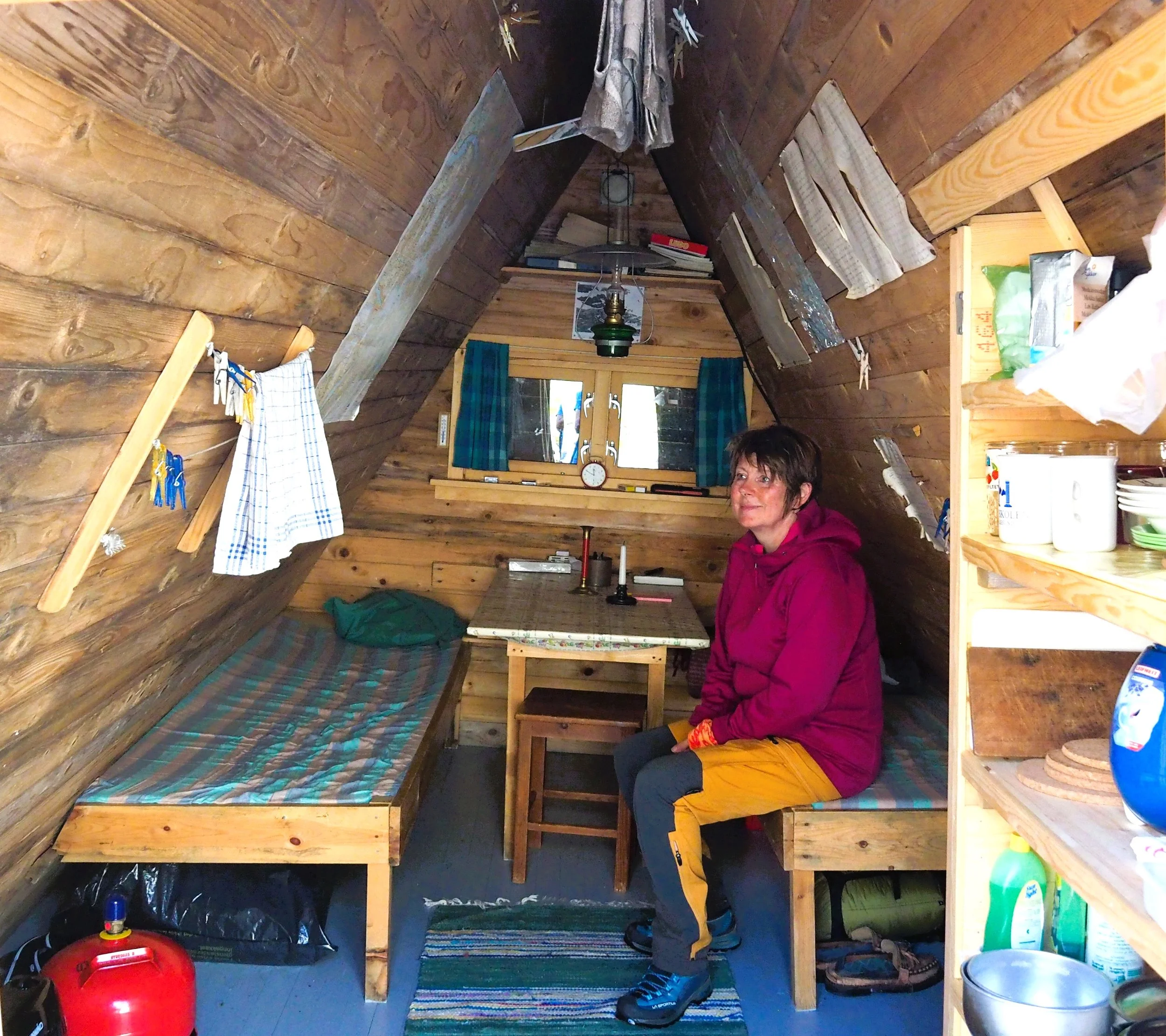
Infimus is equipped with two bunks with mattresses, a gas stove, and a gas heater.
It is open and unlocked year-round, and serves as an emergency shelter maintained by the Indre Nordfjord Trekking Association (INT).

Photo: Tor Reiel Guddal
At Infimus, about 30 meters from the cabin, a well-camouflaged outdoor toilet has been created. There is a sign on the cabin wall.
Erdalsbreen 18.07 2025 Photo: Kenneth Berge-Scøld
It’s only a few hundred meters from Infimus to the glacier lake.
In the mid-1990s, the glacier covered the entire lake. Today, the lake is one kilometer long. This is a striking example of the rapid retreat caused by global warming.
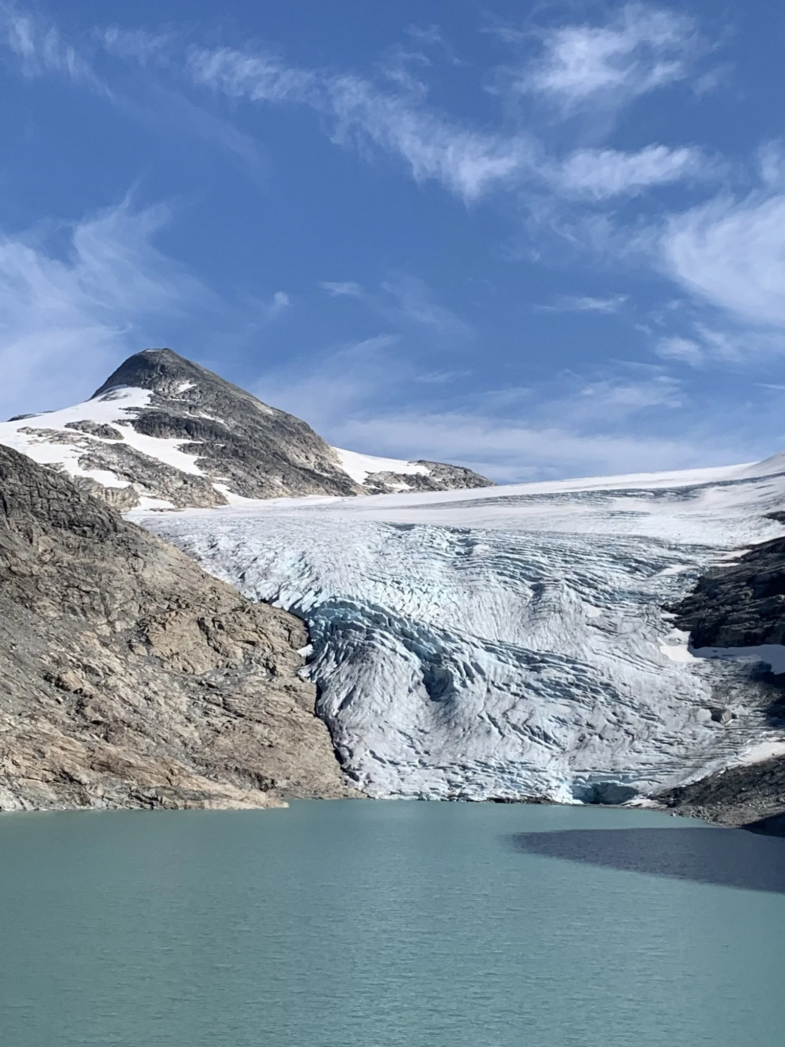
Erdalsbreen 17.08.2021
The glaciers have never retreated as rapidly as they have in the 2020s.
We will feel a great loss when our glaciers are gone.

Jens and his group enjoy a small dram by the glacier.
There is said to have been a brook not far from the glacier known as Brennevinsgrova — “the Liquor Brook.” The name may come from the fact that a drink was especially welcome after a long journey across the glacier.
Perhaps it was a spring with particularly good water. Today, no one knows exactly where Brennevinsgrova was located.

Between 1900 and 1950, the glaciers retreated significantly. The photo shows that around 1930, Erdalsbreen formed a steep edge against the rock.
In 1923, a cattle drive had to turn back here and take the route over Strynefjellet because it was impossible to get onto the glacier. After that, the tradition of driving livestock across Erdalsbreen came to an end.
Brit Sørum is the owner of the three black-and-white photos.
By the glacier lake, you can find several types of alpine plants. They are characterized by having shorter and sturdier stems compared to their lowland counterparts, and their flowers are more colorful. In addition to a strong scent, these traits are crucial for attracting insects that pollinate the plants.

Mountain harebell,
Campanula uniflora

Mountain goldenrod,
Solidago virgaurea

This is our national flower, the bergfrue,
Saxifraga cotyledon, also known as the queen of the mountains.
Text: Asbjørn Berge, 2025
Photos: Marit og Asbjørn Berge