
HIKE TO FOSSEN


The hike to the waterfall takes you through varied terrain. You first walk through lush mountain birch forest, then the trail follow along a rushing glacial river in open, rocky terrain as you approach an impressive waterfall. Behind the waterfall lies an idyllic glacial lake.
Grading: Demanding. This hike requires good physical fitness and experience with steep terrain.
Distance: 2.6 km one way from Vesledalssetra.
(6.2 km from the parking lot at the end of the toll road.)
Elevation gain: 440 meters from Vesledalssetra. (640 meters from the parking lot)
Estimated time: 3.5 hours round trip from Vesledalssetra. (6.5 hours round trip from the parking lot)
Season: Summer and autumn
Parking: You can park at the lot at the end of the toll road. Remember to pay the fee!
If you park at Greidung, the hike will be more demanding.
Note: The entire route is marked with red Ts.
The final stretch up to the ridge by the lake is particularly steep. Here, a fixed chain is bolted to the rock for support.
See 'Hike to Erdalssetra' and 'Hike to Vesledalssetra'.
There is no mobile coverage on the mountain hike!


Hike description
Vesledalssetra has long traditions as a starting point for hikes across the Jostedalsbreen glacier. The photo is taken facing towards Fossen (the waterfall) and the Vesledalsbreen glacier. You can find the trail along the left edge of the picture.
The red tourist cabin at Vesledalssetra was once owned by glacier guide Tor Greidung. He was one of the last licensed glacier guides in the area and led many trips across the glacier. Most of the tours went across the Vesledals-
breen to the Styggevasshytta cabin — and later on to Slæom, on the east side of the glacier.
Tor Greidung passed away in 1999, at the age of 80. Today, the Indre Nordfjord Turlag (hiking association) is responsible for the cabin. They have a rental agreement with the current owner, and the cabin is well maintained.
Vesledalssetra is located in a majestic landscape with high mountains and glaciers hanging on the mountain slopes. Cattle are grazing peacefully on the summer farm pasture.

Glacier guide Tor Greidung (1919-1999)
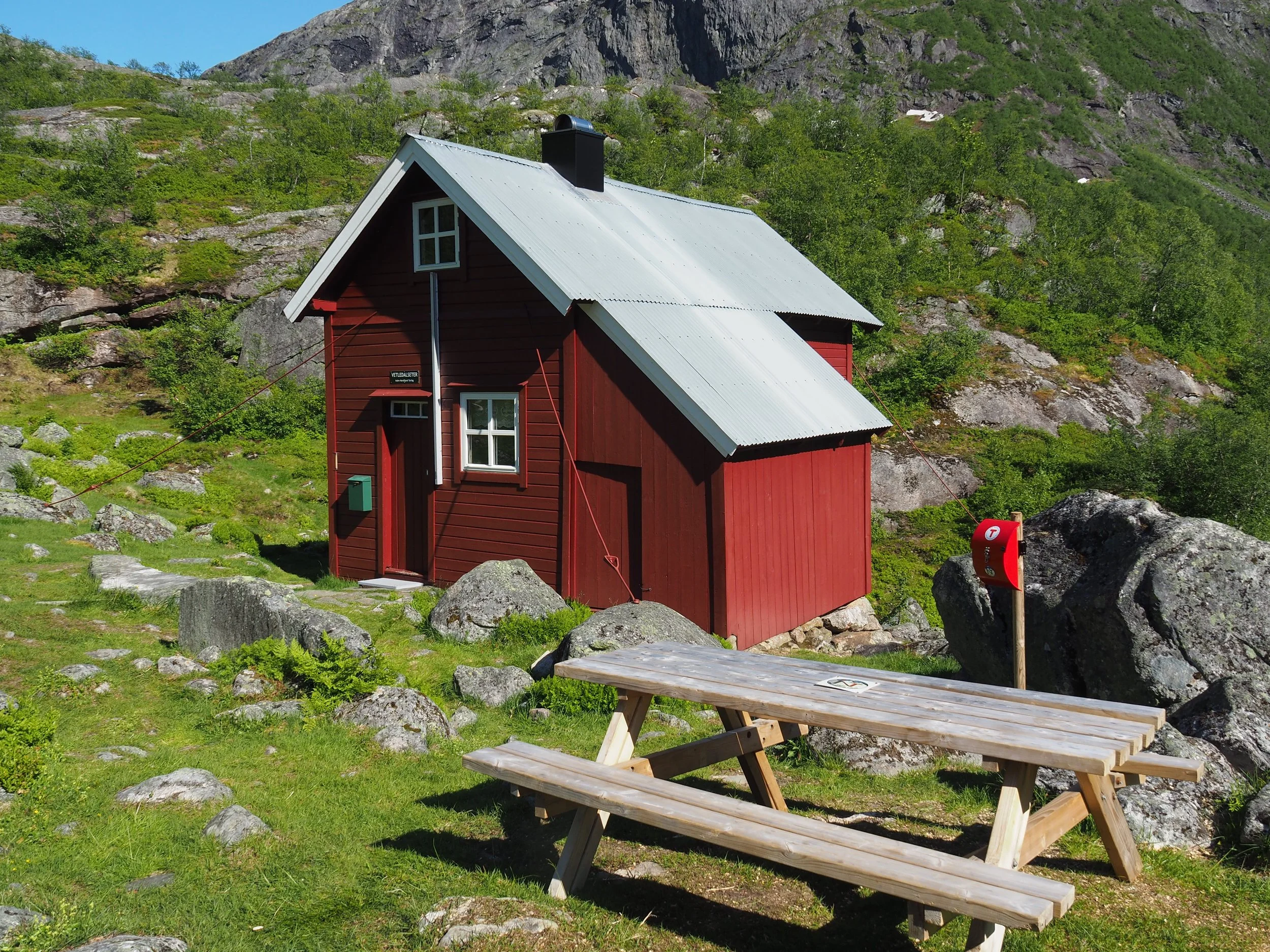
Solar panels have been installed. The living room has been repainted and is cozily furnished. A new kitchen has been fitted. In the loft there are many sleeping places, and some provisions can be purchased.
The key is always hanging by the door.

The trail is cleared and well marked with red Ts. It should not be difficult to find your way. The first part of the hike goes through lush mountain birch forest.

After about fifteen minutes of walking, you reach a large open plain called Seltuftene. Excavations indicate that there was likely a summer farm here as far back as the beginning of the Common Era. Today, little remains to be seen. It was likely a damming of water or a rockslide that forced the farmers to move the summer farm down to where the summer farm buildings stand today.
No one today knows for sure when the summer farm was relocated. It must be several hundred years ago.

From Seltuftene, the trail winds its way further through the mountain birch forest. In some places, the ground may be wet, but the path is mostly easy to walk.
As you approach Tårnet (See the picture below.), the trail follows a rushing river. The powerful roar of the waterfall will accompany you for most of the hike further to Fossen.
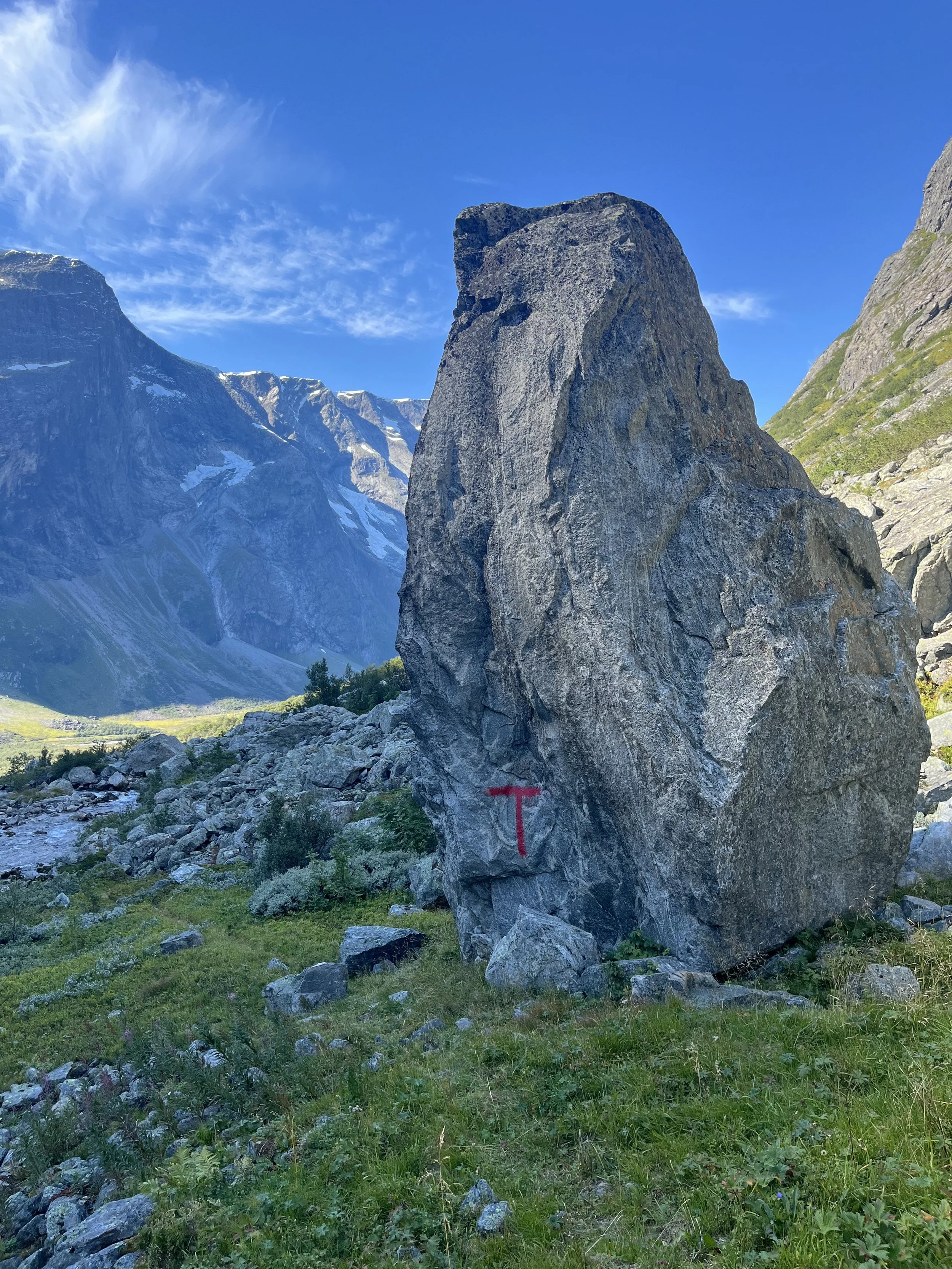
Here you see Tårnet (tower), a large upright-standing rock. Tomefjellet (1835 m a.s.l.) to the left, and Middagshyrna (1857 m a.s.l.) in the background.

As you pass Tårnet, the landscape opens up, offering a wide and free view with the impressive waterfall in the background.
The trail then winds its way up the valley through a field of rocks, as shown in the picture.
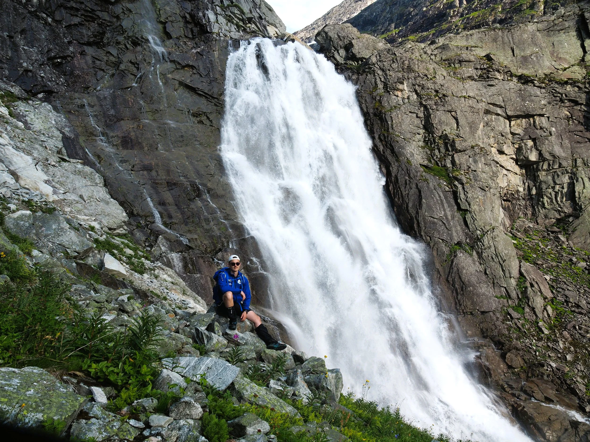
The waterfall is majestic when the water flow is high on hot summer days.

The Queen of Norway, Sonja, at Fossen, 1st August 1993. Painting by Kolfinn Bolstad after a photography by Håkon Loen.

The last section near the waterfall is steep, and here you need to walk carefully and hold firmly onto the chain. As you can see in the photo, the trail is well marked with red Ts.
People with a fear of heights may find this part challenging.

These little boys have made it all the way up to the height where the waterfall plunges over the cliff.
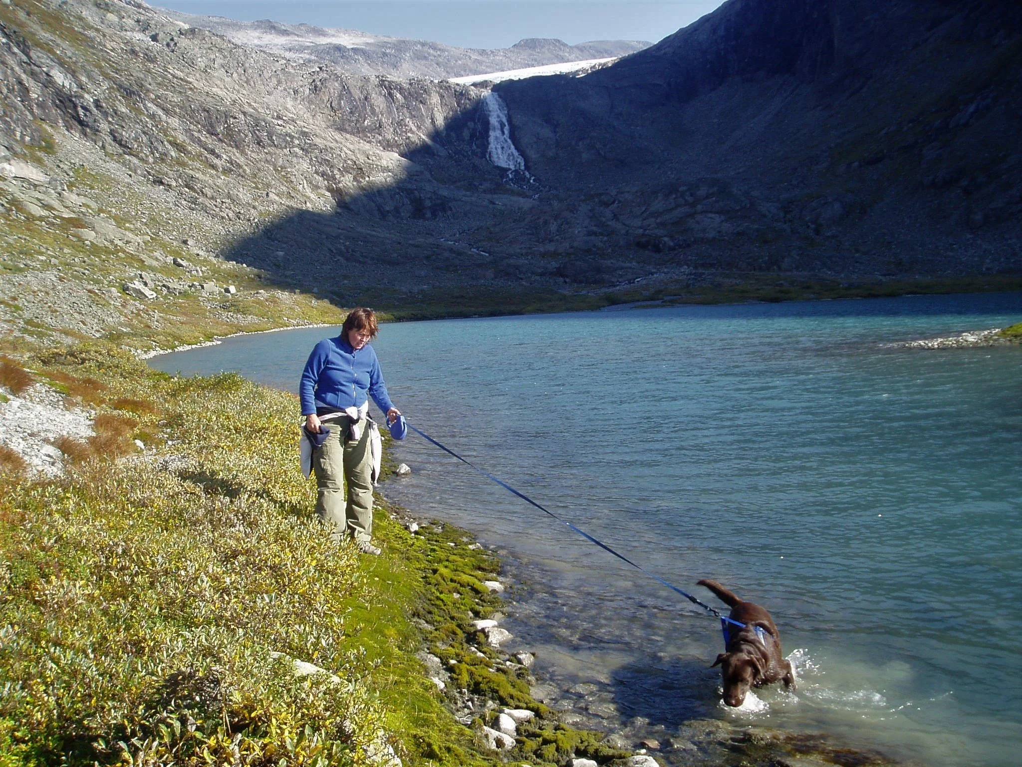
When you reach the rise by the first glacial lake, you can see yet another waterfall, and behind it you can glimpse the Vesledal Glacier.
The glacial lake is gradually being filled with moraine material carried by the river from the glacier. At some point in the future, there will be a glacial outwash plain here.
Text and photos: Asbjørn Berge, 2025