

Hike from Folven to the old Sundal farm


The hike into Sunndalen starts with a steep climb until you reach Kleiva. In the middle of this first climb, you will see a memorial stone to the two largest landslides that occurred in 1718 and 1868. Many people were lost in these two events.
Grading: Medium difficulty. Gravel road. Driveable road for both cars and tractors. A slightly steep section at the start.
Length: 4.5 km one way.
Elevation gain: 195
Time required: As a walk – 3.5 hours return.
Season: Spring, summer and autumn
Toll road: Payment at the cash register or Vipps
Parking: You can park at the starting point right by the gate/trail or in the parking lot between Haraldsfallet and the Sundal farm. At this parking lot there is also an information sign for Jostedalsbreen National Park.
Note: If there is a lot of snow in the mountains early in the year, there may be a risk of avalanches in both Svellingsfonna and Haraldsfallet.

Hike Description
The hike into Sunndalen starts with a steep climb until you reach Kleiva. In the middle of this first climb, you will see a memorial stone to the two largest landslides that occurred in 1718 and 1868. Many people were lost in these two events.
As you continue uphill, you will come to the first nature and cultural trail post – Kleiva when you pass a bend in the road with a high rock cliff on one side and large seating stones on the side of the road. Here you have a good view both down and up Hjelledalen. These nature/cultural trail posts are marked with wooden signs along the road and are set up at well-known places along the road, often linked to natural conditions and history. When you get a little further uphill, you will come to Hogane, or Furuhogane – the name probably comes from the fact that this is where you see the first pine forest in the valley. The road now goes through slightly hilly terrain, and you pass name signs such as - Heimste Hogane - Kolura - Fremste Hogane - Folvagotene - Kagehølen - Gutalsgotene - Knut-Erike-kvilet - Trongurledet
Then you come to Alfloten, a place that was cleared and houses were built on by the users of Sundal farm. And was used as an overnight place for their families when there was a danger of avalanches in Sundal.
Further inland you come to Haraldsfallet, first to a steep hill where the road has found its footing between the river and a high rock cliff. In early spring there can be a risk of landslides here, if there is still some snow in the high mountains. When you reach the last bend here, you will find a large gravel/sand layer that has been taken out of the river. This is used as aggregate to repair the road after flooding situations – which have happened many times throughout history.
A little further into the valley you come to the parking lot with information signs about Jostedalsbreen National Park. More information about the nature and culture trail posts can be found in separate articles.
The gravel road continues flat for a few hundred metres before you reach Sunndalsbakken. When you arrive here, try to catch a glimpse of the old stone walls from the two farms situated beneath the cliff up to the left.
A little way up the hill, you will see a sign marking the old village road leading up to the farmstead. You can follow this path to see the remaining stone walls from the houses on this avalanche-prone farm.
Another option for viewing this cultural heritage site is to turn left at the top of Sunndalsbakken and walk back along the upper side of the barn, where you will find a track leading out to these ruins.
The farms were abandoned in 1902, and since then there have been no permanent residents at Sundal farm. However, during the 1960s and into the 1970s, goats were milked here during the summer months. The current owner of the farm is Ivar Jarle Åsvoll.
On 1 May 2026, the association “Gamle Sundal gard” (“Old Sundal Farm”) was founded here, with around 150 people attending. The purpose of the association is to clear the area around the old stone walls, put up information boards, and restore an old farmhouse to serve as a museum. They aim to tell the dramatic story of this avalanche-prone farm — and of the people who never gave up their struggle against the forces of nature.
Responsible for text and images:
Tor Guddal
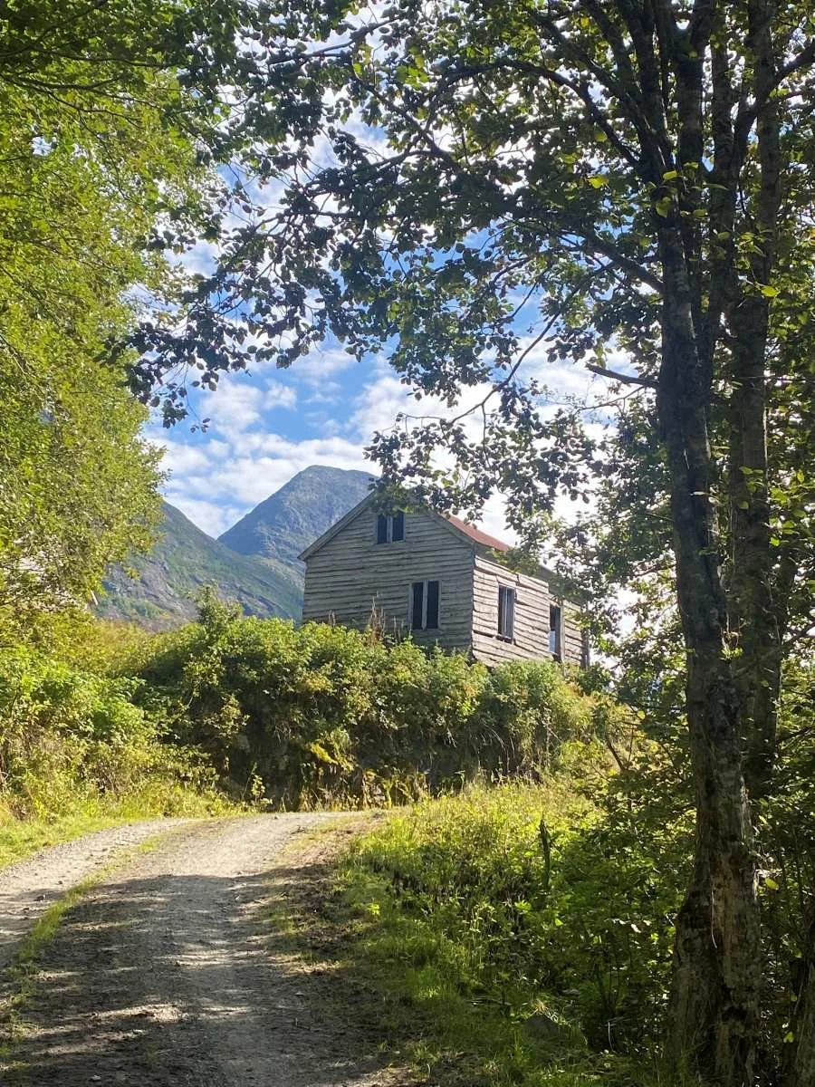
This old cottage at Sunndalsbakken will be turned into a museum
Some Photos From the Hike

The memorial stone after the landslides

Svelingsfonnja – landslide in March 2025 with damage in Hjelledalen from a snow plug/water reservoir upstream that suddenly dissolved.
Old and hollow tree at Alfloten

Information at the Parking Lot

Information at the Parking Lot
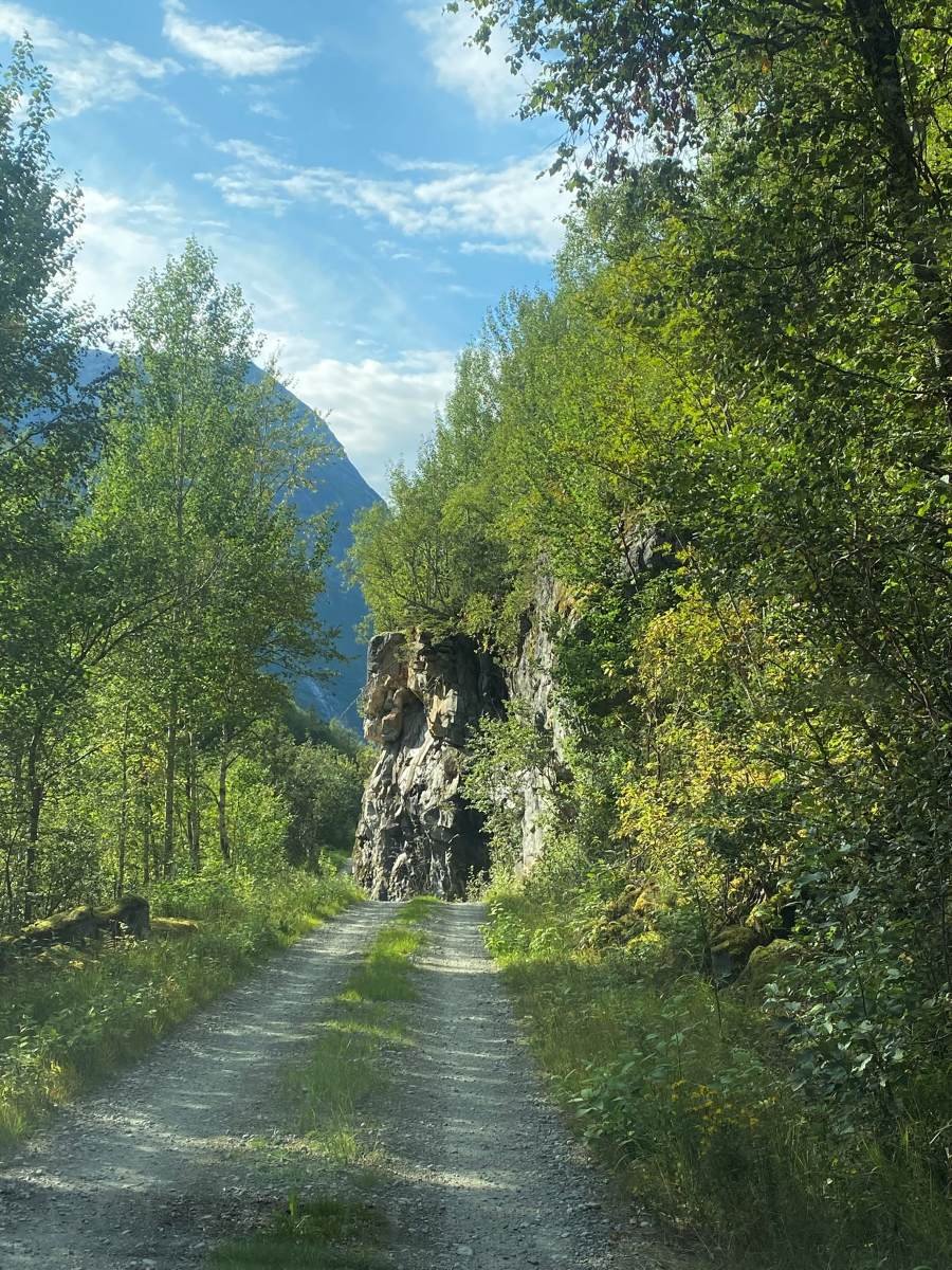
Haraldsfallet. Here, Sunndalen is at its narrowest.
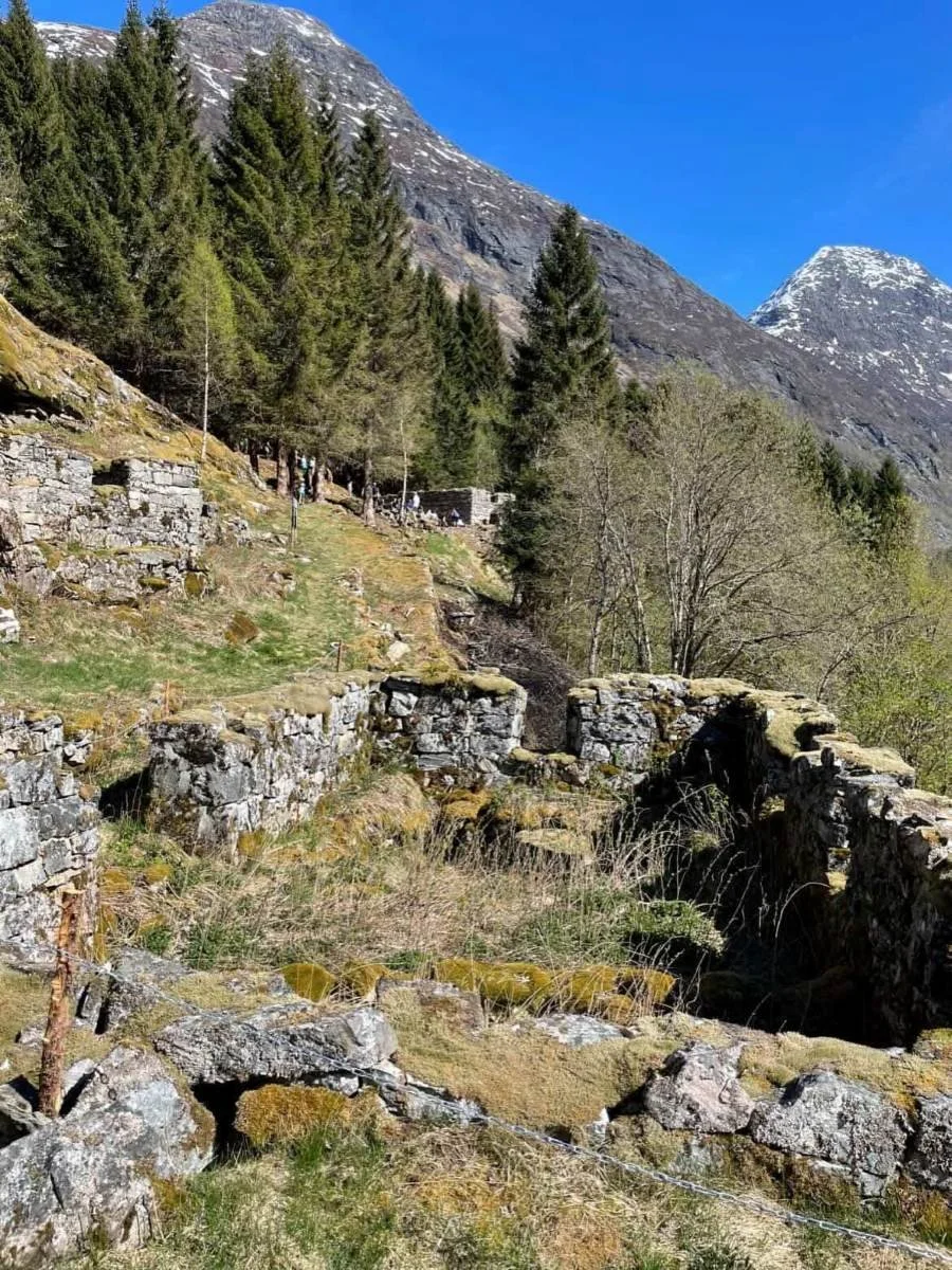
The stone walls of an old cowshed. To the left is a farmhouse (Larsbruket). In the background is a cowshed. (Nilsbruket)
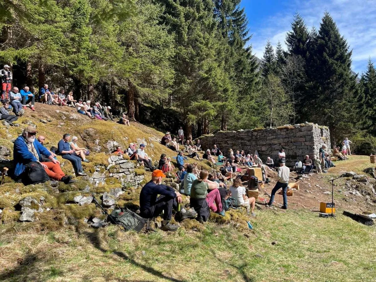
Official opening of the association Gamle Sundal gard, 1 May 2026.