

Hike to Tverrelvskaret


Tverrelvskaret
Grading: Challenging
Length: 4,5 km one way
Elevation gain: 650
Time required: 6 hours round trip.
Season: Summer and autumn
Toll road: Payment at the cash register or Vipps
Parking: You can park at the starting point right by the gate/trail or in the parking lot between Haraldsfallet and the Sundal farm. At this parking lot there is also an information sign for Jostedalsbreen National Park.
Note: This Hiking description starts at Sunndalssetra and goes up the terrain on the east side of Tverrelva. Steep climb almost the entire way. There is a signpost at Sunndalssetra route direction.
There is no mobile phone coverage on the hike!

Hike Description
The hike from the parking area to Sunndalssetra is described under Hike to Sunndalssetra via Hola.
It may be wise to download the PDF file Hike to Tverrelvskaret.
The hiking route is not drawn accurately.
The majestic Tverrelva, which you can see from almost everywhere in Sunndalen, comes down the mountainside from the north side of the valley.
Tverrelva is a photo opportunity and provides various nature experiences, almost all year round. From frozen ice floes in winter to breathtaking waterfall spray and rushing from the river in summer.
The entire continuous waterfall starts at an altitude of 920 meters above sea level and ends at the confluence with the Sunndøla river at an altitude of about 440 meters.
Tverrelva originates from the melting of the glacier from Tystigbreen, the mountain area at Nuken and the surrounding area. In the last 10 years, the glacier edge has retreated a lot, like most other glacier arms in our country.
During flood periods with a lot of rain and high temperatures, a lot of loose material is also transported with the river. These loose masses are carried along with the watercourse further down to the outlet in Oppstrynsvatnet. Some also end up in the river course to Hjelledøla. This has become an increasing problem for agriculture in the valley, since sedimentation on the riverbed results in more flooding of agricultural land than before.
There is a path that branches off from the flat grazing area at Sunndalssetra to Tverrelvskaret. A signpost is located approximately in the middle of this grazing area, and along the first part of the trail, the forest has been cleared away.- so that the start of this trail is clearly visible.
The difference in altitude between Sunndalssetra and Tverrelvskaret is approximately 500m.
The trail winds steeply uphill through lush birch forest. The path is both cleared and marked, but you still need to pay attention to avoid taking the wrong way.
There is good grazing for sheep in Tverrelvskaret, and red deer also thrive in this area. In earlier times, there were many wild reindeers here as well, but the population has declined significantly. Old hunters’ shelters bear witness to the period when reindeer hunting took place in Tverrelvskaret. The hunters found shelter beneath overhanging rocks, and they built stone walls to protect themselves from the wind.
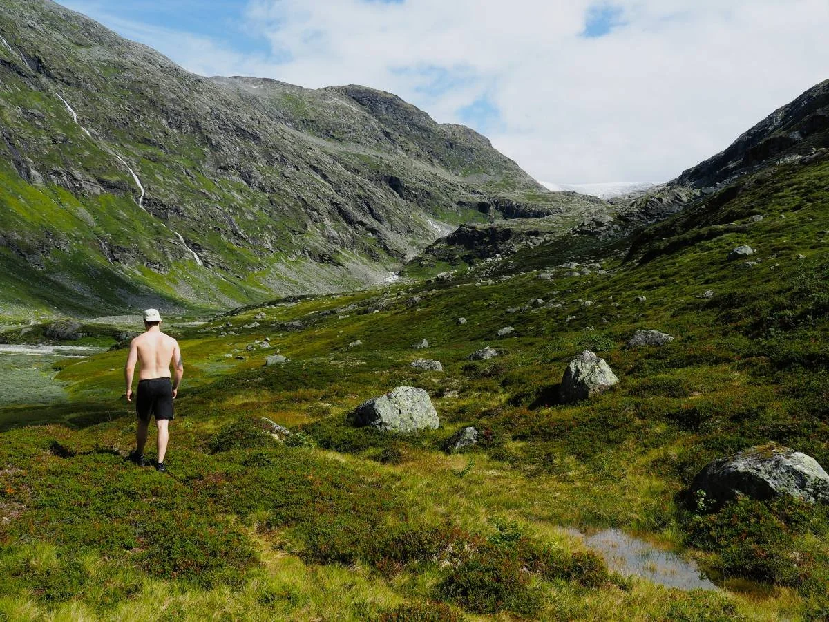
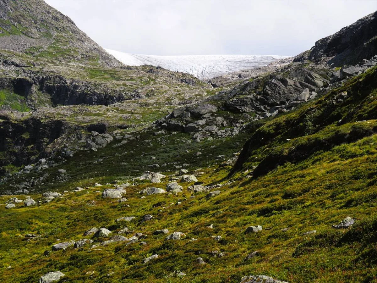
If you are in good physical shape, you may continue further into the valley. The terrain is fairly flat at first, but after about one kilometre it begins to rise steadily. If you walk two kilometres further into the valley, you will get a close view of one arm of the Tystigbreen glacier. There are several steep, glacier-polished rock slabs in this area because the glacier has only recently retreated from here. Wet rock slabs can be slippery, so take care.
If you have experience navigating in the mountains, you should be able to find a safe route across to Kamperhamrane and follow the old mountain trail back to Sunndalssetra.
Text and photos: Tor Guddal and Asbjørn Berge, 2026
Some Photos From the Hike
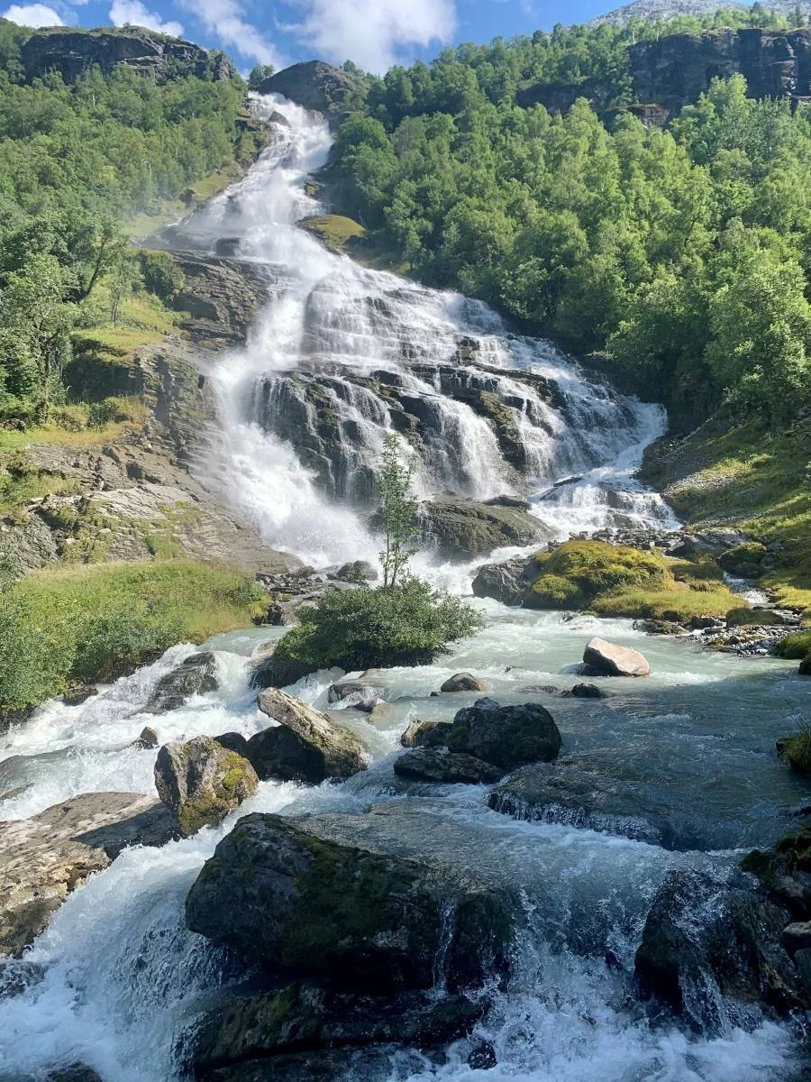
Tverrelva
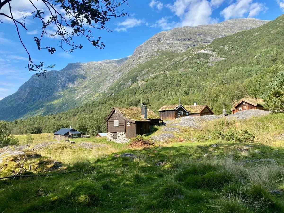
Sunndalssetra. Tverrelvskaret in the back to the right.
On the path. Sognskaret behind.
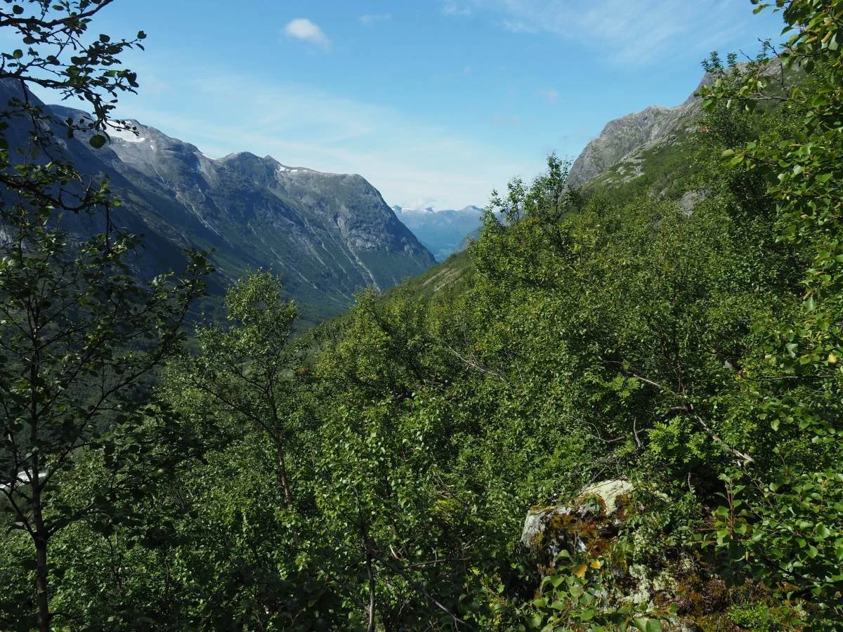
On the path. View towards Oppstryn.
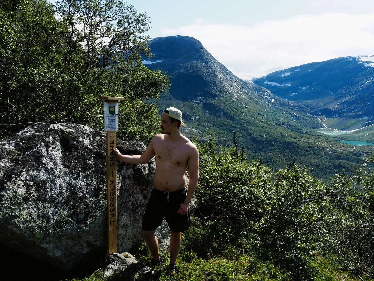
Destination reached: Tverrelvskaret.
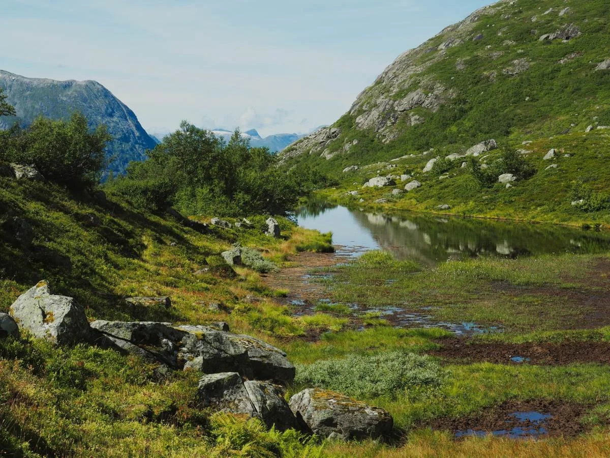
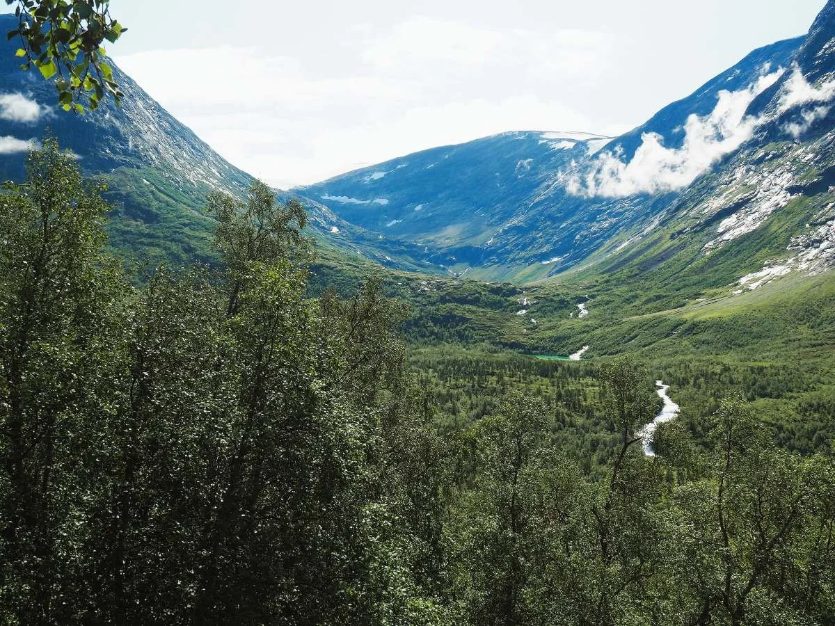
Idyllic tarn in Tverrelvskaret.
Flat terrain for the first section inward.
The terrain rises inward towards Tystigbreen.
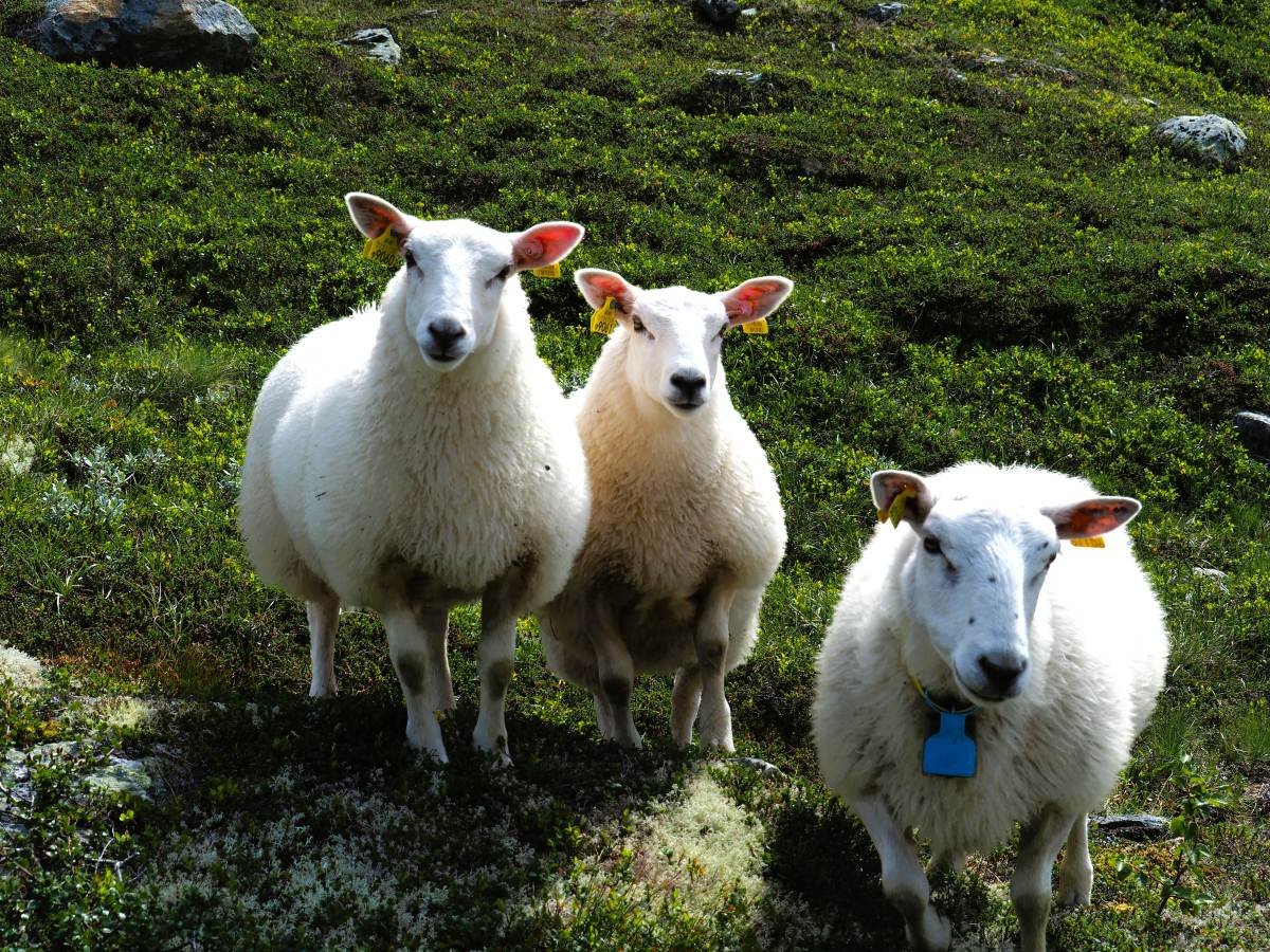
Ewe with two lambs. Clean, white wool.
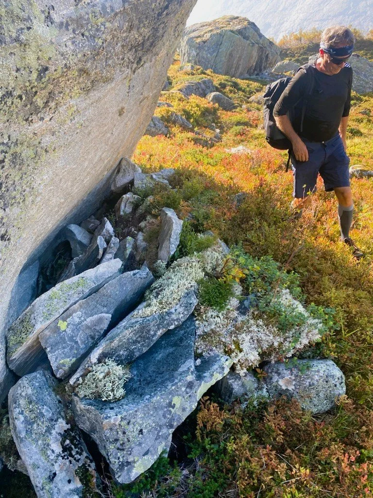
An old resting place.
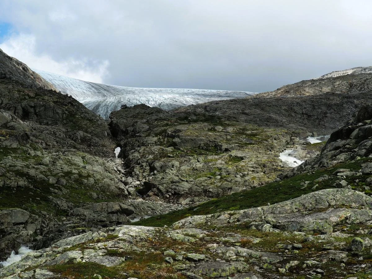
Barren landscape. Tystigbreen in the background.
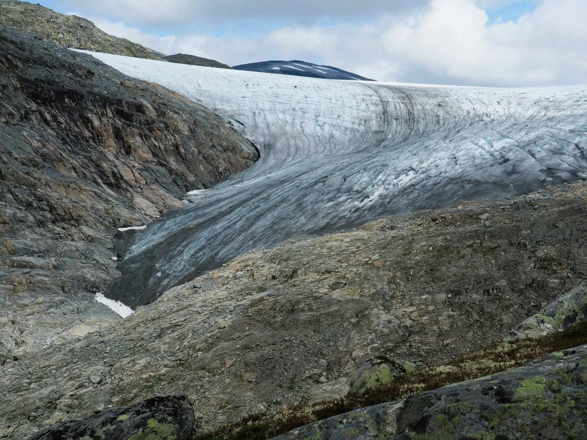
An arm of the Tystigbreen glacier.