

Hike to Sunndalssetra over Setreåsen


Sunndalssetra (Summer farm)
Grading: Medium difficulty. Hiking inland along the valley where you follow the farm road over Setreåsen. Three steep hills, otherwise mostly flat terrain.
Length: 3.3 km one way.
Elevation gain: 180
Time required: 3 hours round trip.
Season: Spring, summer and autumn
Toll road: Payment at the cash register or Vipps
Parking: You can park at the starting point right by the gate/trail or in the parking lot between Haraldsfallet and the Sundal farm. At this parking lot there is also an information sign for Jostedalsbreen National Park.
Note: Here you start walking on an improved path inland and up Grønebakken (financed by State funds for improving access to the National Park). Further inland, two other ascents have also been improved by the landowners' association - to make it easier for cattle to get to summer pasture. There was clearing along the path and some other upgrading in 2024.
There is no mobile phone coverage on the hike!

The orange line shows the trail across Setreåsen.

Overview map of Sunndalen
Hike Description
When you start walking in from the parking lot, there are a few hundred meters of flat road before you enter Sunndalsbakken. When you round the bend and look up the road/hill, try to catch a glimpse of the old stone walls from the two farms up below the hammer on the left. There is dense forest here, but you can see through the forest – at least before the leaves come out. Another option to see this cultural monument is to turn left up on Sunndalsbakken, go back up the slope where you will find a path out towards these ruins. The farms were abandoned in 1902, and since then there has been no permanent residence on Sundal farm.
However, in the 1960s and a little into the 1970s, there was summer milking of goats on the farm.
The current owner of the farm is Ivar Jarle Åsvoll.
A little past the red house you come to the end of the road, where there are gates on both sides of the bridge over Sunndøla. Just after the bridge, you have to go right into a section of trail. Here are also signs for the two trails you can choose to walk. The trail for this description will go forward on the south side of the valley – over Setreåsen to Sunndalssetra. In local vernacular it is called – “to go Åsen”. The trail inwards to the setra is slightly hilly, but with three steep climbs along the way. It is up the three hills called Grønebakken, Skorbakken and Brattestigen. Start first on the improved trail that was completed in 2018/2019 by the National Park Administration. This is to improve the arrangements for exits in the national park. The trail has been improved from the bridge in Sundal to the top of Grønebakken. Further inland there is a flat section before reaching Skorbakken. Up at the gate/trail here, you will see the sign that shows you have entered the National Park.
From here and further inland, it is actually a downhill slope at first, before continuing on almost flat terrain until the last climb called Brattestigen. Here you pass a marsh area under the hammer called Storemyra. If you are lucky and out at the right time, there may be mullet to be found here.
Once you have reached Brattestigen and a little further, you have come to a place called Glåma. The word means "to stare with wide eyes" - "to glow" - "to shine". This is the place where you can see the seal buildings on the setra through the forest.
There are many different tree species growing in Setreåsen, but at the top of Brattestigen/Glåma it is dominated by old pine forest. Some old dry pines can also be found in this area.
Further inland, it is a bit downhill before you reach Setrebrua, where you cross the Sunndøla River. A few hundred meters further on you will come to the trail section, where on the return journey you can walk along the river back to Sundal gard. From here it is only 500m to Sunndalsetra. Through the management plan for the national park (prepared in 2022), measures have been prepared under the auspices of the Jostedalsbreen National Park Board to safeguard both the trails and the farm landscape in Sunndalen/Sunndalssetra. This is in collaboration with the landowners. This also means that landowners who carry out prioritized tasks/work are paid for this work according to fixed hourly rates.
Responsible for text and images
Tor Guddal
The Hike in Photos

Looking back over the valley

The foundation wall is still standing well

Looking out over the valley from the ruins of the farm buildings

From the top of Grønebakken

Skorbakken

Up at the gate/trail here, you will see the sign that shows you have entered the National Park

Brattestigen

Glåma

Here we see the cabins at Sunndalssetra

Dry pine in Setreåsen
Sunndalsetra with Kamperhamrane in the background

Sunndalssetra – a nice place for a break
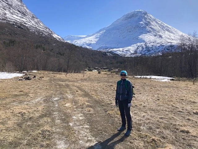
Sunndalssetra on a nice spring day

Who are you???

Sheep collection