
Hike to Stol


The Stol summer farm is beautifully situated on a ridge deep inside Glomsdalen. It is about 9 km from the parking area at Glomnes, with an elevation gain of 650 metres. On the way to Stol (680 m a.s.l.), you pass two summer farms: Glomnessetra (400 m a.s.l.) and Midtstøylen (620 m a.s.l.). At Stol, several protected cultural heritage sites have been registered.
Difficulty: Demanding. This hike requires good physical fitness and experience with walking on uneven terrain.
Length: 9 km one way
Elevation gain: 650 m
Duration: 8.5 hours round trip
Season: Summer and autumn
Parking: You can park at the parking lot located about 200 meters from the Glomnes farm. Remember to pay the fee!
Note: Early in the summer, it is common to encounter snowfields across the valley at Utfalla.
You will not have mobile phone coverage on the hike.

Hike Description
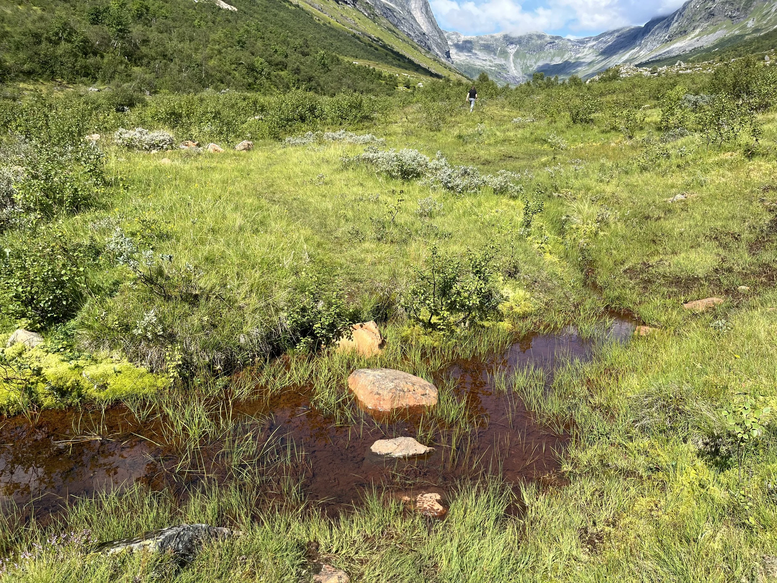
Right by the car park, you go through a gate that leads into an enclosure for sheep. You go on through yet another gate and follow the path along the fence until you turn 90 degrees to the right up a hill. Here it is relatively steep and winding all the way to Kvilefloten. See the map.
The path further from Kvilefloten meanders easily upwards to Glomnessetra. Here you pass two cabins that have been erected in recent times and an old stone cabin that is destroyed by the test of time.
You will first pass an old cabin built of stone. The roof is gone and the house is falling apart. Then you will see two cabins built in recent times.
The Glomnes summer farm had an enclosure. They cut the grass, dried it and carried it on their back to Kvilefloten. From there they sent it on a zip-wire to Glomnes.
Milking at Glomnessetra and Segestadsetra ended in 1950. They stopped cutting the grass here just before that time.
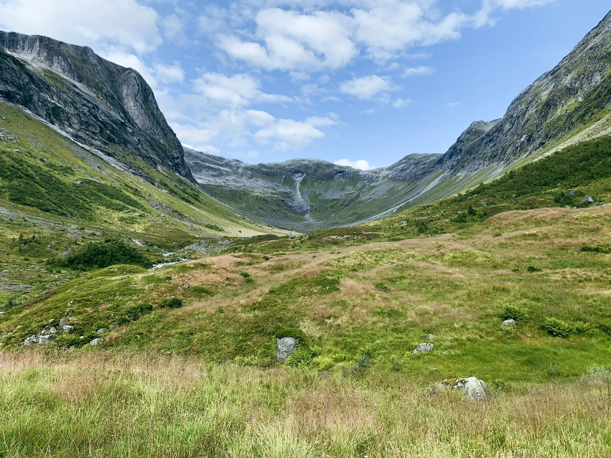
The path continues with a gentle ascent into the valley. After about 2 kilometers you can see Nos/Bolstadsetra on a ridge on the other side of the river.
After you have passed Nos, it is not far to Utfalla. Here, there are large avalanches in winter and the snow can be lying well into the summer. Bear in mind that the stream melts the snow from underneath, and it can be unsafe to pass. Be careful!
There is a simple, small bridge across Tverrelva. This is put aside every autumn so that avalanches cannot destroy it.
At Midtstøylen a cabin has been built that has a special protection against avalanches.
In older times, there were many cabins down by the river up here. It was Hjelle's summer farm. Today only a few ruins remain.
When you pass Midtstøylen, you will see Stol on a ridge further ahead. Then there is barely 1.5 kilometers to walk.
If you have the energy for it, you are welcome to walk a short quarter of an hour further towards Stolsbotnen. Close to the path there is a flat rock with many bowl pits. These bowl pits may date from the Bronze Age (1800-500 BC) and were probably used during religious rituals. The bowl pits are approx. 5 cm in diameter.
Remember that there are sheep grazing. The dog must go on a leash. Show consideration and shut all the gates on your way!
The Hike in Pictures

The parking area at Glomnes. Remember to pay the parking fee.

On the way towards Kvilefloten. View towards Erdalen.
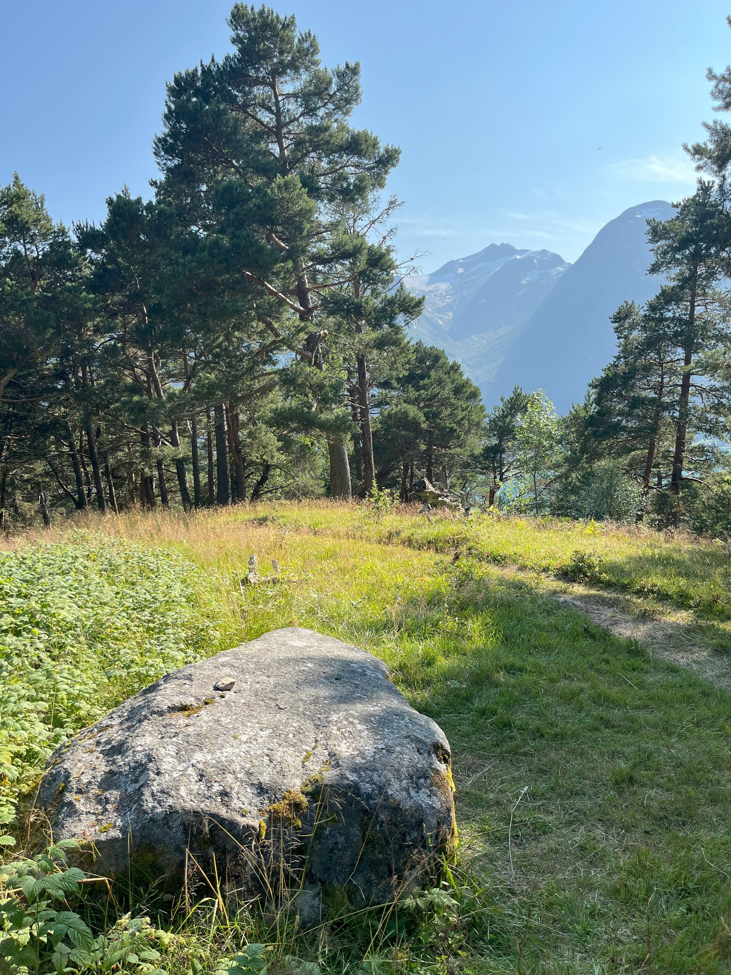
The resting stone at Kvilefloten

Glomnessetra.
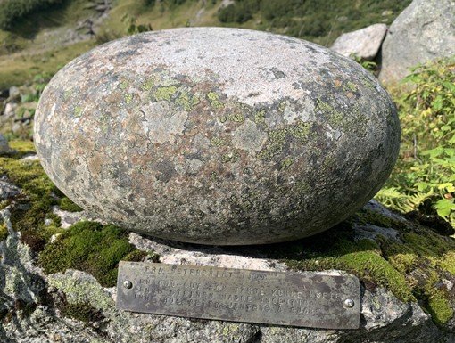
A little way past Glomnessetra, the trail passes this stone. It says: “Any young man who could not lift this stone had no business visiting the summer farm girls.”

You can see Nos/Bolstadsetra on the other side of the river.

The summer farm huts at Nos/Bolstadsetra

Utfalla. Snowfields often lie across the valley here.

The photo is taken just beyond Utfalla. In the background you can see Stryneskåla (1848 masl.) and Storskredfjellet (1815 masl.).

We are approaching Tverrelva (Bornielva).

The cabin at Midtstøylen. A solid snow-protection barrier has been built.

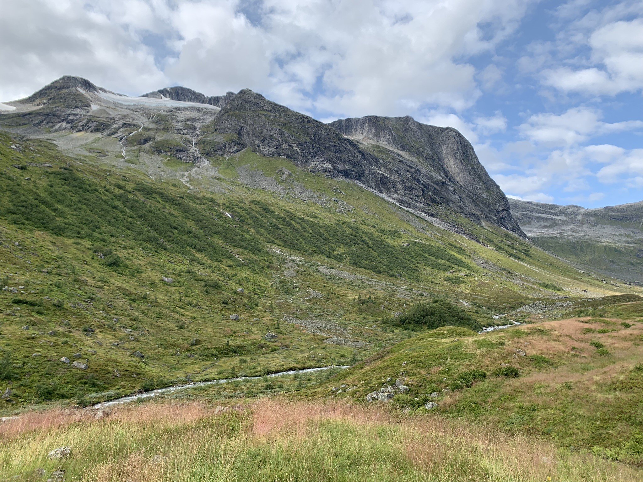
Midtstolskaret with Rinddalshyrna (1677 m a.s.l.) in the background

View from Midtstøylen towards Stolsbotnen

Stolsbakken. The huts stand on the top of the slope.

Stol with a view back down the valley.

This stone tumbled down the mountainside just before the year 2000 and became a millennium memorial. The stone stands not far from the huts at Stol.
Behind the glacier to the left in the photo, we can see the mighty Stolshyrna (1852 m a.s.l.). Behind it lies the old hunting trap.
The Cabins at Stol - today and before 1950

Monsselet
Tussebu III
Isakeselet
Arneselet
Gml. Isakeselet
Knuteselet
Fjellro
Geileselet
Tussebu I og II
Monsselet
Ruinar etter ein fjøs
Ruinar etter ein fjøs

The image and illustration are taken from the book Setrar i Oppstryn og Nedstryn by Kjell Råd
The Summer Farm in the old Days
Ella Grønfur, born 1910, has said that her grandmother, Elisabet Totland, was milking the cows at Stol for ten summers, and she was probably the last one. (Kjell Råd). One can imagine that milking ended here around 1880.
It has been said (Olga Nesje) that the cows were milked at the summer farm, and they made cheese and butter. Once a week a man came to the summer farm with a packhorse and brought the goods home.
From about 1880 until the 1990s, cows grazed at Stol every summer. Today, only a few sheep graze in the mountainsides around the summer farm. Where the cows used to graze, the grass now reaches knee height.
It was a long and harduous journey to take the animals from Nesje and Brekke to Stol. They had to get up at three or four in the morning to get to Glomnes before the car traffic picked up. In later times, they took the animals by tractor to Glomnes. Then they had to walk the nine kilometers through the long Glomsdalen valley.
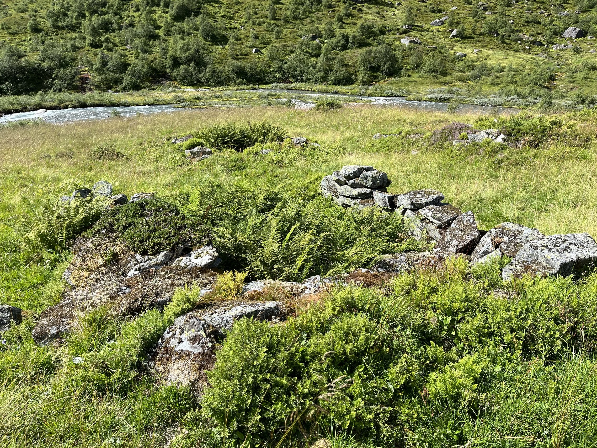
Ruins of Hjelle’s summer farm at Midtstøylen.
On the downhill side of the trail towards Midtstøylen, just before reaching the distinctive cabin with its plough-shaped stone snow barrier, several ruins of summer farm huts can be seen. These were the summer farm of the Hjelle farms. The summer farming was probably discontinued shortly after 1900.
Summer Farm Trek to Skjerdingsdalen
View from Stol towards Stolsbotnen, the end of the valley. The route over Nautebreen to Skjerdingsdalen went to Stolsbotnen and then up the mountainside to the right.
It was arduous to drive the animals from Brekke and Nesje to Stol, but even more difficult for the farms Skåre, Grov, Grønfur, and Mork, which had summer farms in Skjerdingsdalen. This well-sheltered valley had very difficult access. They had to drive the cattle all the way up through Glomsdalen, over Nautebreen, and down to the summer farm in Skjerdingsdalen. The journey took two days, with an overnight stay at Stol.
In 1851, there was heavy snowfall before they could drive the herds home in the autumn. During the storm at Nautebreen, 20 cows were left behind (J. Aaland). After this tragic event, they agreed to blast a road through Glæra, the steep mountain section between Jøl Bridge and the summer farm in Skjerdingsdalen. The road was completed in the summer of 1853, but it was only one metre wide.
Registered cultural heritage sites at Stol

1 Huldre Stone: Cup-marked stone just above the summer farm huts at Nos.
2 Viking Age Arrowhead Find: Discovered near Midtstolhyrna.
3 Cooking Pits and Some Charcoal Pits: Located near the dairy huts at Stol. The oldest cooking pits may have been used more than 3,000 years ago.
4 Cup-Marked Stone: About one kilometre further in from Stol, along with four hut ruins dating from the 11th–12th centuries.
5 Hunting Trap: With several bow positions, located not far from Stolshyrna.

Iron Age cooking pit. Viken County Municipality.
Photo: Reidun Marie Aasheim
Cooking Pits
Cooking pits have been used in Norway since the Stone Age (around 6,000 years ago). A pit was dug in the ground and stones were placed at the bottom. A fire was then lit over the stones. Once the stones were glowing hot, the fire remnants were swept away, and food—often meat, fish, or vegetables—was placed over the stones. The food was wrapped in large leaves, bark, or animal hides. Turf or soil was then placed on top. The food could remain in the cooking pit for many hours, acquiring a distinctive smoked flavor.
Cooking pits were probably not used for everyday meals, but rather for gatherings with ritual and/or social significance.
The Cooking Pits at Stol
Nine cooking pits have been found along a moraine ridge just east of the dairy huts at Stol. One of them has been precisely dated to 580 ± 150 BCE, placing it in the Late Bronze Age–Early Iron Age. The pits have a diameter of approximately 90–140 cm and a depth of 10–35 cm. Some of the pits do not contain fire-cracked stones at the bottom; these may be charcoal pits.

On this moraine ridge in the slope just above the dairy huts at Stol, nine cooking pits have been recorded. Some of them may be charcoal pits. (kulturminne.no)
Charcoal Pits
The photo shows a charcoal pit from Nord-Fron, Oppland. Photo: L. T. Lieng © Historical Museum, University of Oslo / CC BY-SA 4.0
Charcoal pits were used during the Iron Age and Middle Ages. Later, charcoal production moved to charcoal kilns. In the pits, they were able to produce charcoal, which was essential for extracting and shaping iron.
The Charcoal Pits at Stol
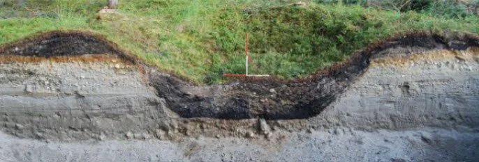
About 125 m north-northeast of the stream that crosses the trail just past the dairy huts, a pit has been registered that is likely to be interpreted as a charcoal pit. It sits atop a gravel mound and measures 2 m in diameter and approximately 40 cm deep. The pit has clearly defined embankments. Between the turf and the gravel lies a 3–4 cm thick layer of brown soil over a 10 cm thick layer of charcoal with some scattered stones.
About 140 m north-northwest of this charcoal pit, a similar pit has been registered. Both pits are dated to the Iron Age–Middle Ages.
The cup-marked Stone at Stol
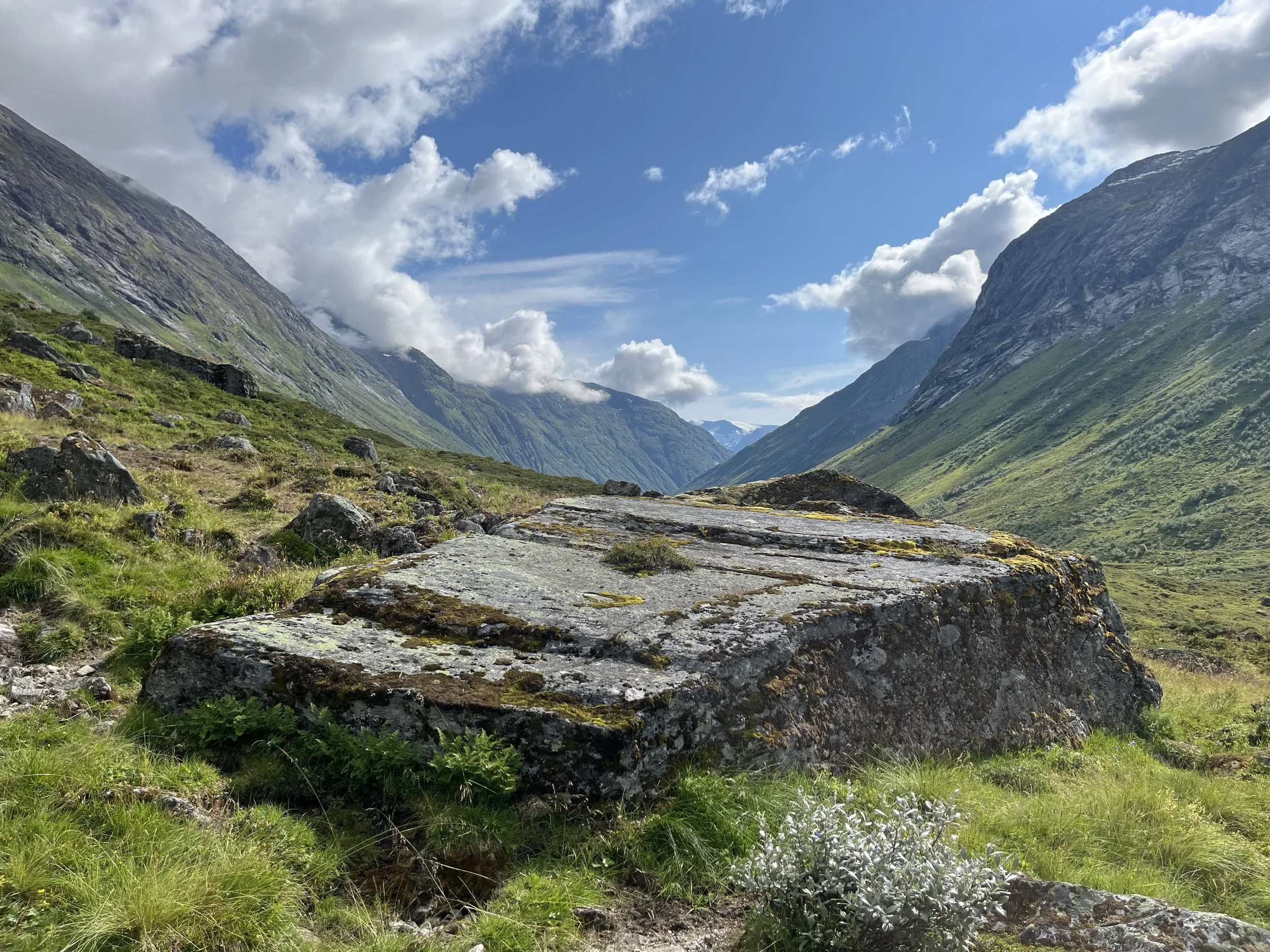
The cup-marked stone located a short distance in front of Stol
The stone is approximately triangular and measures about 5 × 5 × 7 meters. It lies between two hut ruins from the 11th–12th centuries. Twelve distinct cup marks have been carved into the stone, with diameters of 4–7 cm; one of the cups is as large as 10 cm. There is said to be another cup-marked stone in the area, but it has not been officially recorded.
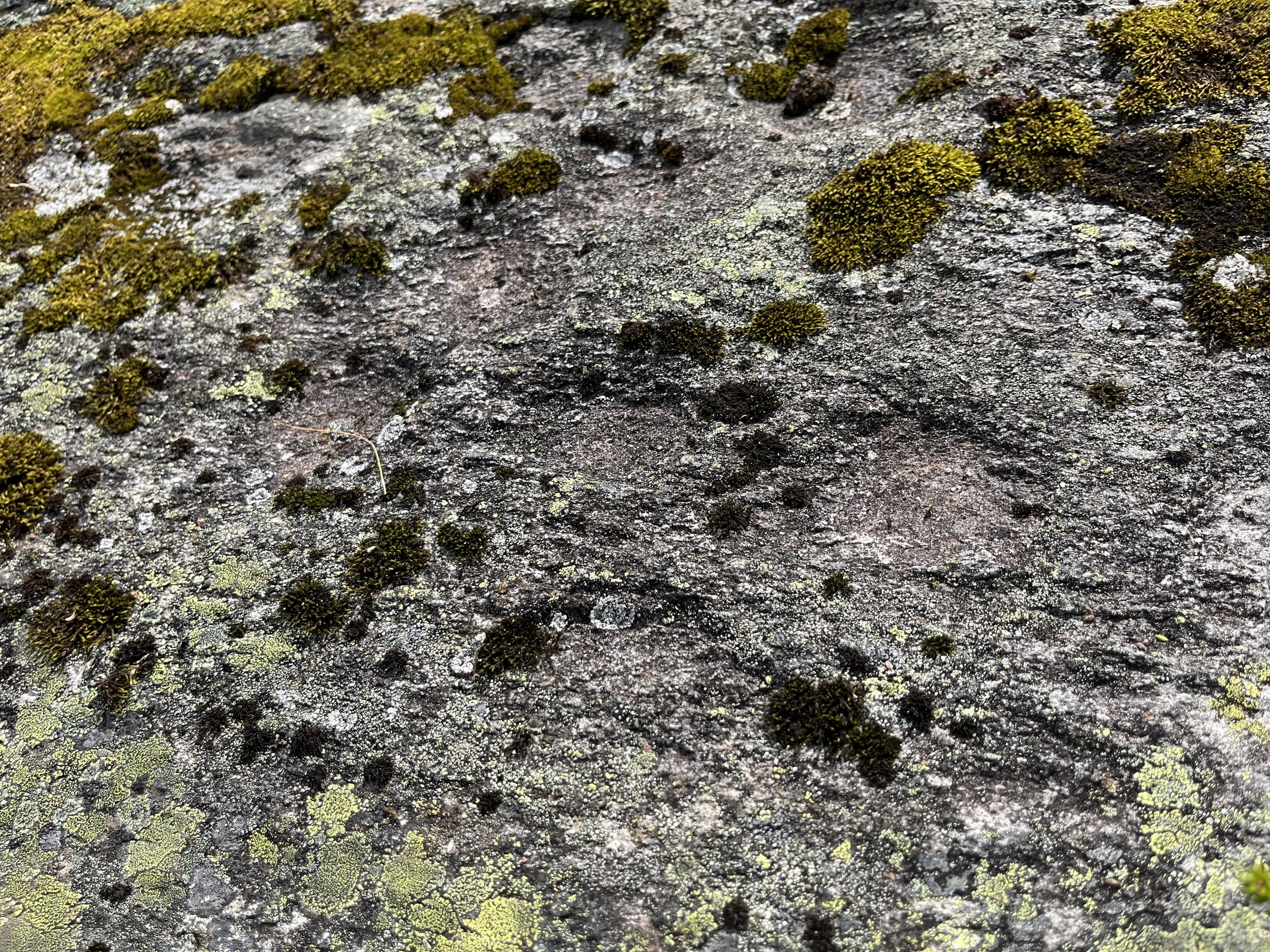
These are cup marks on the stone near Stol. They are round depressions carved into the stone. Such marks are often considered a form of rock engraving. Their exact function is uncertain, but archaeologists believe they may have been used in rituals related to fertility, hunting, and agriculture. Milk, blood, or grain was offered to gain divine protection or blessing.
House Ruins
Near the cup-marked stone, just under a kilometre past Stol towards Stolsbotnen, four ruins have been found, two of which are dated to the 11th–12th centuries. One ruin is dated to the Middle Ages.
Bog Iron
You pass this rust-brown stream on your way to Stol
Some types of rock can contain iron. Some of the iron is dissolved by rainwater and carried to bogs and lakes, where it precipitates. If a rust-brown stream flows out of a bog, it may indicate that a large amount of iron has accumulated.
In Glomsdalen, you pass a few such streams, which may suggest that bog iron was extracted here in ancient times.
The bog iron was dug out of the bog, crushed, and dried. It was then placed in a bloomery pit.
Bloomery Pit
A bloomery pit had a stone-lined bottom, on top of which a layer of charcoal was placed. Using a bellows, they managed to make the charcoal burn at a temperature high enough for the iron ore to melt and settle at the bottom of the pit.
Extracting bog iron was very labor-intensive, and many men were involved. With simple tools, they had to prepare a large amount of firewood, dig turf from the bog, and ensure that both the charcoal pit and the bloomery pit functioned properly.
Hunting and Trapping
An arrowhead was found on the ridge slightly north of Midtstolshyrna at about 1700 masl. (Kvamme & Randers 1982). The find is dated to the Viking Age–Middle Ages.
Along a narrow mountain ridge between Vollsetskåla and Storhammaren, just north of the border to Sunnylven, on the north side of Stolshyrna, three sites have been registered, each with several bow positions. The northernmost site is dated to the Bronze Age–Iron Age and contains eight bow positions. The two other sites are from the Iron Age–Middle Ages, with six and two bow positions respectively.
There are also said to be animal burial sites in the area.
Both areas, near Midtstolshyrna and Vollsetskåla, were accessible to hunters and trappers who stayed at Stol.

Bow position at Trollkyrkja in Tafjordfjella, Møre og Romsdal
Map showing the ow positions

1, 2, and 3 refer to the three sites with bow positions between Vollsetskåla and Storhammaren.
Source: kulturminnesok.no

View from Stol. Stolshyrna (1852 m a.s.l.) can be seen behind the glacier.
The distance from Stol to the nearest bow positions at Vollsetskåla is about 5 km, and the distance to the northernmost bow positions is approximately 1.5 km further. It is likely that these bow positions were used by hunters from several directions: Flo, Glomsdalen, and Holedalen.
Text: Asbjørn Berge, 2025
Photo: Marit and Asbjørn Berge