

Hike to Glomnesnakken


The hike to Glomnesnakken is the shortest and easiest mountain hike you can do in Oppstryn. From the top, you get a majestic view of Oppstrynsvatnet and the mighty mountains and glaciers surrounding it. In good weather, this is a nature experience you will remember!
Difficulty: Moderate. A steep and slightly challenging section towards the end.
Length: 2.5 km one way
Elevation gain: 620 m
Duration: 4 hours round trip
Season: Summer and autumn
Parking: You can park at the parking lot located about 200 meters from Glomnestunet. Remember to pay the fee!
Note: The steep section near the top can be demanding on wet and slippery surfaces.

Hike description
The hike to Glomnesnakken is the shortest and easiest mountain-top hike you can do in Oppstryn. At the top you get a majestic view of Oppstrynsvatnet (lake) and the mighty mountains and glaciers around. In good weather, this is a nature experience you will remember!
The distance to the top is 2.5 km, and there is a little over 600 meters in altitude. You should allow four and a half hours for the entire hike.
If you want a longer hike, you can continue on the trail to Segestad when you come down from the top. See "Round trip in Glomsdalen".
You can park at the car park 200 meters from the Glomnes farm. Please remember to pay the fee!
Right by the car park, you go through a gate that leads into an enclosure for sheep. You go on through yet another gate and follow the path along the fence until you turn 90 degrees to the right up a hill. Here it is relatively steep and winding all the way to Kvilefloten. Have a look at the map.
The path from Kvilefloten winds gently upwards. It is not far before you come to a sign showing the direction towards Glomnes-
nakken.
The first part towards Glomnesnakken is very steep, but harmless. The path winds up along a ridge in the birch forest, but flattens out a bit before you reach a steep section where it is necessary to use your hands. Here you have to be careful when it is wet and slippery! Once you have passed this steep escarpment, you are immediately at the top.

The road to Glomnes with a view towards the Glomnes farm to the right and Storskredfjellet in the background.
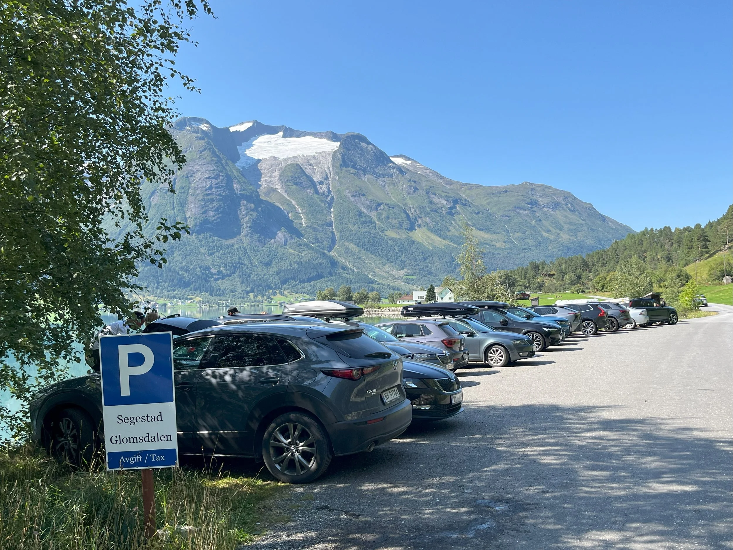
The car park at Glomnes. Remember to pay the parking fee.
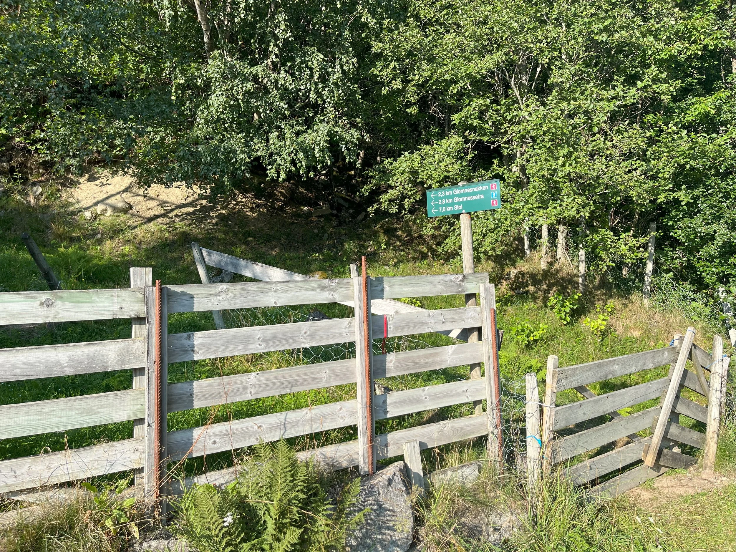
The hike starts at this gate, right next to the parking area.

On the way toward Kvilefloten. We are looking toward Erdalen.
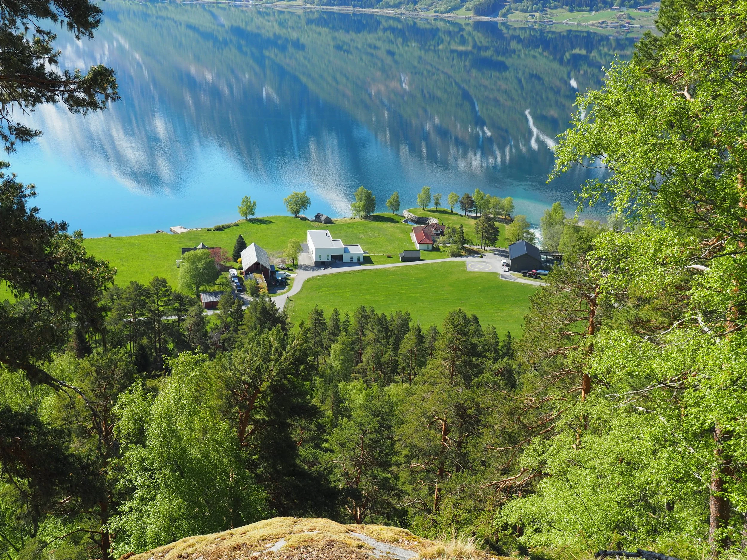
On the way toward Kvilefloten. We can see the Glomnes farmyard .
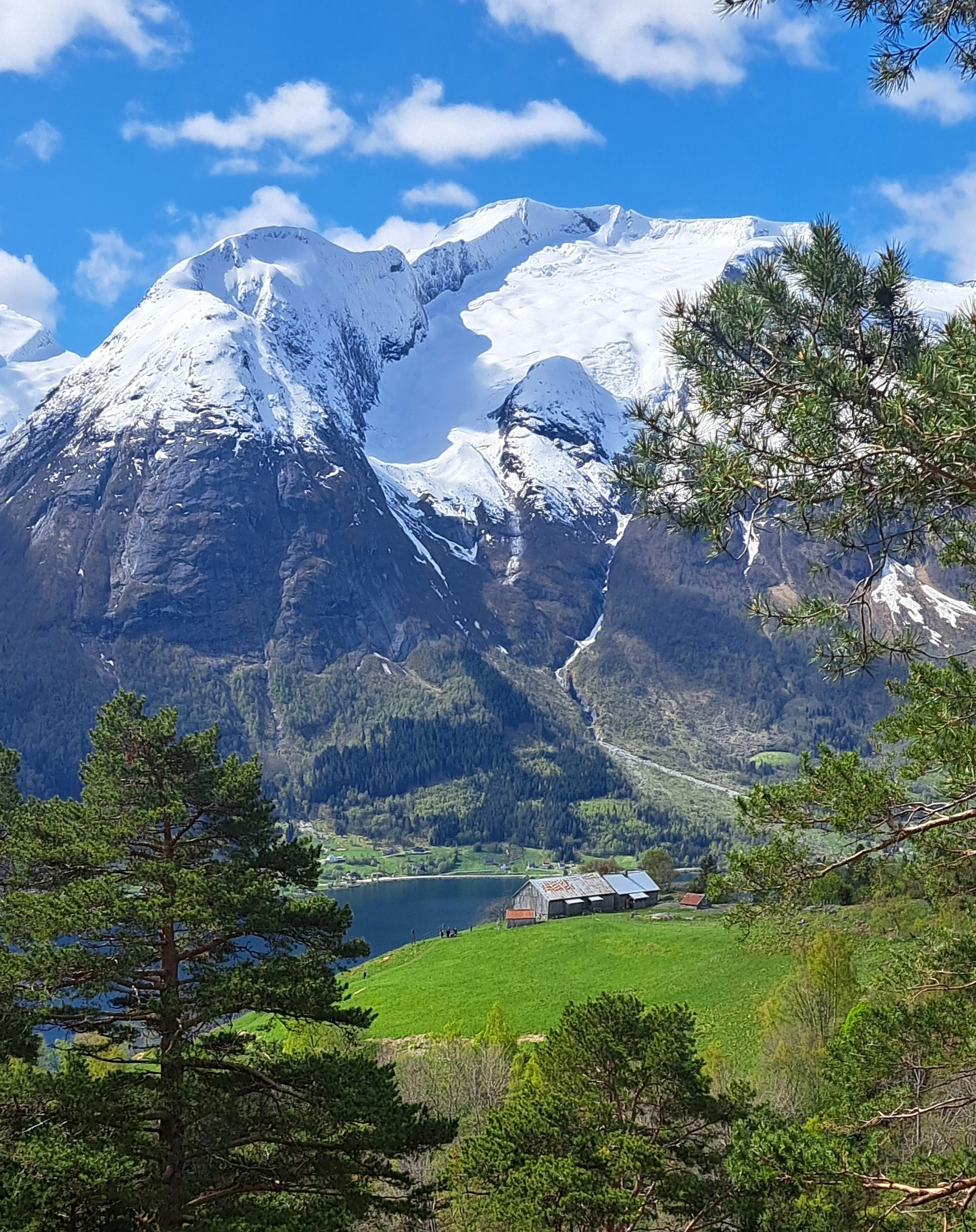
View from Kvilefloten. We are looking toward Segestad and Storskredfjellet (Breifonna).
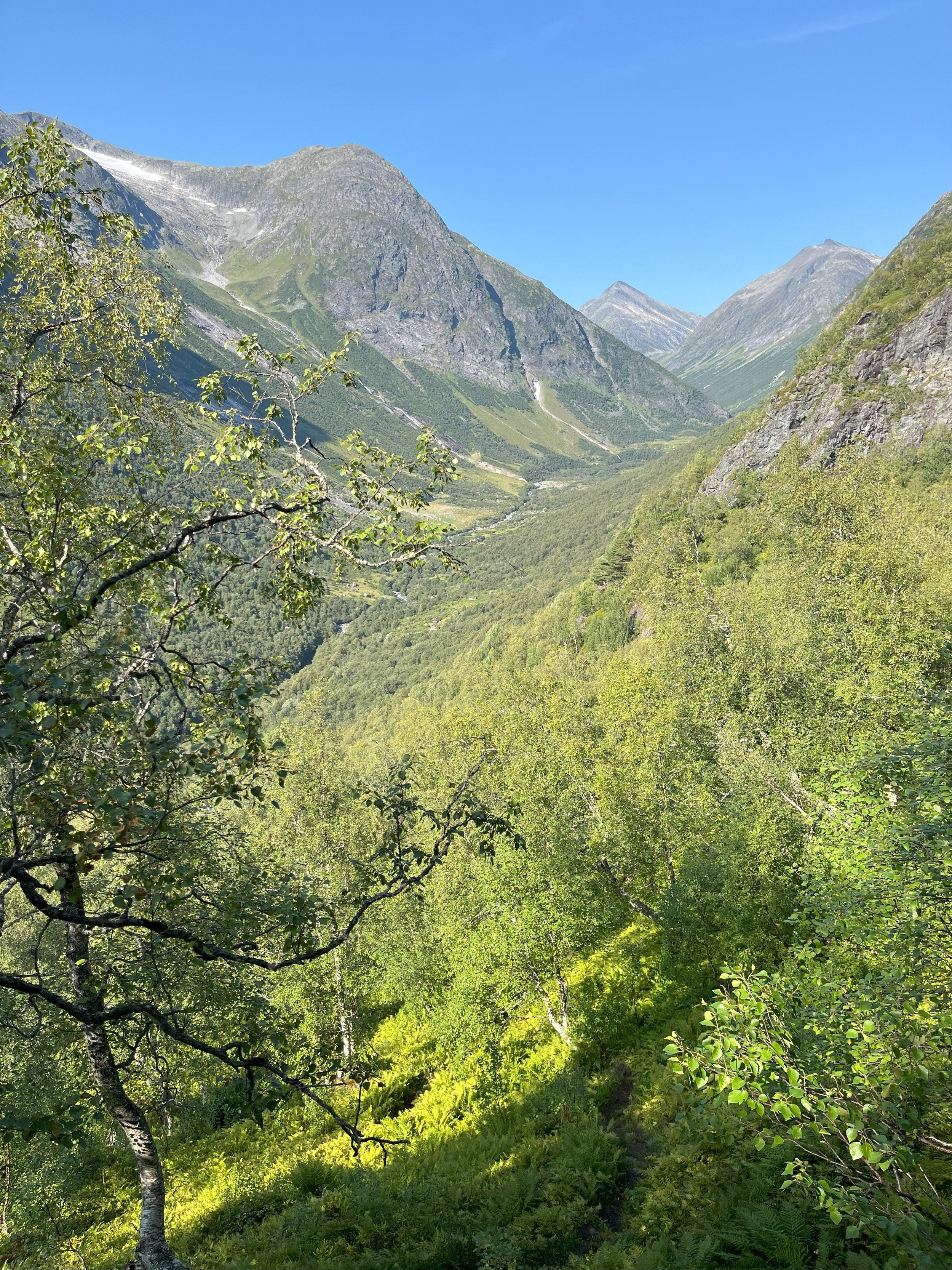
On the way to Glomnesnakken you will have a nice view into Glomsdalen. If you zoom in on the image, you can see both Glomnessetra, Segestadsetra and Nos/Bolstadsetra; three summer farms in the olden days.

The path flattens out before you reach the steepest part of the hike. You can make out Glomnesnakken behind the birch forest.
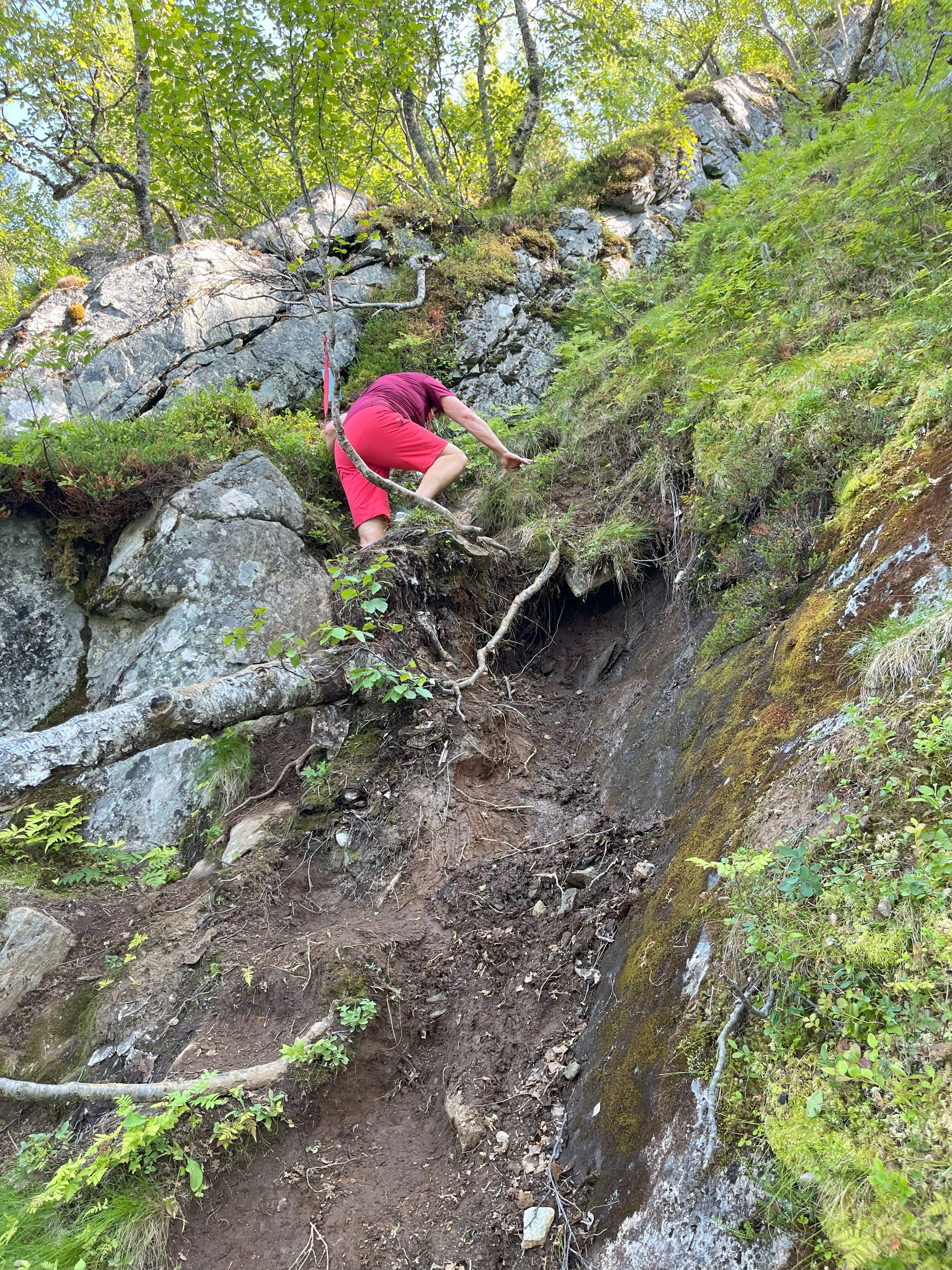
The last part of the hike demands some climbing. You have to be careful here, especially when it is wet and slippery.
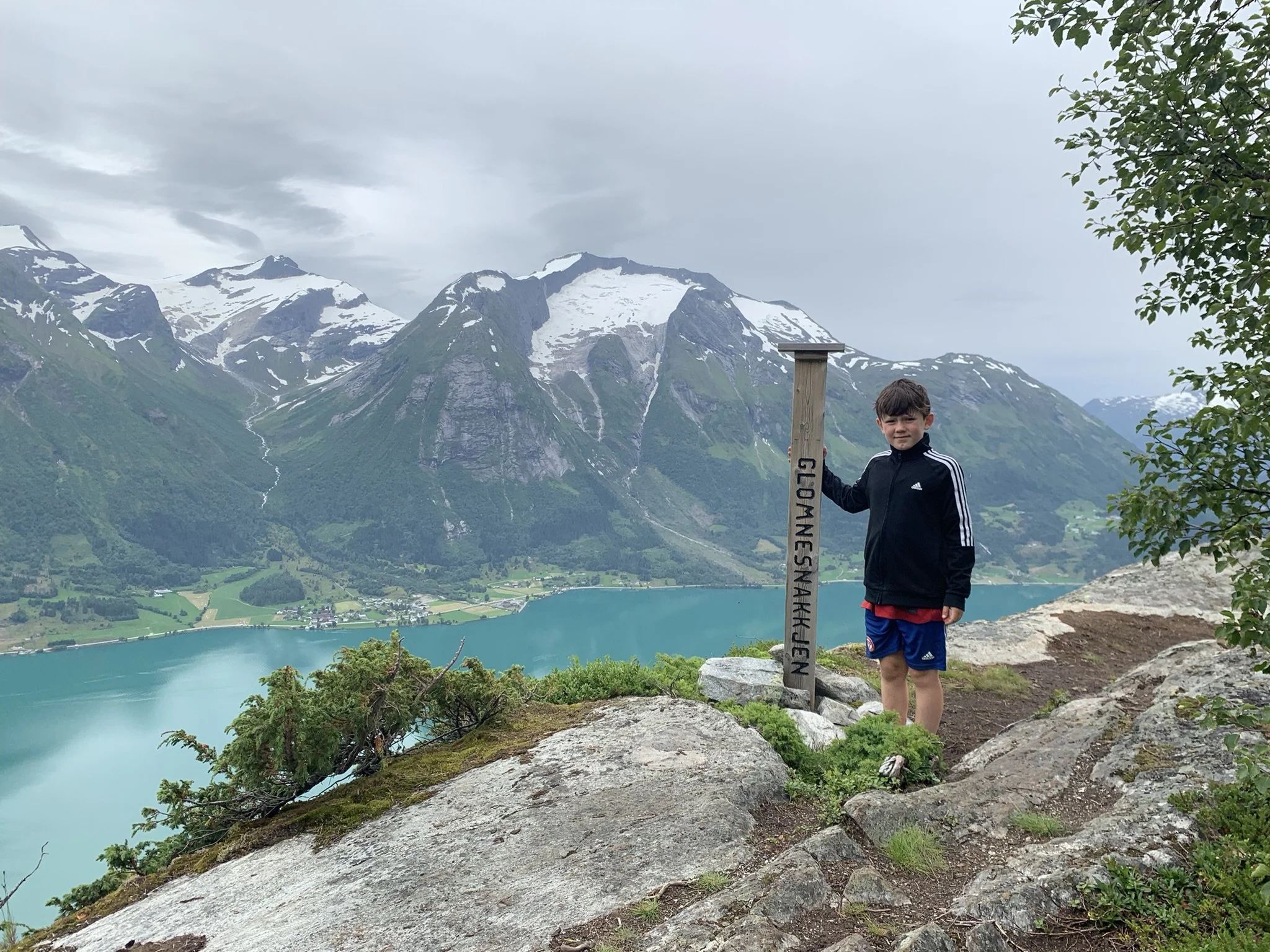
Glomnesnakken (650 masl.). In the back-ground we see Skåla (1848 masl.) and Storskredfjellet with the glacier (1815 masl.)

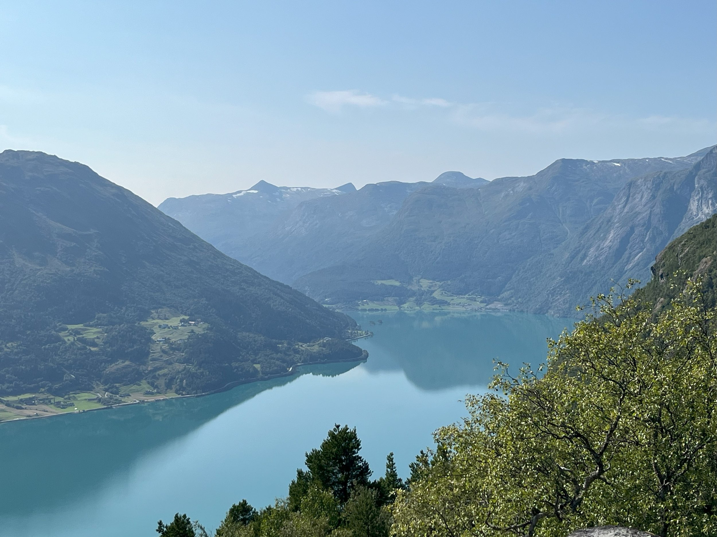
View from Glomnesnakken
There are not many places in our country where you can find mountains that rise as high above the valley floor as in Oppstryn. From Glomnesnakken you get a powerful view of many of these mountains. Have a look at the list.
1 Lodalskåpa 2083 masl.
2 Tomefjellet 1835 masl.
3 Middagshyrna 1857 masl.
4 Tundraskarbreen
5 Bings Brekuppel 1877 masl.
6 Nonshyrna 1510 masl.
7 Tindefjell 1775 masl.
8 Kampen 1640 masl.
The elevations of the mountains are taken from the map on ut.no.

View toward Erdalen.

View toward Fosnes and Fosdalen.
View toward Veslebygda.
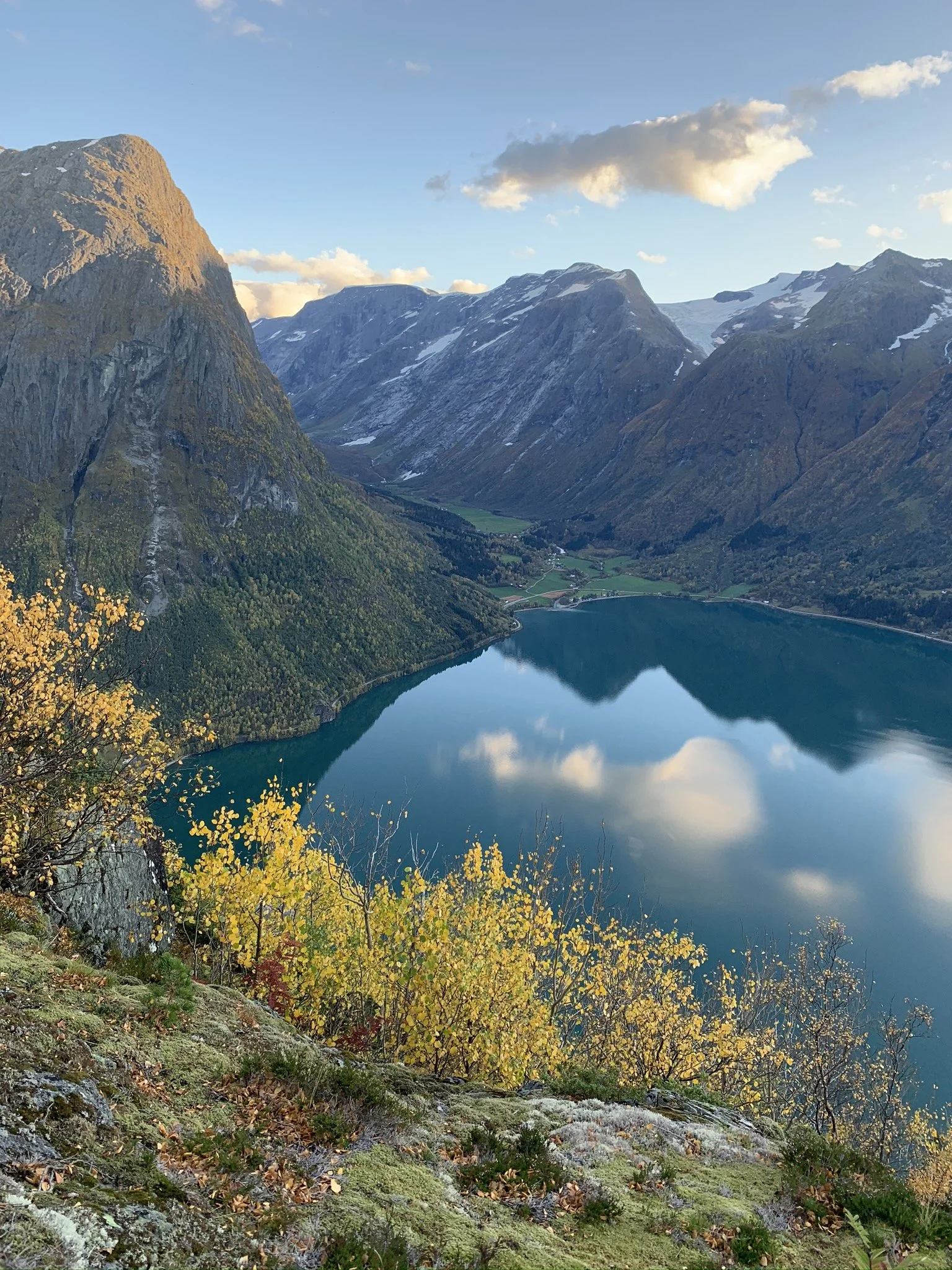
Autumn view from Glomnesnakken.
Text: Asbjørn Berge, 2025
Photos: Marit and Asbjørn Berge