


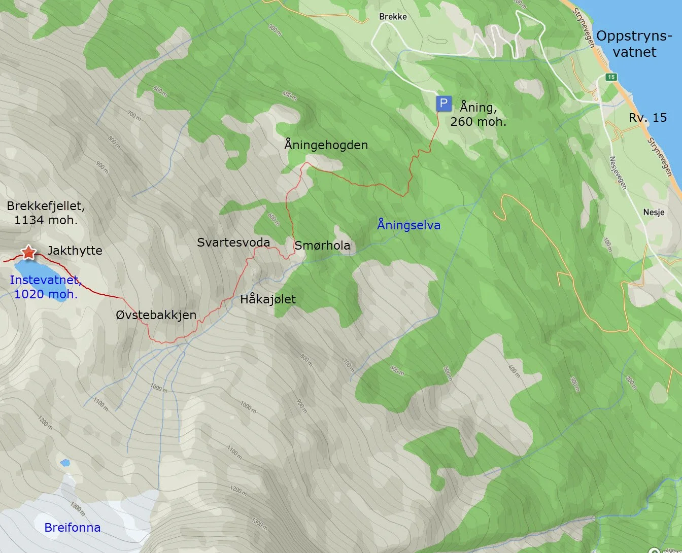
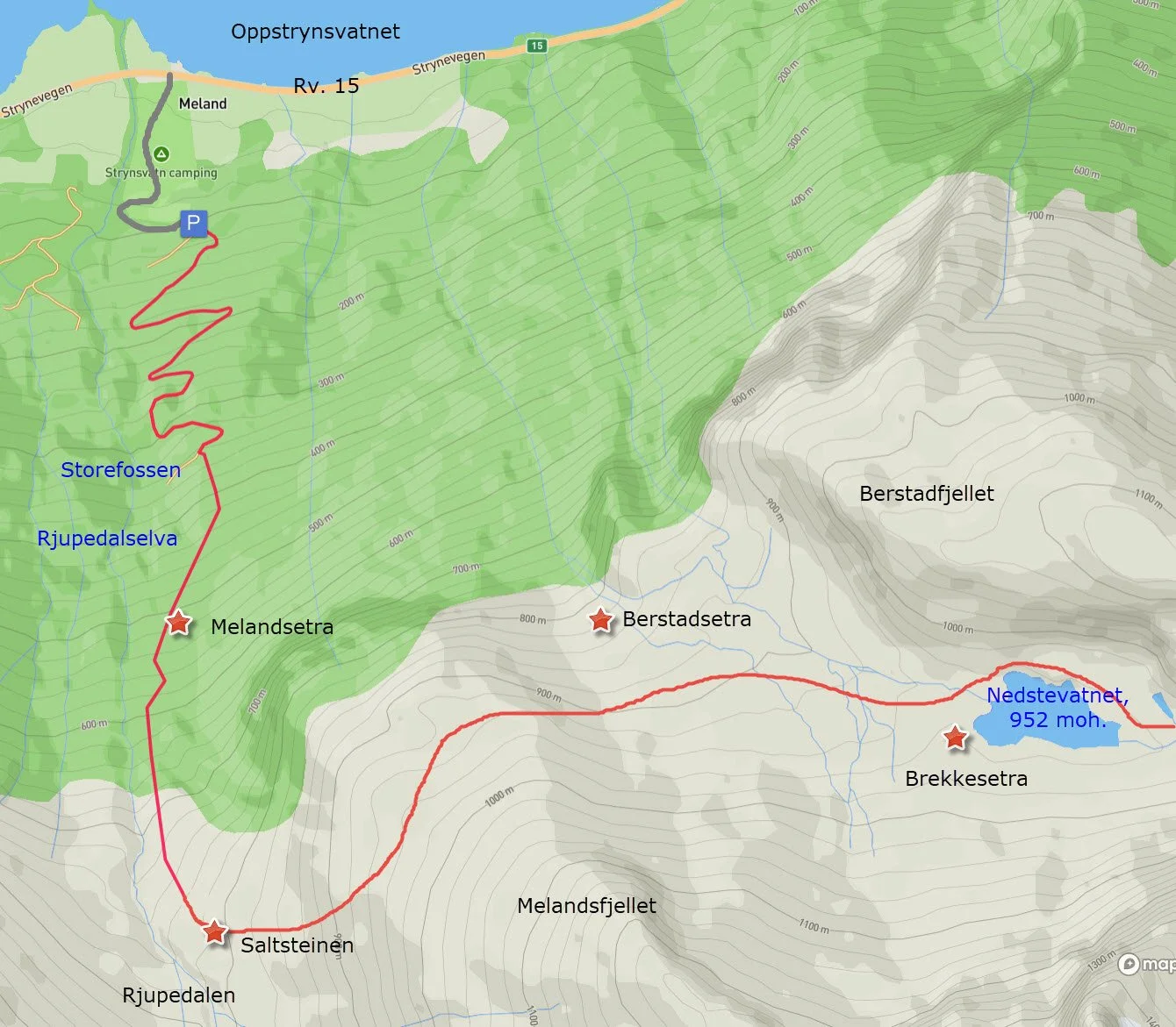
Hike to Brekkedalen
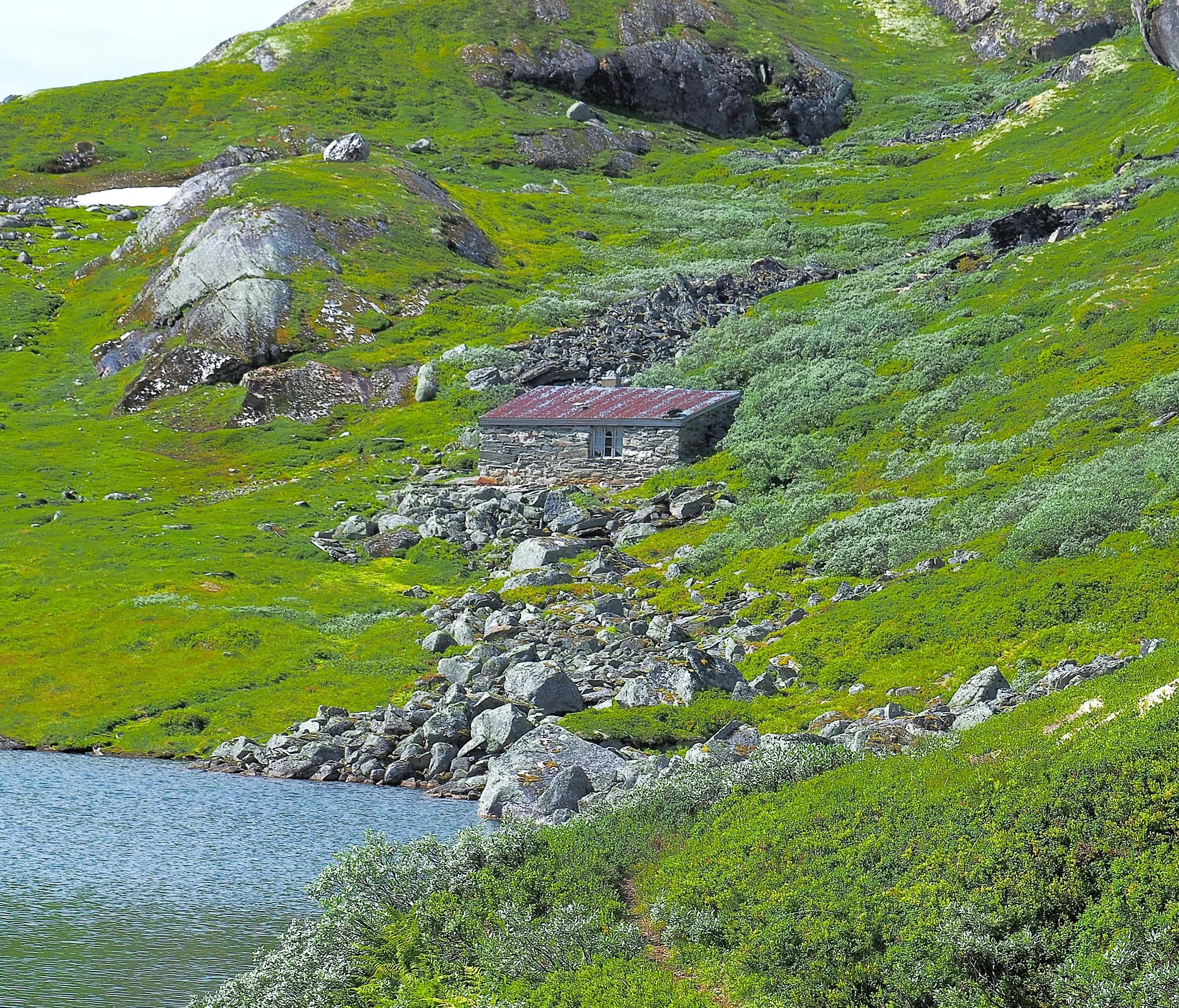
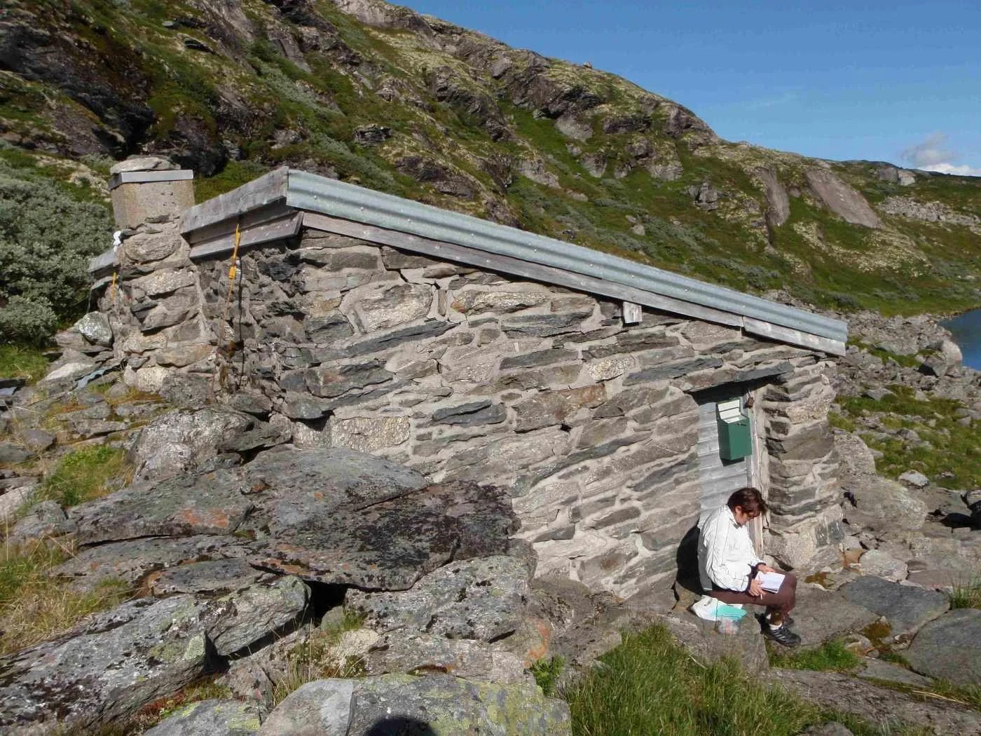
The hunting cabin by Instevatnet
Brekkedalen is a beautiful mountain valley, located somewhat remote between Brekke and Berstad. In the old days, there were two summer farms in the valley: Brekkesetra and Berstadsetra.
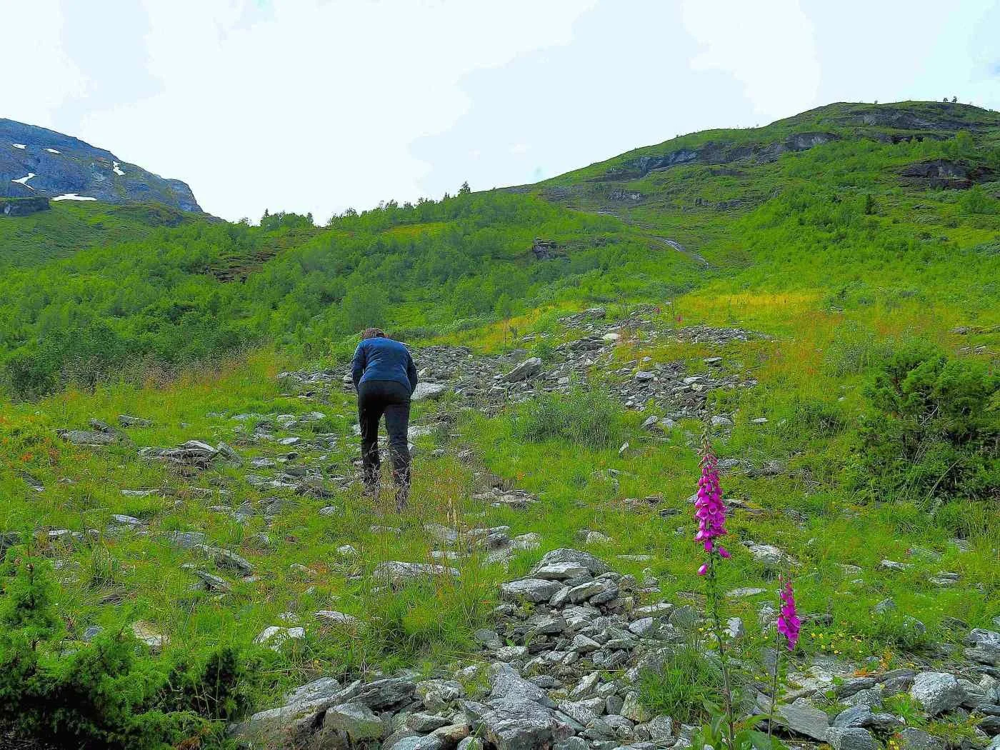
From Åning, there is a clear path that follows the old mountain farm road. The old path from Berstad, however, is difficult to find, and the terrain is steep.
Difficulty: Demanding. A hike that requires good physical fitness and experience in steep terrain.
Distance: 9 km from Åning to Meland
Elevation gain: 900 meters
Duration: 7 hours
Season: Summer and autumn
Parking: You can park at Åning.
Note: The hike can of course also start from Meland.
There is no mobile coverage on the hike.
Route description
If you are in good physical shape and have some experience with navigation, a hike from Åning to Meland through Brekkedalen can be a good option. A shorter alternative is to walk from Åning to the hunting cabin by the idyllic Instevatnet and then return the same way.
You can park your car at Åning and walk to Meland, or park at Meland and walk to Åning.
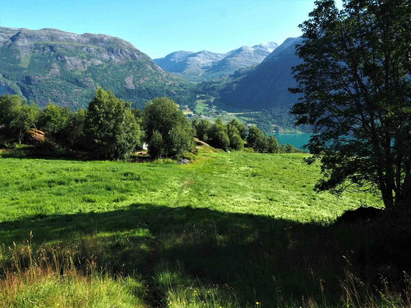
The photo shows the trail crossing a meadow at Åning. Åning lies at 260 meters above sea level and is the highest farm with permanent residents in Oppstryn.
This is the starting point of the hike towards Brekkedalen from the eastern side. You can just as well start from Meland and walk through Brekkedalen to Åning.
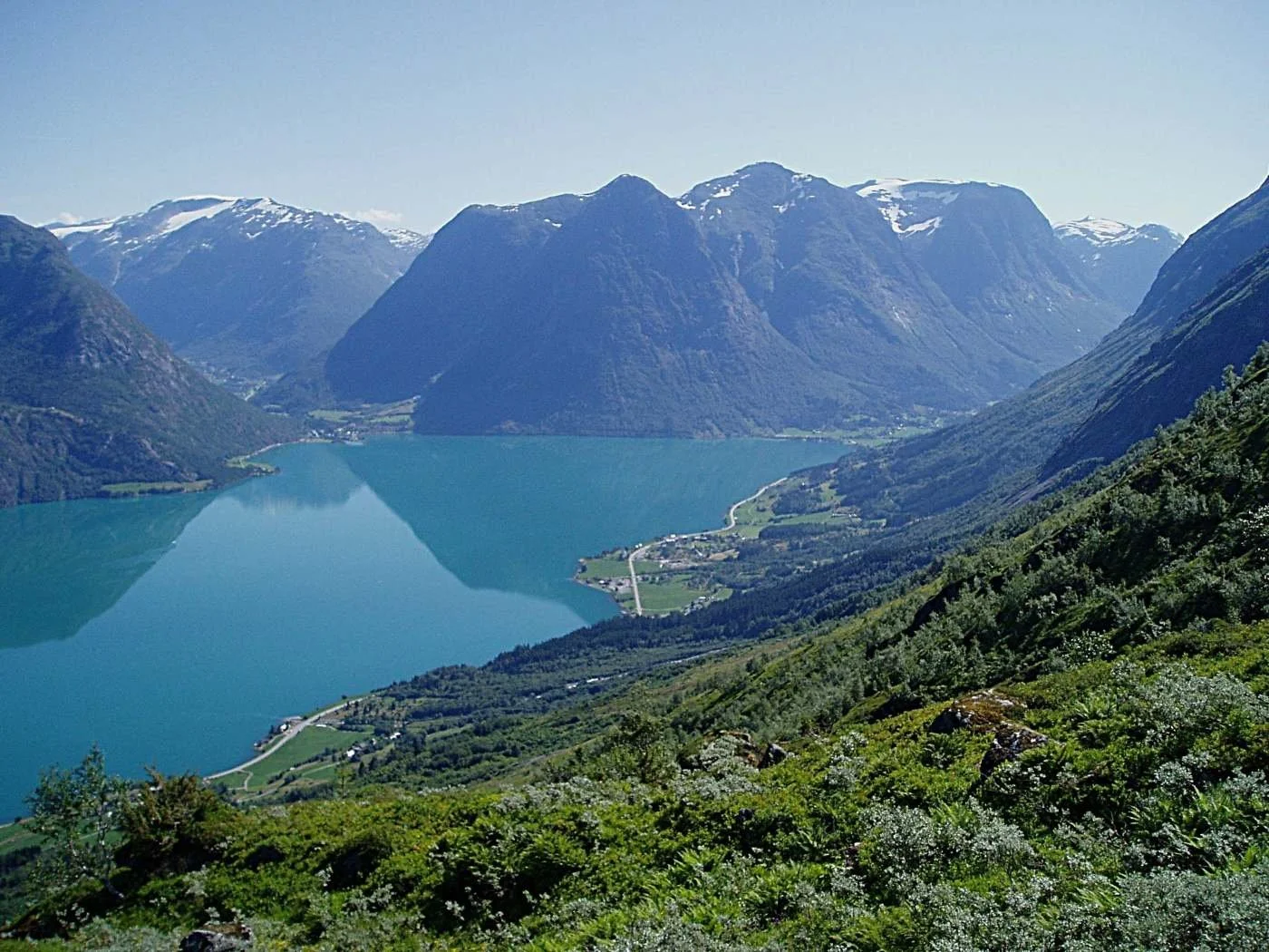
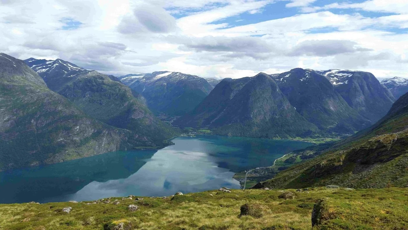
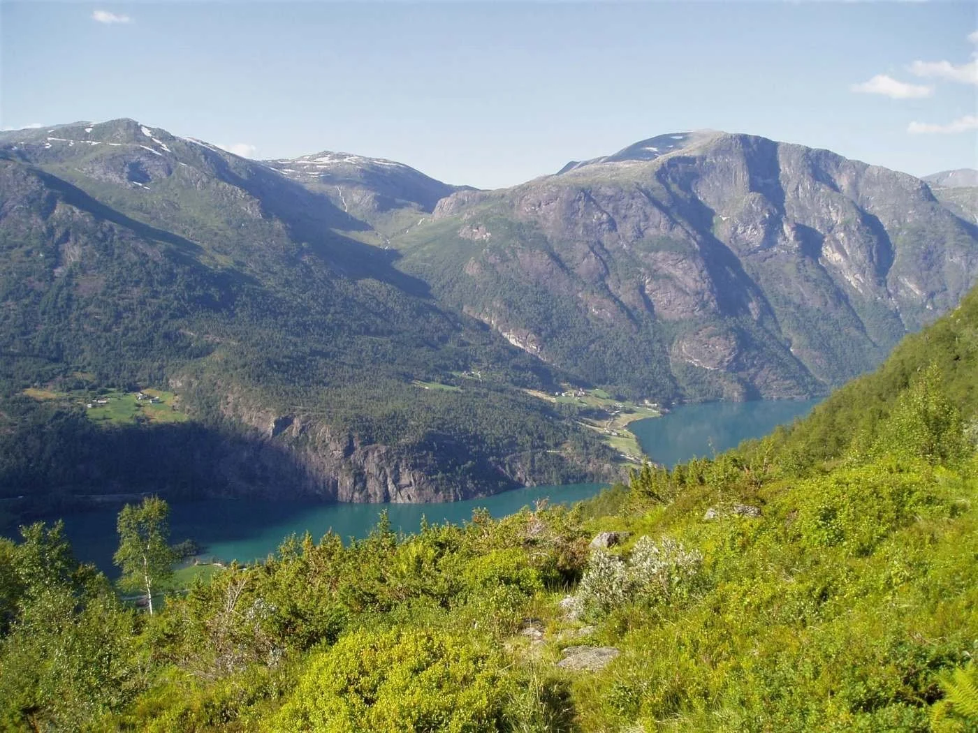
When you’ve crossed the meadow, you reach the outlying land at Åning. The path winds its way through a wooded area and climbs to the top of a ridge, Åningehogden. Here, the landscape opens up, and you get a fine view of Oppstrynsvatnet (lake) and the surrounding villages.
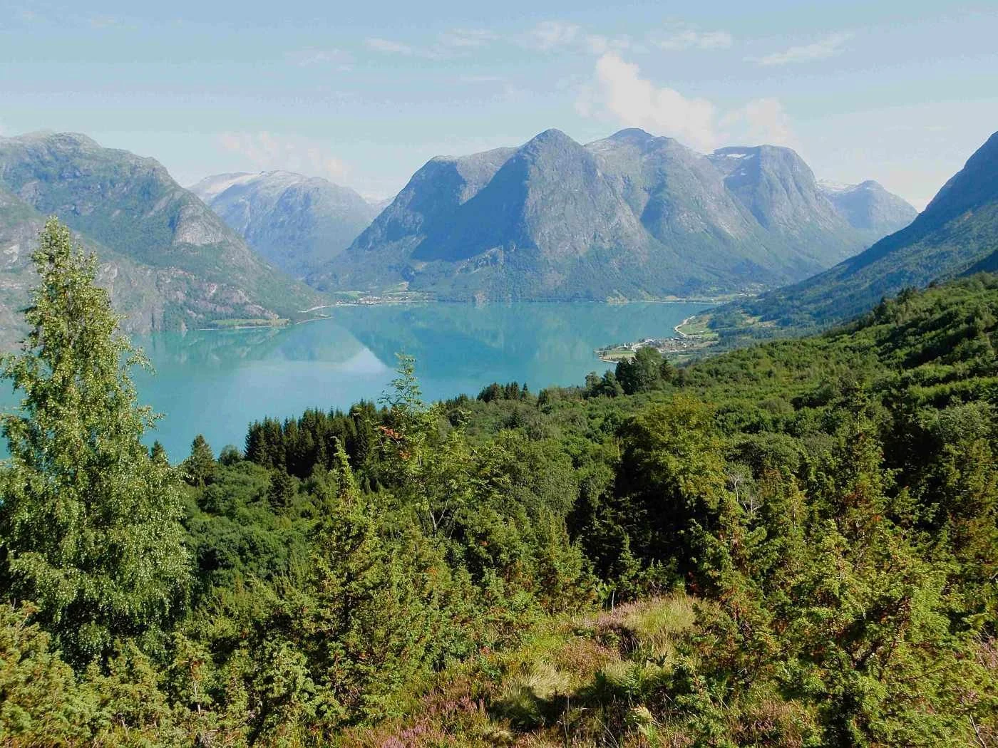
View from Åningehogden. Erdalen lies to the right, and Hjelledalen to the left in the background.
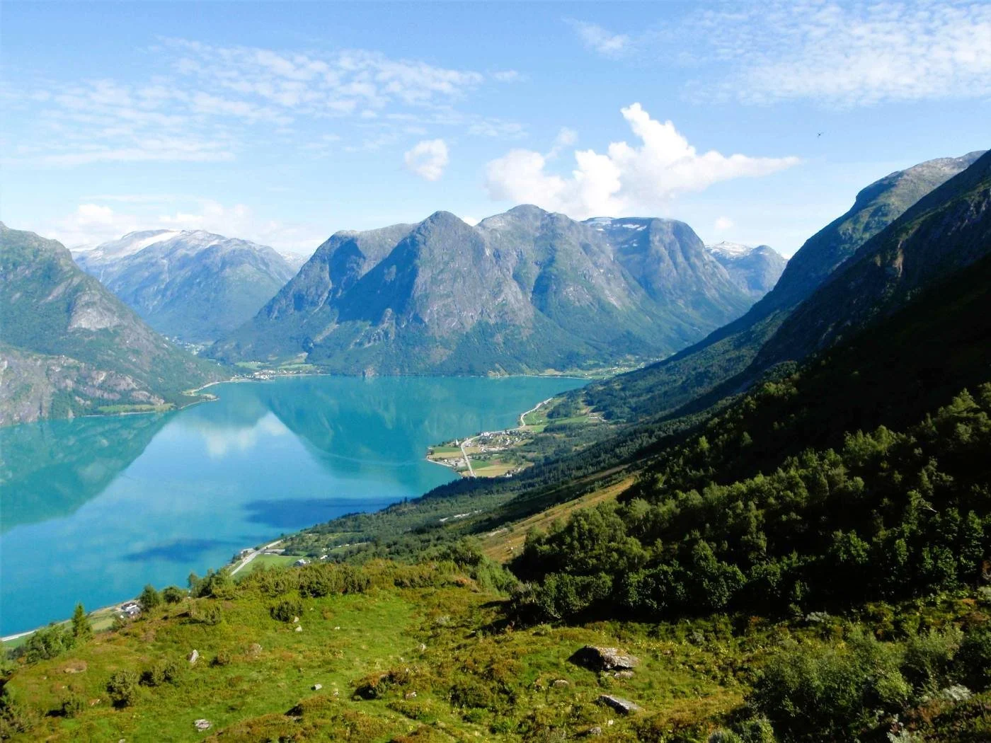
View from Åningehogden towards Flo and Flofjellet
The image shows Flo and Flofjellet. The high peak rising toward the sky on the right edge of the image is Stolshyrna (1,852 m above sea level).
The valley on the right side of Stolshyrna is called Rinddalen, while Vesledalen runs along the left side. The valley furthest to the left leads down to Vollset in Sunnylven.
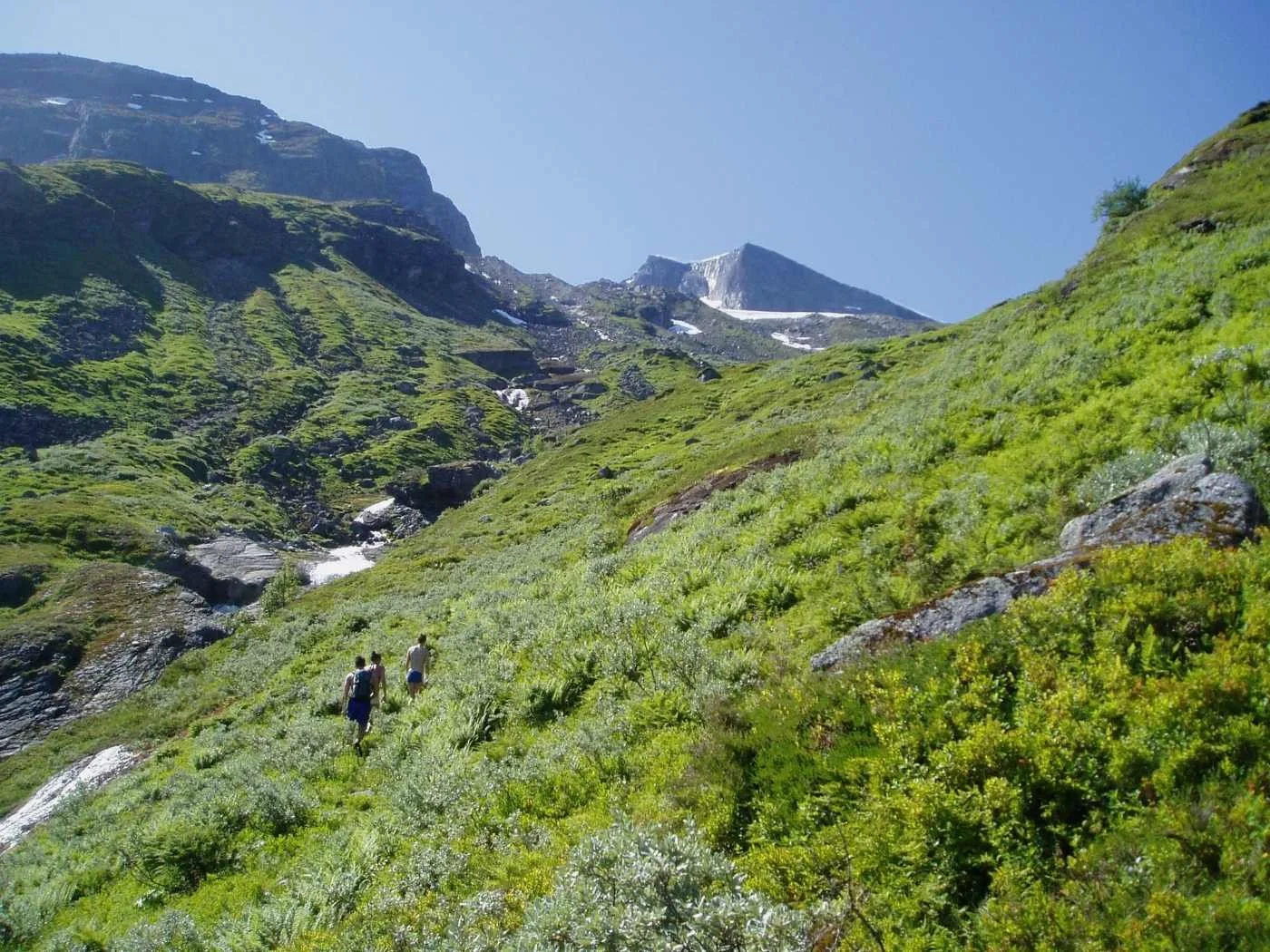
From Åningehogden, the path climbs up a scree slope before turning left toward a small flat area called Smørhola. You can see this flat section in the upper left of the image.
It appears that a water outburst or small flood has recently passed through here.
This is Smørhola. The terrain here is flat and pleasant, with good grazing for cattle. There is quite a lot of buttercup (meadow buttercup) growing here, which may explain the name.
Cattle tend to avoid eating buttercups because they contain the toxin protoanemonin, which can cause diarrhoea.
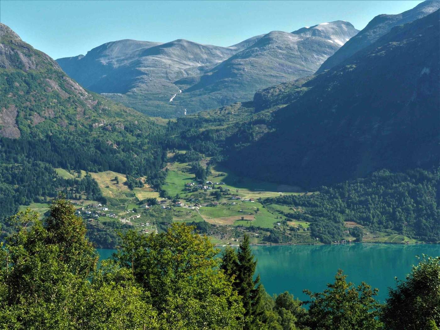
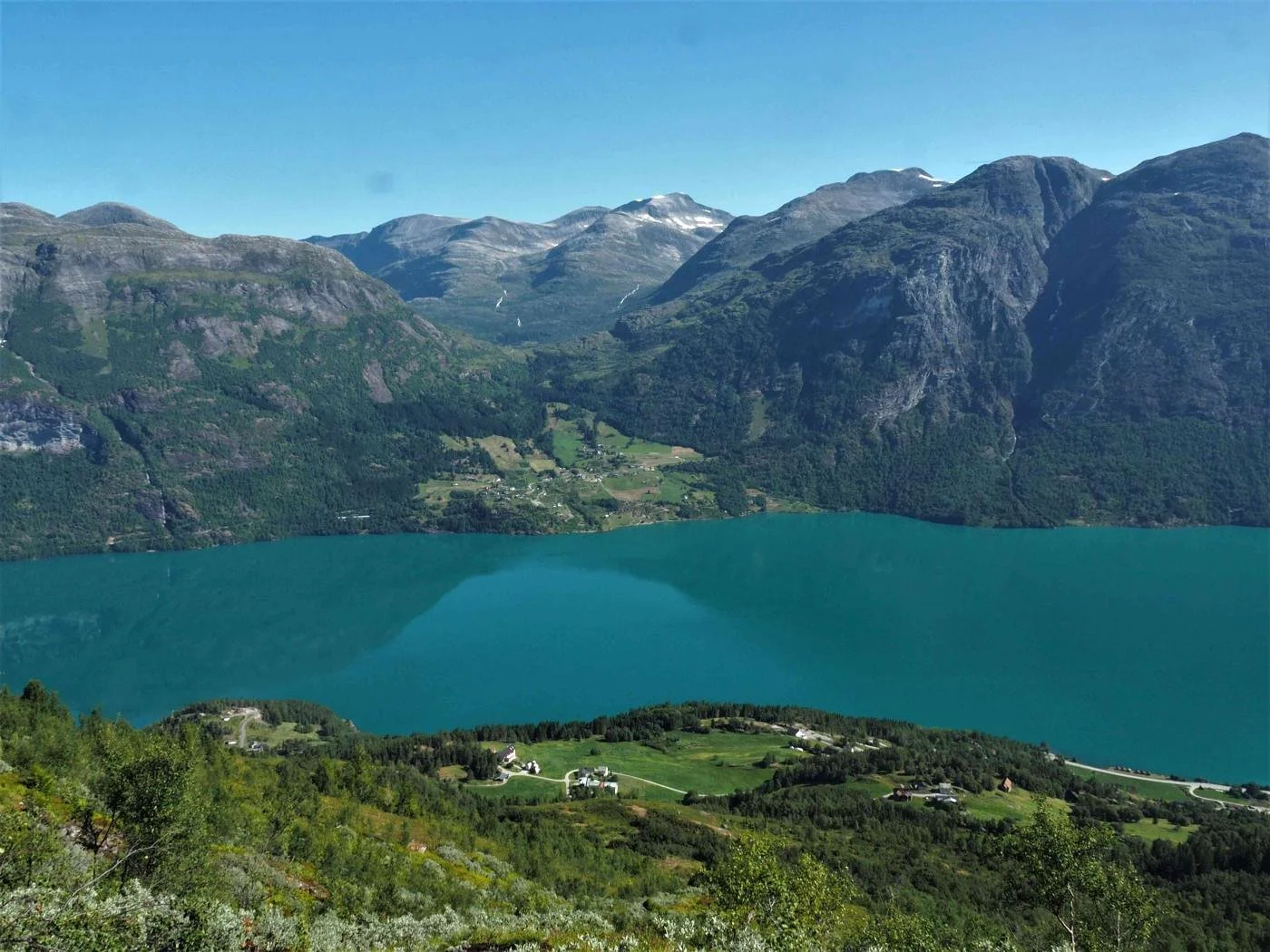
From Smørhola, there is an open view toward the settlements around Lake Oppstryn.
Here we see Strandsida, with part of the farm Nesje closest to us. Further on, we see Fosnes, as well as parts of Erdalen and Hjelledalen.
The steep mountain in the centre of the image is Hjellehyrna (1,368 m above sea level).
From Smørhola, the path continues straight uphill to Svartesvoda, where it turns toward the Åningselva (river) and then follows it onward.
Smørhola in the foreground
View from Svartesvoda. In the foreground, we see the farms Åning, Brekke, and Tunold — from left to right. In the background, we see Flo and Flofjellet.
The path follows Åningselva (river) for quite a long stretch before turning right across the pass between Storskredfjellet and Brekkefjellet. The pass lies at about 1,040 metres above sea level.
The first section toward the pass is relatively gentle. In the final stretch, just before reaching it, the path winds steeply up a grassy slope known as Øvstebakken.
The image above shows the area where two men lost their lives during Easter 1947. They had spent the night in the cabin by Instevatnet. Heavy snowfall came during the night, and on their descent they triggered an avalanche that took them.
A third person was rescued alive from the avalanche, but he sustained severe injuries and likely died from them a few years later.
The Åning River runs through deep gorges in some places as it flows downhill. If you look closely at the picture above, you can spot a small birch tree by the riverbank. Here, there is a deep gorge known as Håkajølet.
The path used to run right along the edge of the gorge, and at one time something went badly wrong. A man from Håkabruket at Brekke was travelling with a packhorse, and at this very spot the horse stepped off the edge and fell into the gorge. The horse was killed, and after this tragic event the gorge was given the name Håkajølet.
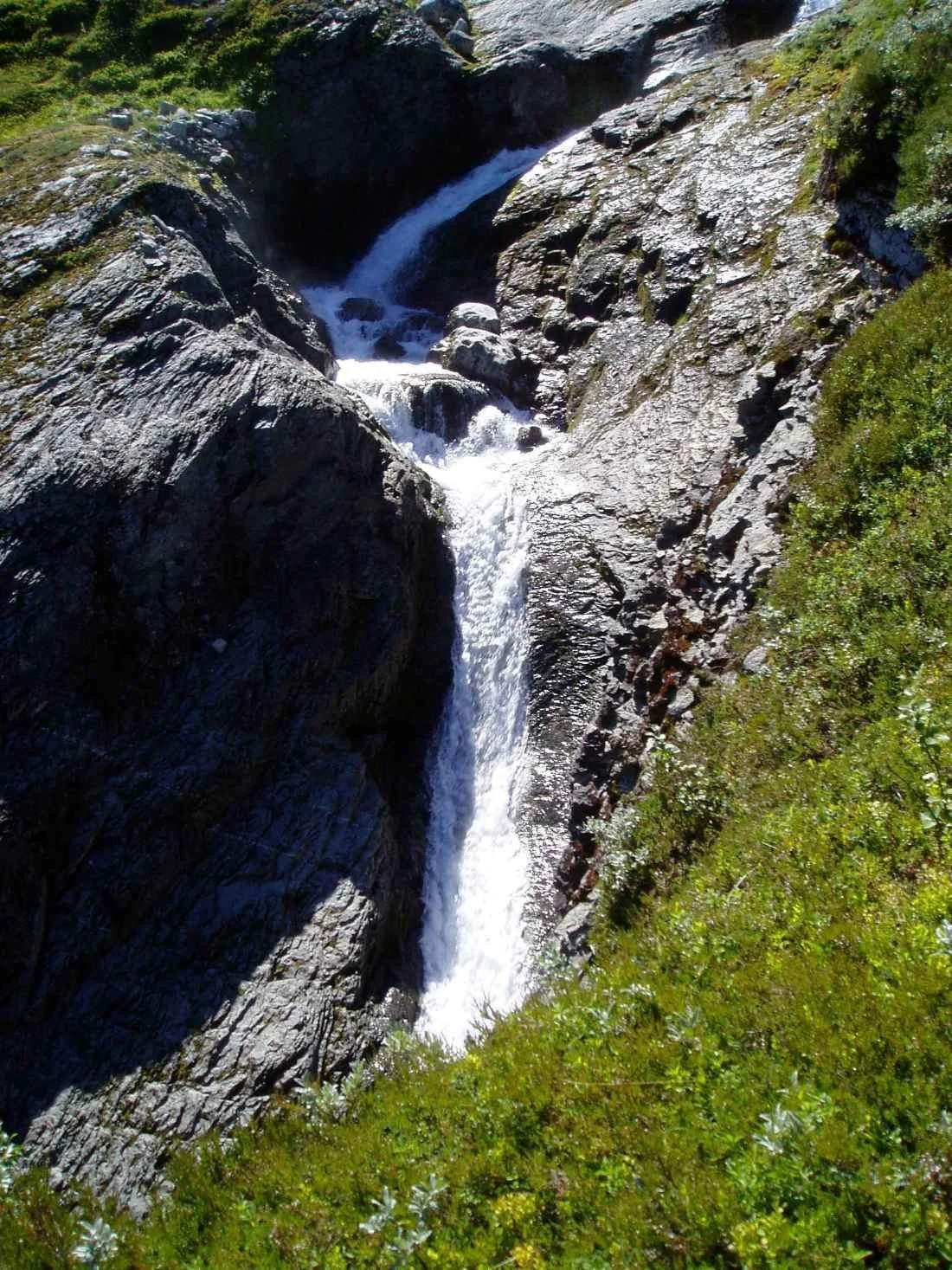
The waterfall is plunging into Håkajølet
Åningselva runs in cascades and rapids down along the path. We can just glimpse part of Breifonna—the glacier in front of Storskred-
fjellet. The light “band” on the mountain in the background shows how much the glacier has retreated over the past hundred years.
It is a dramatic development. One wonders how long Breifonna will continue to exist.
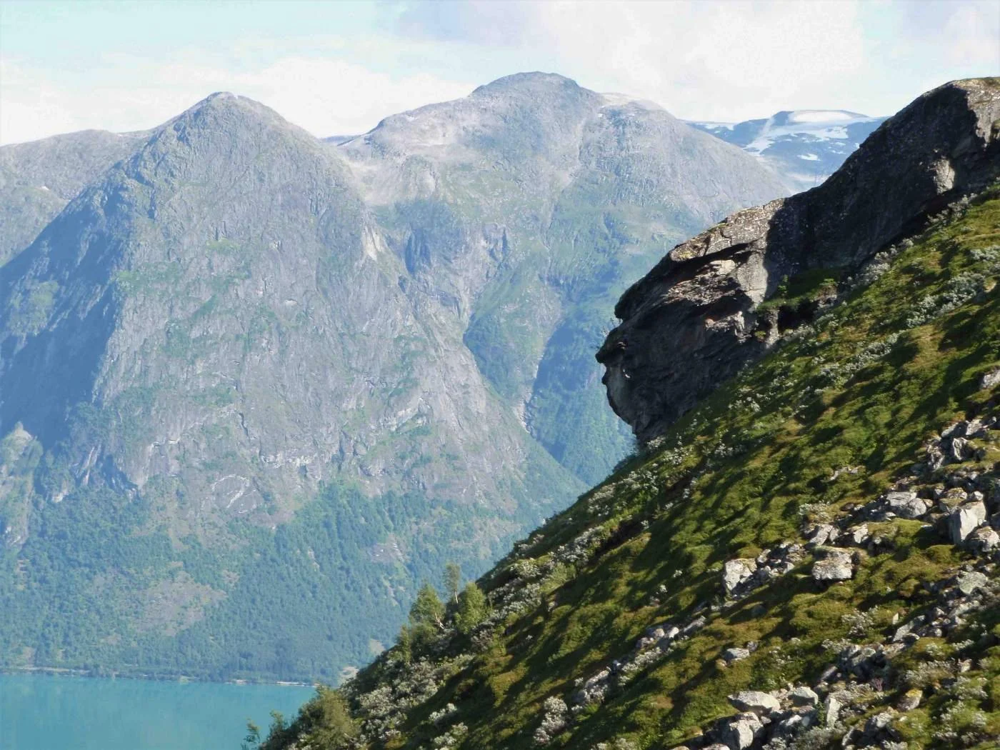
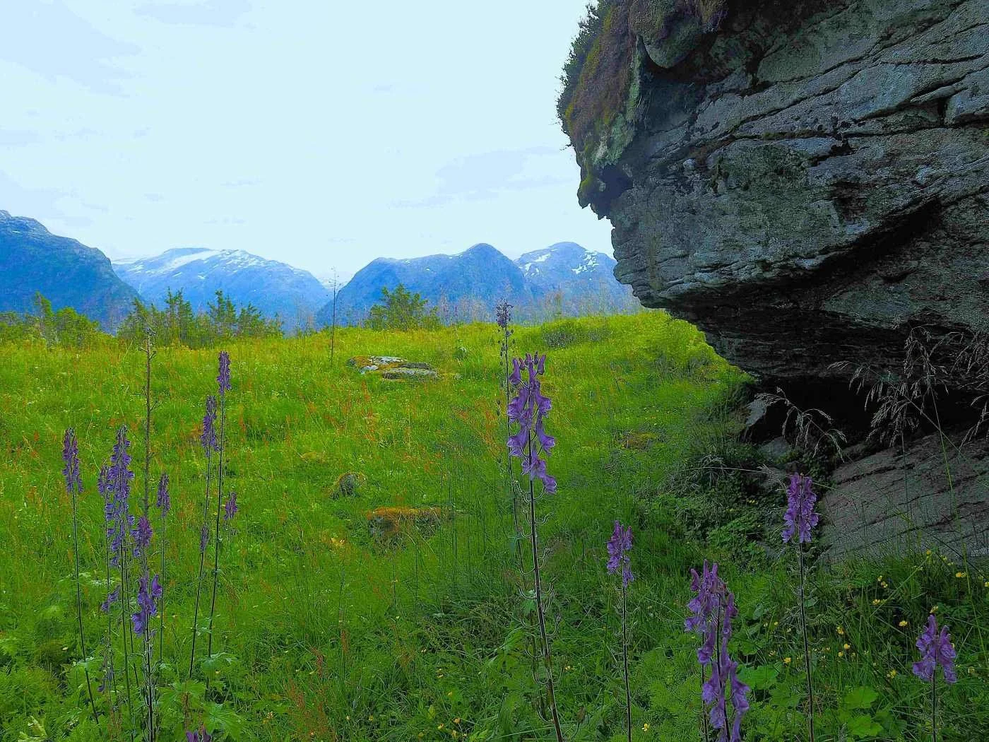
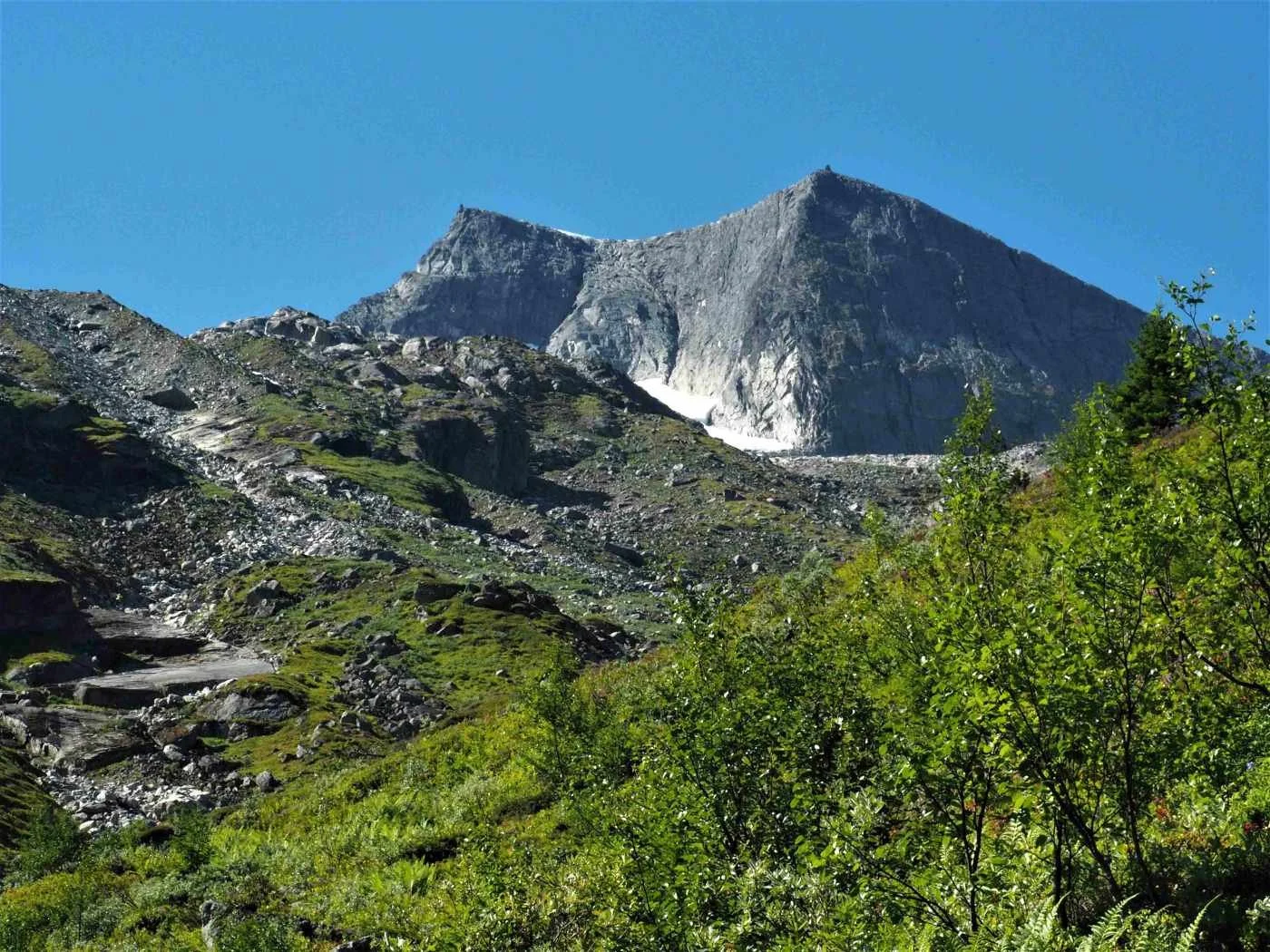
As you pass this rock formation, take a closer look. With a bit of imagination, you may see several shapes here.
The rocky outcrop is called Skuten. It is common for a projecting crag or rock formation in the landscape to be given this name.
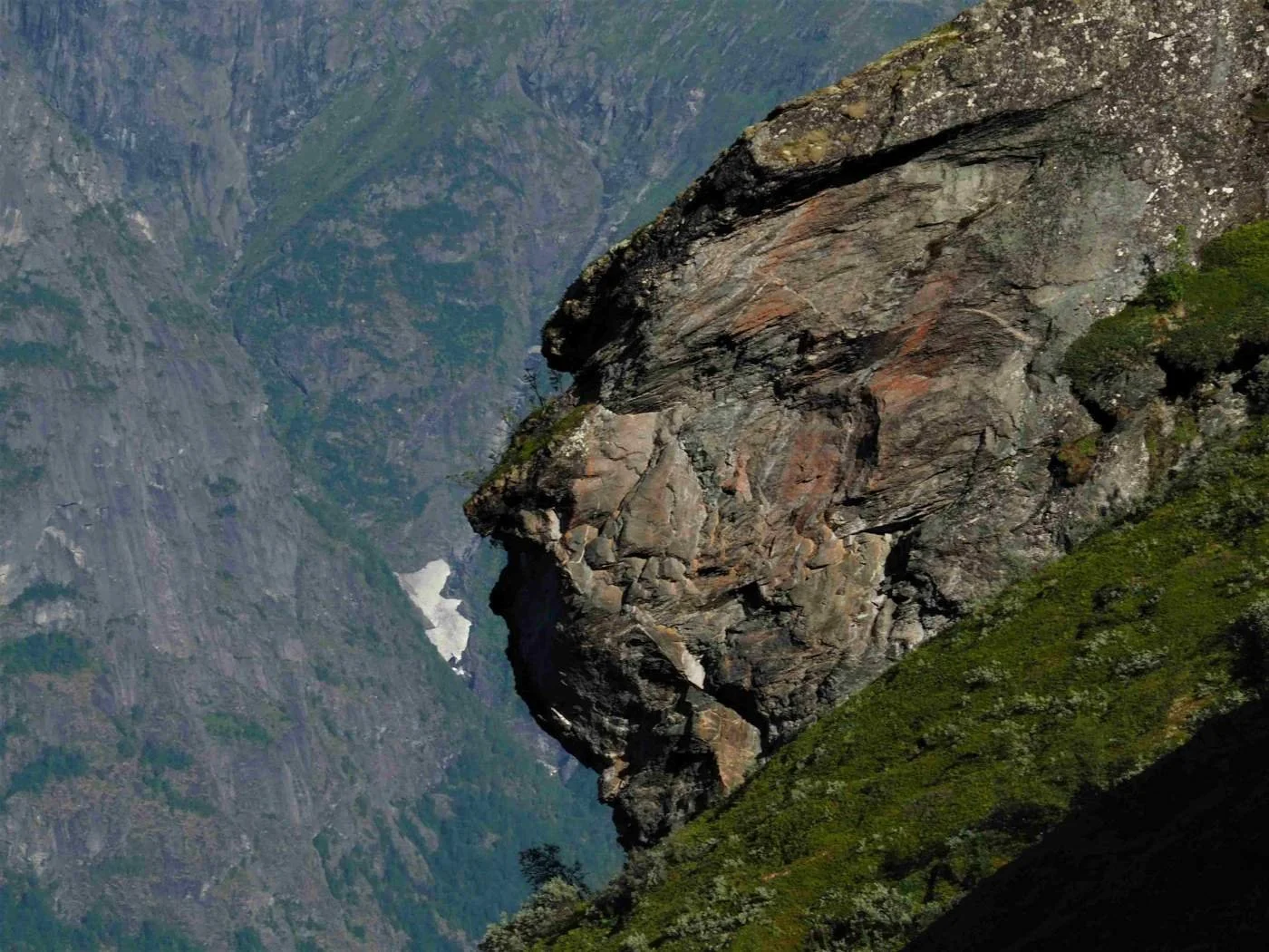
Here is a close-up of Skuten. What do you see?
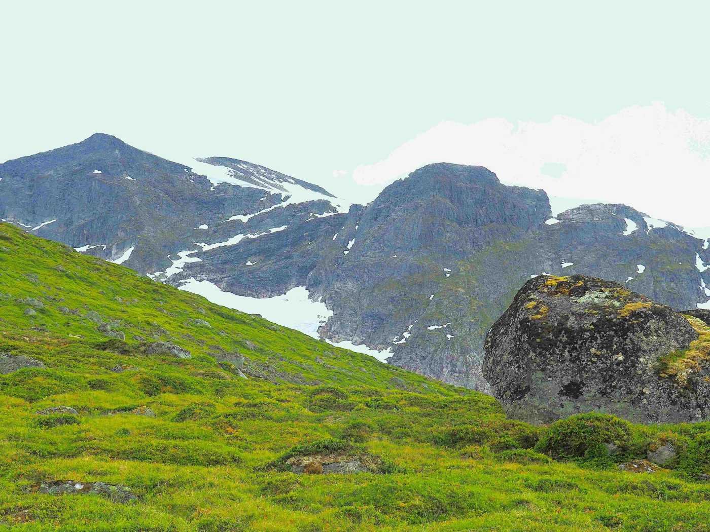
From Skuten, a depression in the terrain slopes steeply down toward the Åningselva, filling with snow every winter.
An old rule of thumb says that when this snow gully has melted in three places, it is safe to continue on to Brekkedalen.
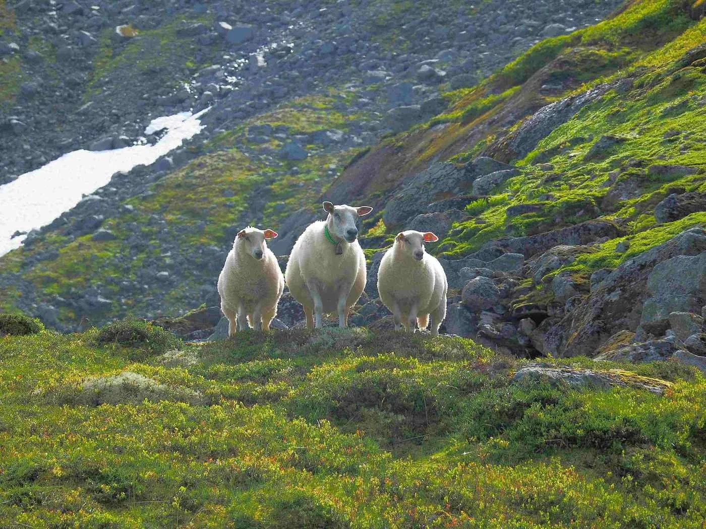
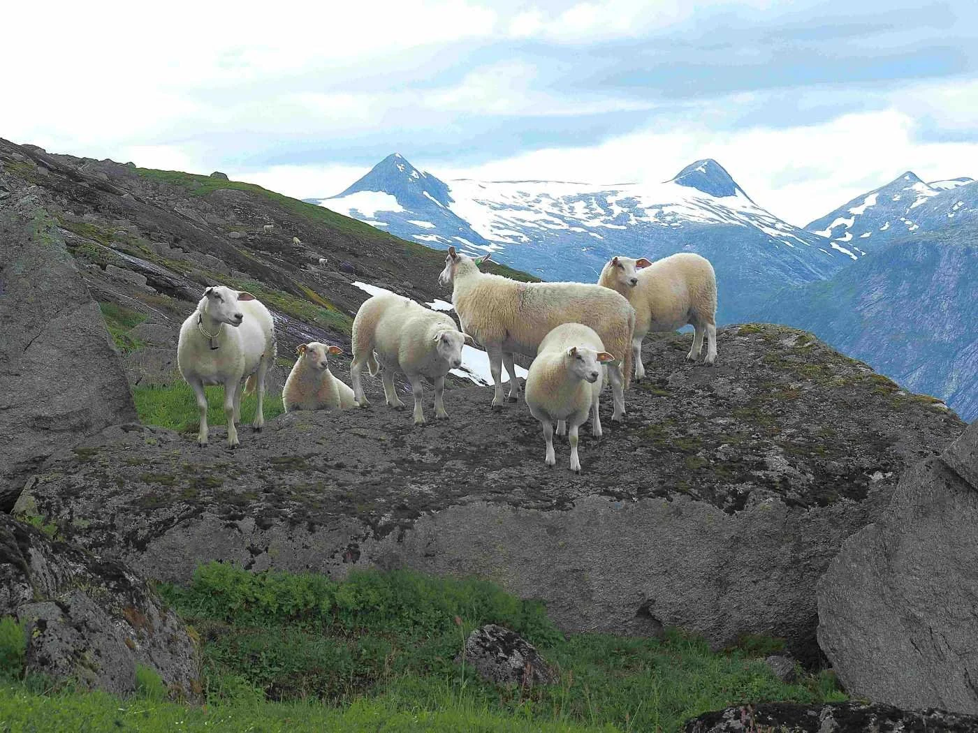
This small family of sheep is doing well in Brekkedalen. As we can see, they are in good condition and are clean and healthy.
The landscape in this area provides good grazing for sheep. Unfortunately, sheep farming is not very profitable, and there are now only a few sheep farmers left in the village.
View from the pass between Storskredfjellet and Brekkefjellet
We see the ridge leading toward Storskredfjellet in the background
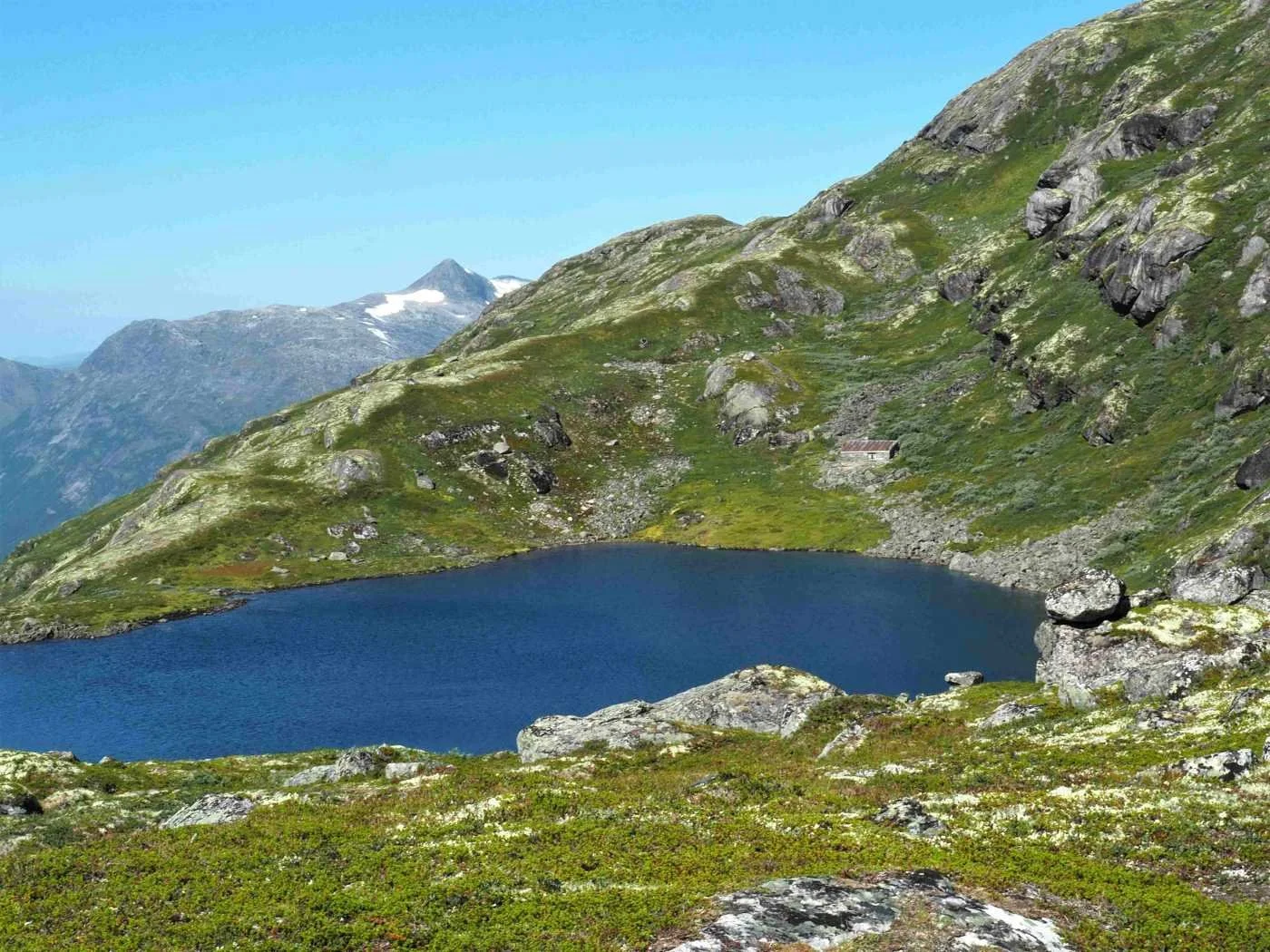
We look down toward Instevatnet. Behind the lake, a cabin can be seen, well camouflaged in the terrain.
This was originally a hunting cabin for the farms Åning, Brekke, and Tunold. The cabin was completed in the early 1930s. In recent years, it has seen little use.
The path to the cabin winds through willow thickets along the north side of Instevatnet.
Oppstryn IL has a mountain hike checkpoint at the cabin and at this idyllic Instevatnet.
The walk up here is steep and hard, but it is well worth the effort.
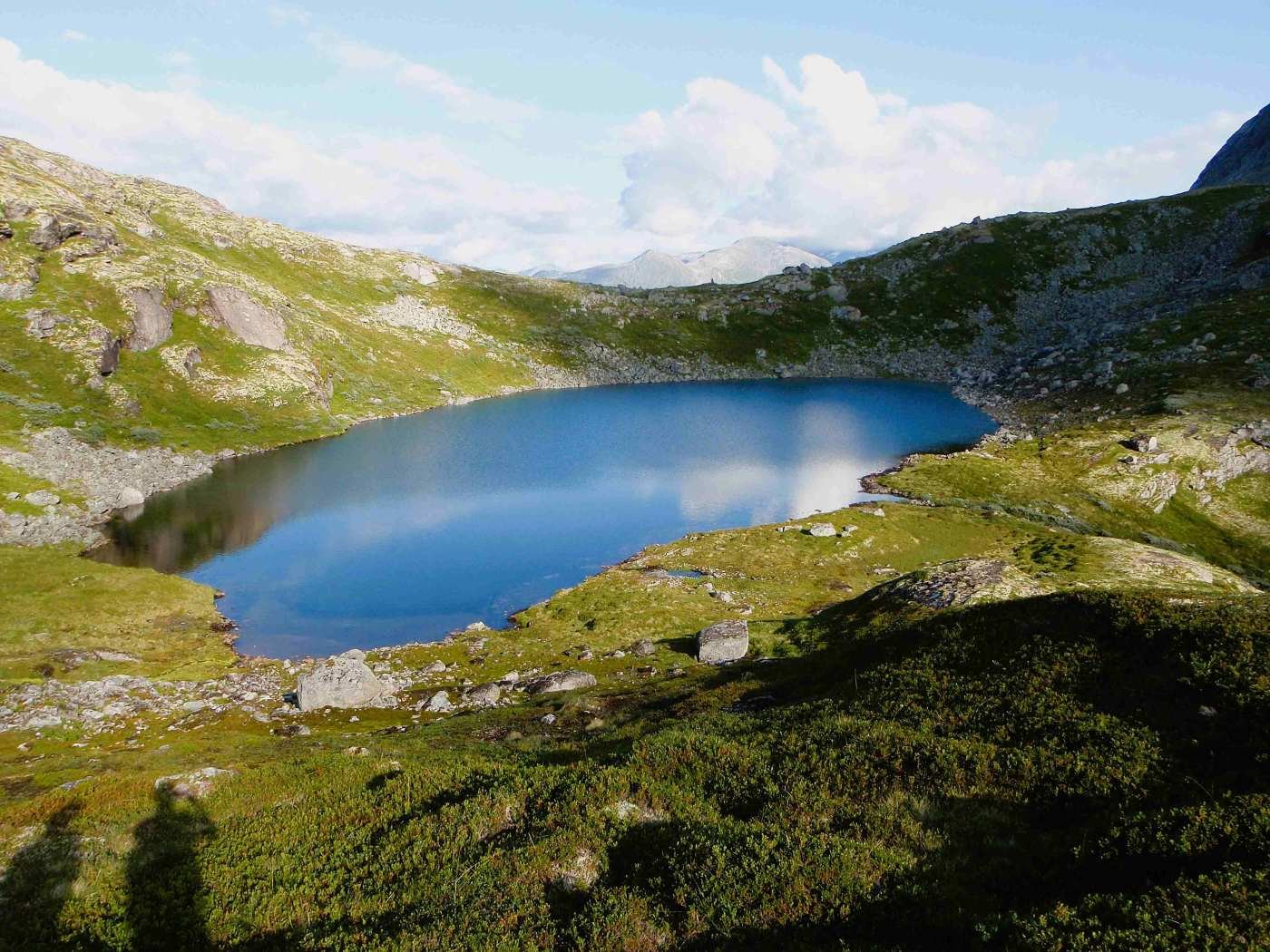
Instevatnet lies at 1,020 metres above sea level. Here you can look back toward the pass where the path from Åning crosses.
The path to Brekkedalen continues down a steep slope on the right side of the stream visible in the image.
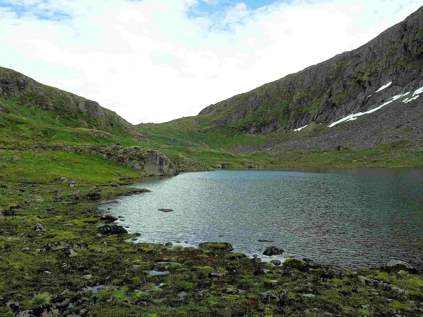
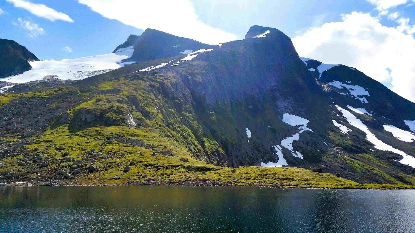
Brekkedalsvatnet, also called Ytstevatnet
Brekkedalsvatnet/Ytstevatnet. View looking west
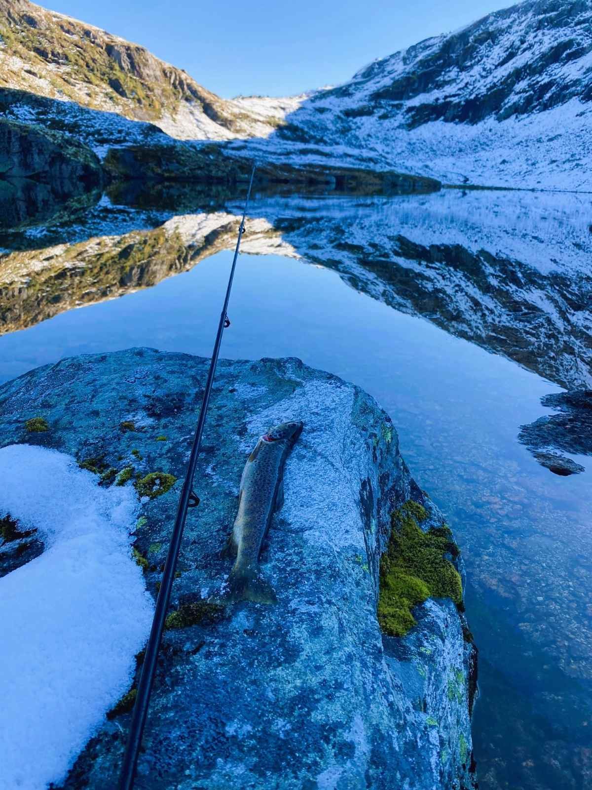
There is fish to be caught in Ytstevatnet. Photo: Inge Guddal
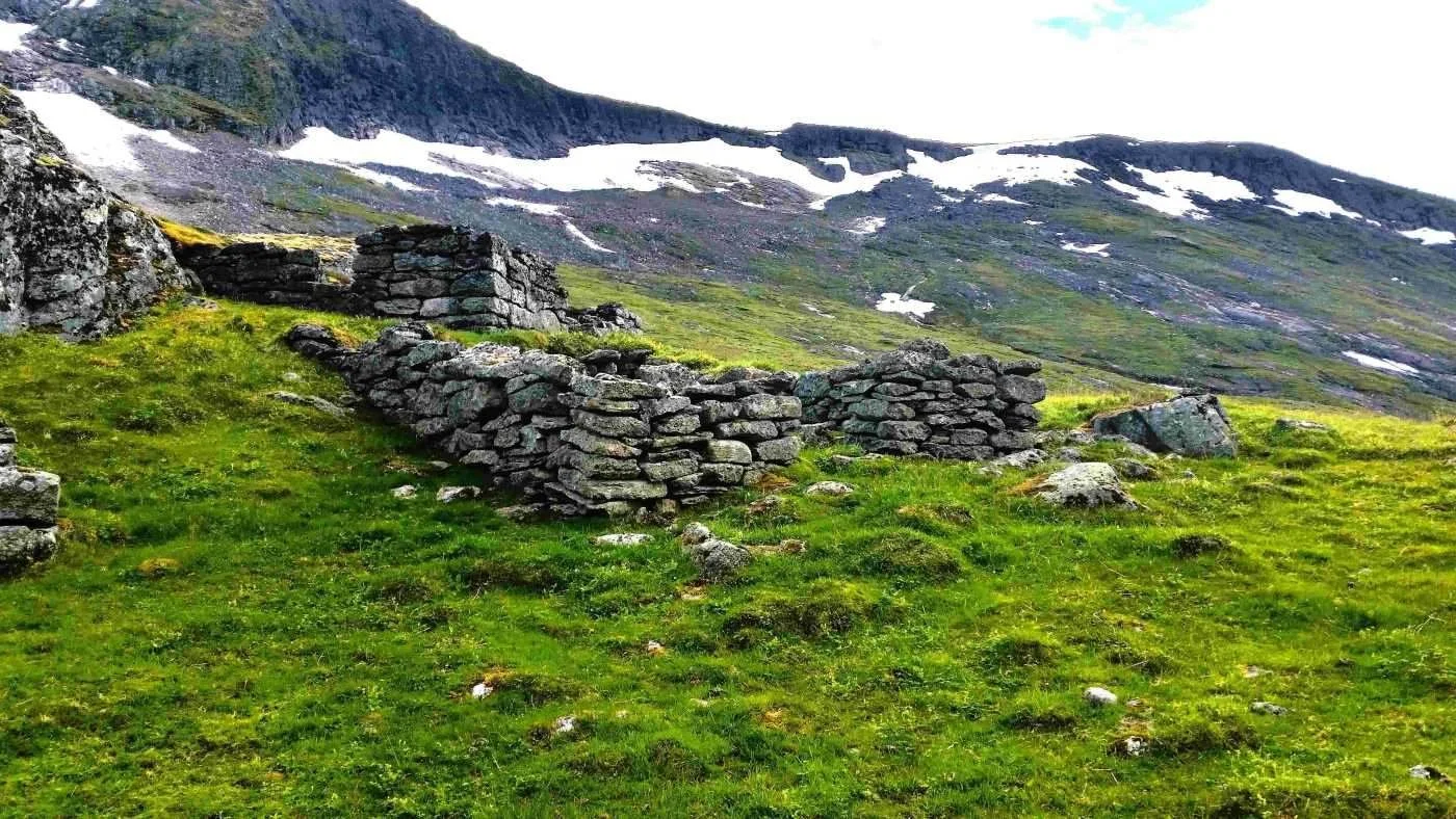
Brekkesetra
In the foreground, we can see the remains of a cowshed, and further back are the ruins of the summer farm cabin. There was probably only one main cabin used collectively, along with several cowsheds.
Brekkesetra is located at the lower end of Brekkedalsvatnet. Jon Åning tells in Kjell Råd’s book Setrar i Oppstryn og Nedstryn that his grandmother, Elisabet Åning, married into Åning in 1902. She was likely the last summer farm girl in Brekkedalen, and it appears that summer farming in the valley came to an end shortly after 1900.
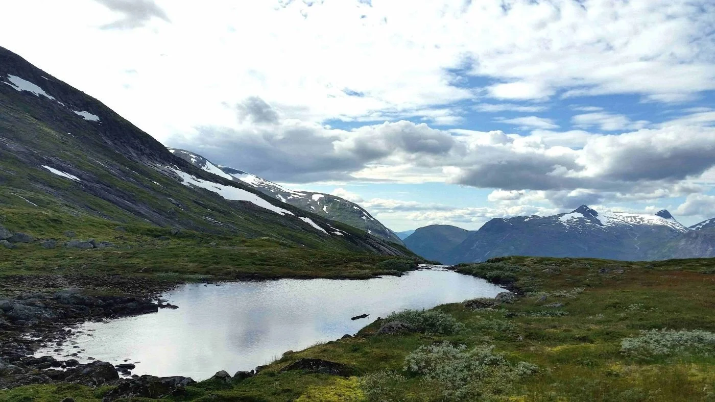
Here we see the lower (western) part of Brekkedalen. In the background, we can see Holtafjellet, also called Blåfjellet (1,478 m above sea level), and Botnenibba (1,372 m) far to the right.
There are ruins of a summer farm cabin and cowsheds right on the edge, just behind the moraine ridge visible in the image. This was the site of the Berstad farm’s summer farm, Berstadsetra.
There was a steep summer farm road from Berstad up to this spot, and today it is difficult to trace the old path. However, deer still use it, making it possible to find your way.
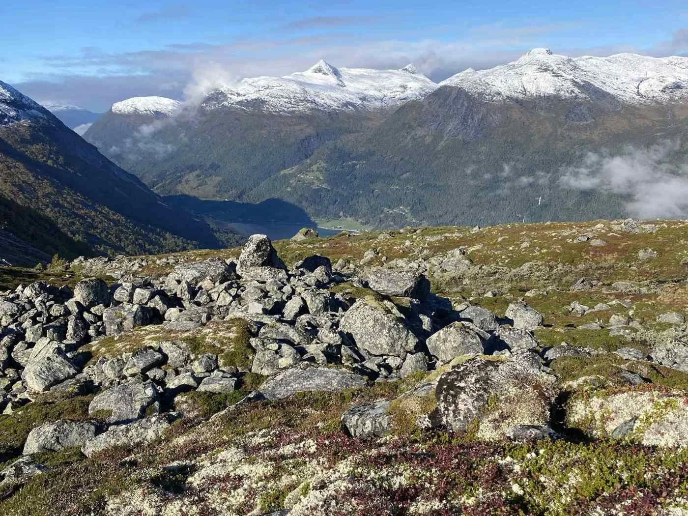
Photo: Inge Guddal
You can see the remains of the old Berstadsetra. Summer farming here probably ended before 1900. Today, no one seems to have any stories or knowledge about this summer farm.
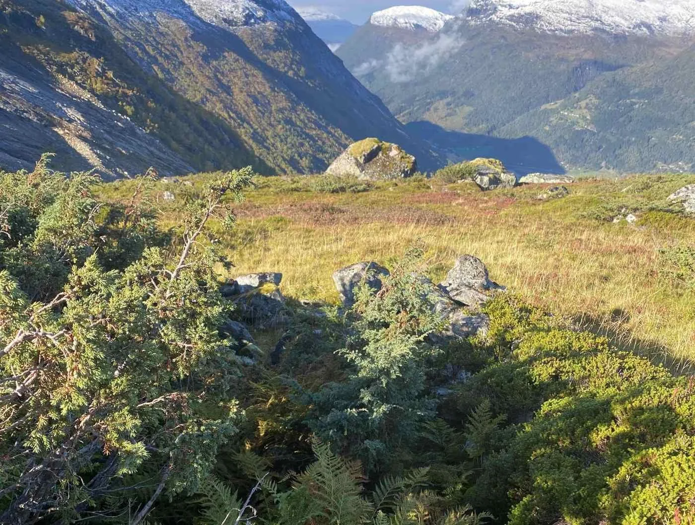
Photo: Inge Guddal
Juniper is growing around the ruins
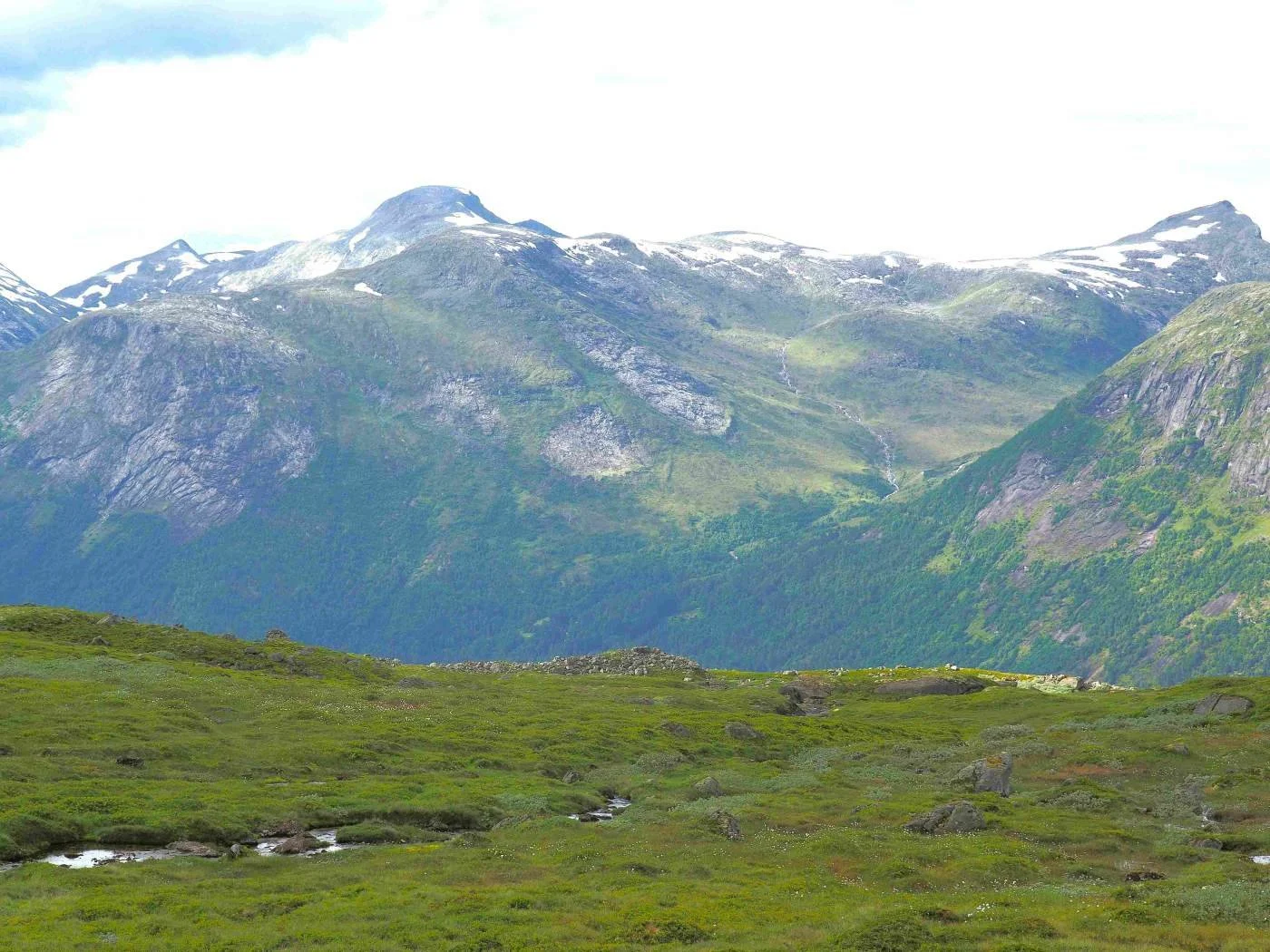
From the lower part of Brekkedalen, it is not too difficult to get across into Rjupedalen. These sheep are grazing in the area where it is natural to take the path.
The two mountain peaks in the centre of the image are, from left to right: Kyrkjenibba (1,400 m above sea level) and Steindalsegga (1,366 m).
We are looking toward Rjupedalen. In the background are Geitafjellhyrna (1,628 m above sea level) and Dispahyrna (1,481 m).
Here, there are large areas of grass and heathland—a good grazing area for sheep.
When you cross over into Rjupedalen, you should angle slightly inward toward the bottom of the valley.
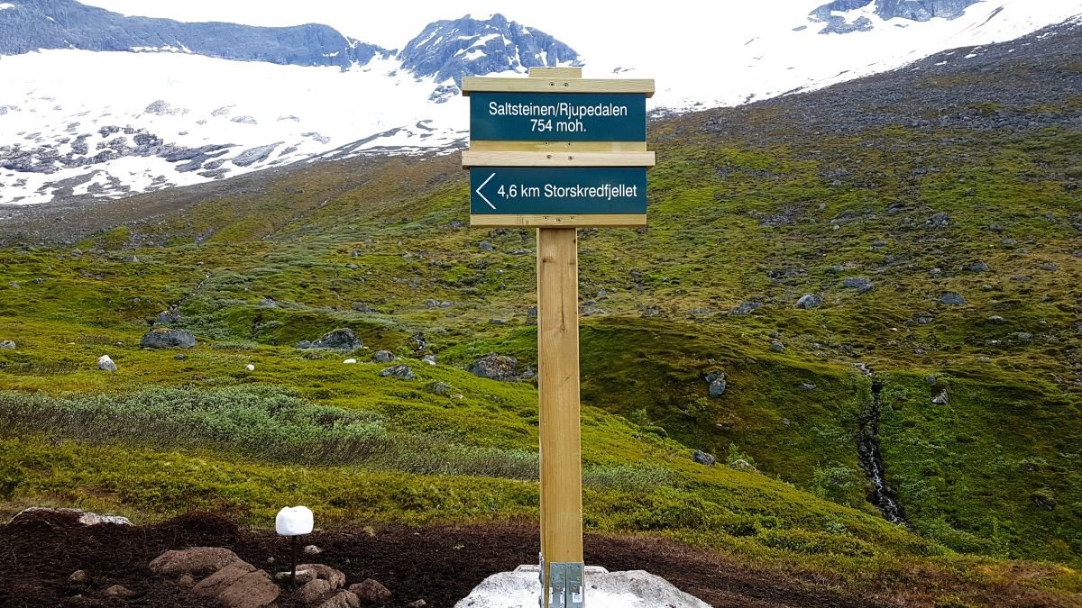
Photo: John Roger Meland
From Saltsteinen/Rjupedalen, the path continues down through the valley.
The path winds downward through the forest. Here, it has been cleared and marked.
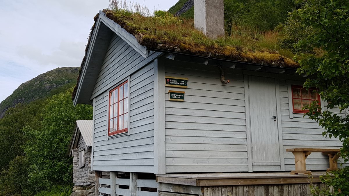
Foto: John Roger Meland
The path passes right by Melandsetra, which lies at 510 metres above sea level. There are now few grazing animals in the area, and forest and scrub are gradually reclaiming the summer farm buildings.
Summer farming at Melandsetra ended in 1949. At that time, there were two cabins and two cowsheds.
The cabin in the foreground belongs to farm unit no. 2. It was built in 1986 on the site of the old cowshed. The old cabin behind it belongs to farm unit no. 1. Farm unit no. 3 also had a cabin, which has now decayed completely.
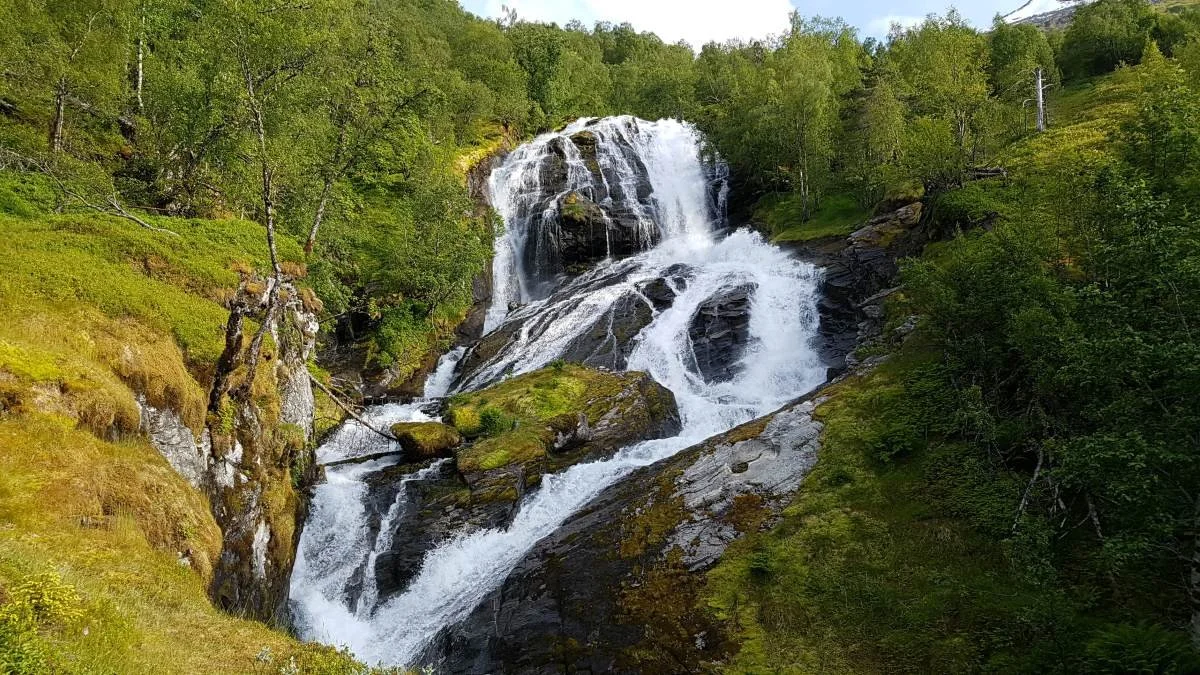
Photo: John Roger Meland
When you reach the forest road, you will see a sign pointing toward Storefossen. It is an impressive waterfall when the water flow is high.
Just before you arrive at the upper tent cabins at Strynsvatn Camping, there is a parking area. You can arrange to be picked up here—or you can start your hike here and walk up to Åning.
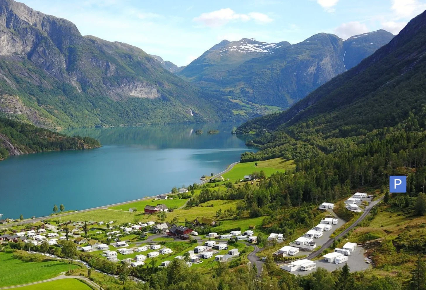
The image is taken from the website of Strynsvatn Camping.
Strynsvatn Camping is a large, modern, and well-run campsite located along Rv 15, 12 km east of Stryn town centre.
You can park at the end of the road—just past the last tent cabin.
Text and photo: Asbjørn Berge, 2026.