

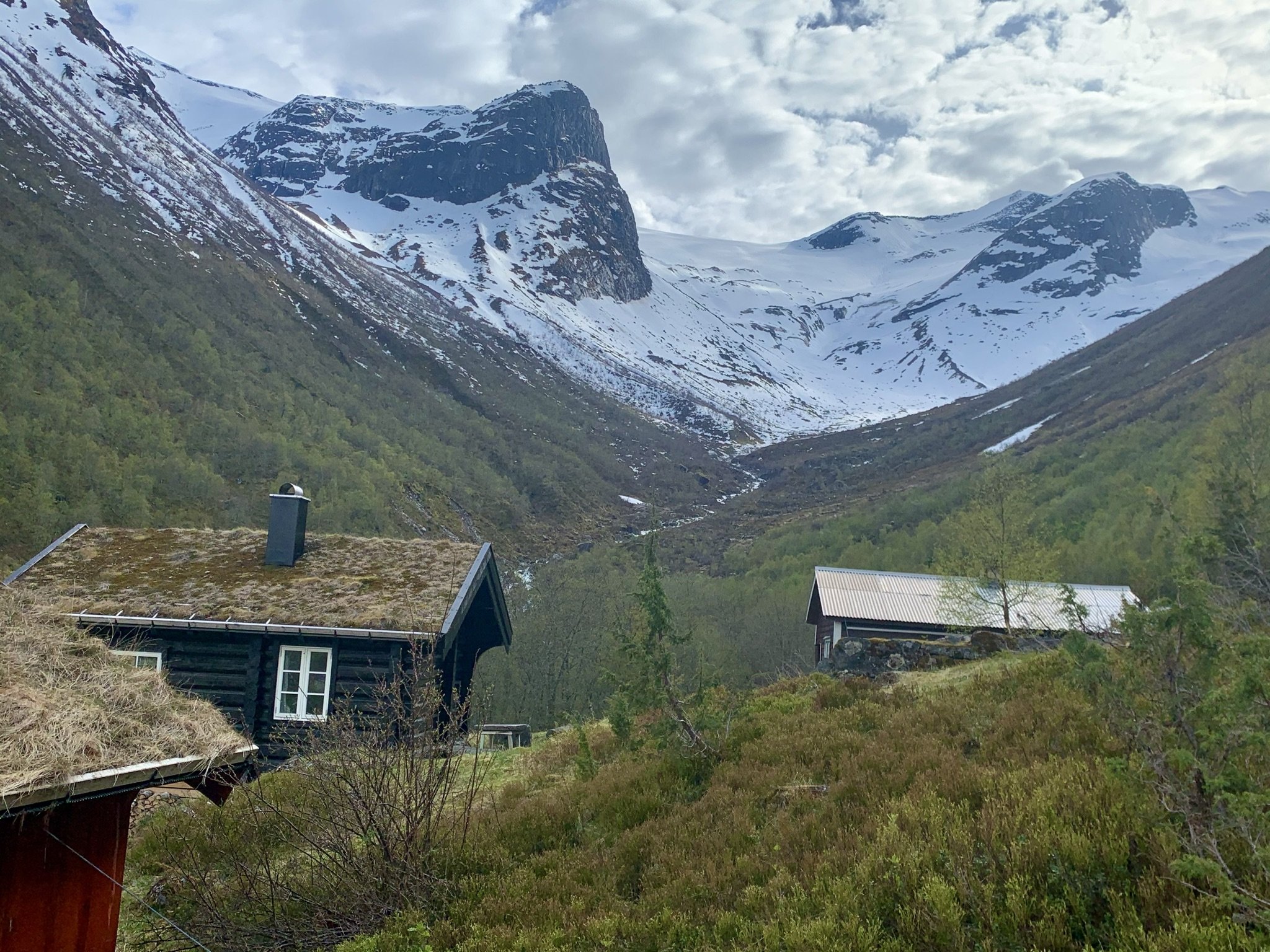
Hike in Fosdalen


Fosdalen seen from Glomnesnakken
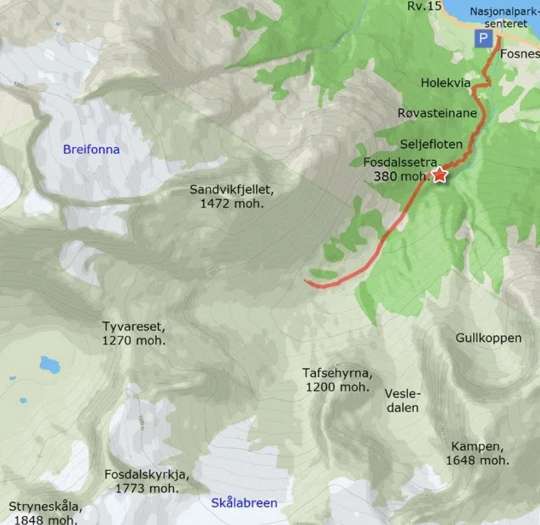
Fosdalssetra is situated at just 380 meters above sea level, making it the lowest of all the mountain farms in Oppstryn. However, the hike can be somewhat challenging, as you will ascend approximately 350 meters in relatively steep terrain.
Fosdalen offers beautiful nature and fascinating cultural heritage from ancient times. The mountain farm was abandoned before World War II, and today, only sheep graze in the valley.
Grading: Moderate difficulty. The trail is somewhat challenging in certain areas.
Length: 1.7 km one way.
Elevation gain: 350 meters.
Duration: 2.5 hours round trip.
Season: Spring – Autumn.
Parking: You can park at the parking lot by Rv.15, near the Jostedalsbreen National Park Center.
Note: It is safe to walk to the mountain farm, but deeper into the valley, there may be a risk of snow and rock avalanches early in the summer.
There is no mobile coverage at the innermost part of the valley.
Culture and nature trail: You can find it here.
Hike description
From the parking lot, follow the tractor road along the Fosdøla river. The road passes a gravel pit and continues up to Holekvia.
From Holekvia, a forest road leads further up a relatively steep hill on the left. A short way up, you will pass an old barn. Further along, you have the option to take a shortcut through the spruce forest on the right.
If you stay on the forest road, you will pass two large boulders called Røvasteinane. In the past, this was the first resting spot on the way to Fosdalssetra. The stones likely got their name because foxes once had dens her. Fox is pronounced "røv" in the Oppstryn dialect.
Where the forest road makes a sharp right turn, the mountain farm trail continues straight ahead. For a short distance, the trail follows the edge of the gorge above Fosdøla. Spruce trees were planted here to prevent livestock from falling off the edge during the seasonal migrations to the farm. Before that, a brushwood fence had to be repaired each spring.
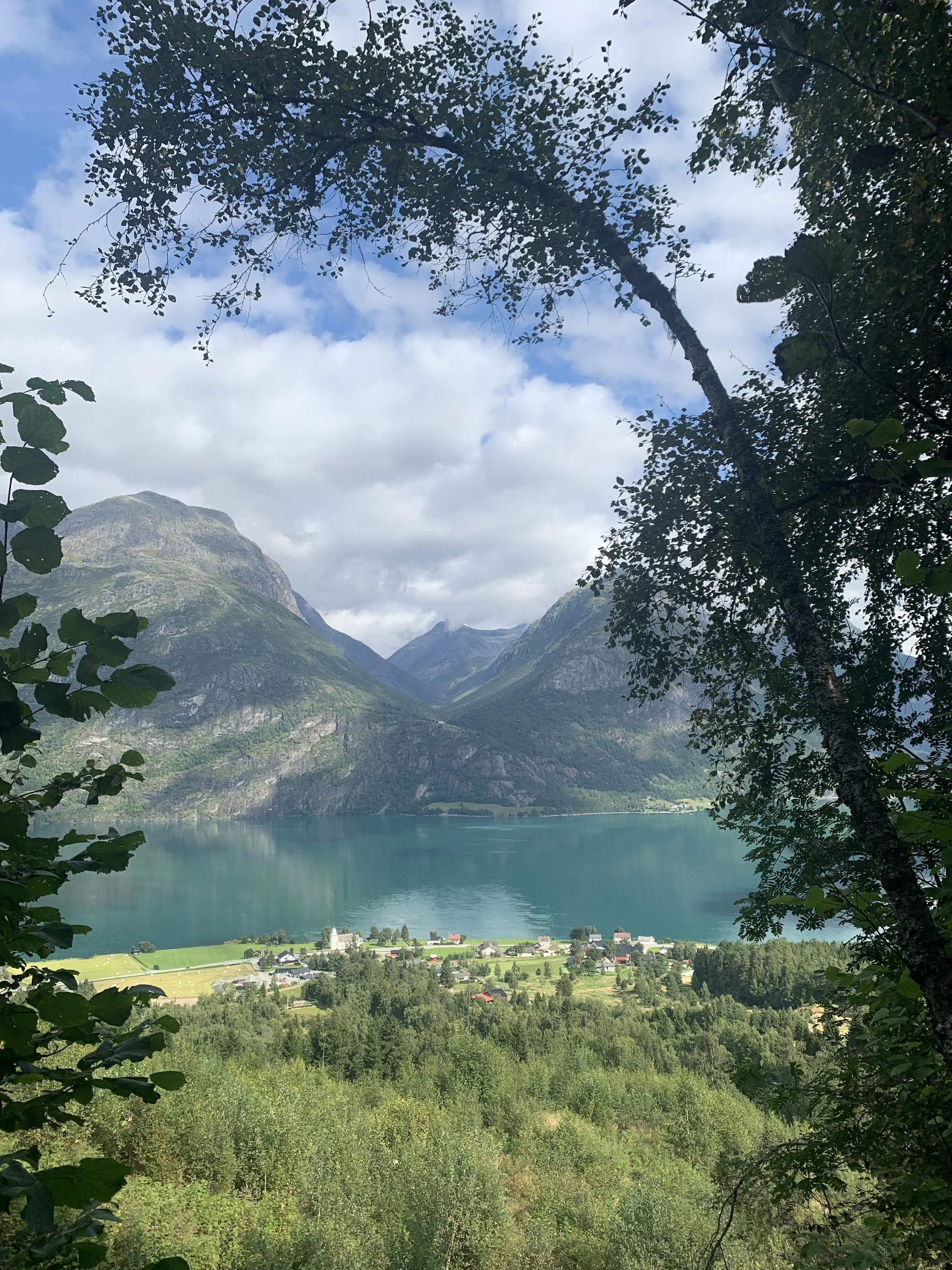
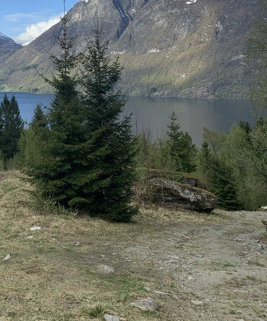
Once past the spruce-lined section of the gorge, you will soon reach the second resting place on the route, Seljefloten. Here, the terrain levels out slightly, opening up a view towards Oppstrynsvatnet, Glomsdalen, and Hjelledalen on the opposite side.
The name "Seljefloten" comes from "selje" (willow) and "flot," meaning a flat or open area. However, today, alder, birch, and rowan dominate the vegetation.
After Seljefloten, you will arrive at Setre-
bakken, the steepest part of the trail. Along the path, you will see some old, uniquely shaped birch trees—take a closer look.
At the top of Setrebakken, you will see the huts of Fosdalssetra.
Fosdalen is a short valley shaped by glaciers and rivers. Snow and rock avalanches are common in the steep mountainsides.
Fosdalssetra (summer farm) lies at the edge of an avalanche-prone area, and over the years, some of the huts have succumbed to the strong winds accompanying avalanches. Originally, there were six huts – three belonging to Sandvik and three to Fosnes.
Cows were milked at the mountain farm until 1935. Until 1970, cattle grazed in Fosdalen, but since then, only sheep have roamed the valley.
The valley is rich with alder forests, along with some rowan and birch trees. Fosdalen is one of the few places in Strynedalen where monkshood and foxglove grow together.

Monkshood , Aconitum Septentrionale

Foxglove , Digitalis Purpurea
The Hike in Pictures
View from the trail to Fosdalssetra. Looking towards Fosnes and Glomsdalen.

Holekvia
This area was once a hayfield. Today, it serves as pasture for sheep.
Holekvia is a terrace formed by loose sediments carried by the Fosdøla river during the melting of the great inland ice more than 10,000 years ago. These sediments were deposited into the sea, which at that time was 75 meters higher than today and reached all the way up to Folven and Guddal in Hjelledalen.
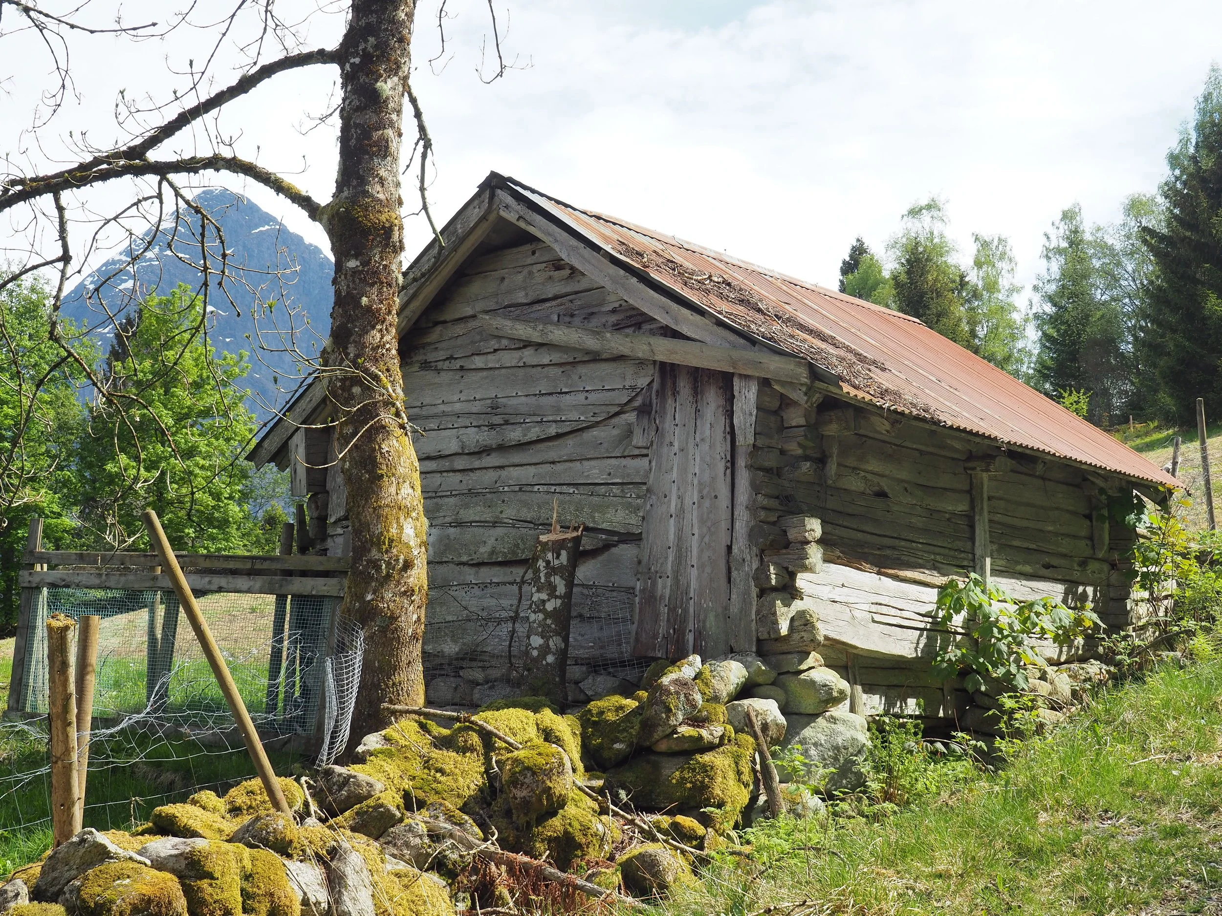
Holekvia. We see an old barn belonging to the Sandvik farm, owned by Per Ivar Skåre. In the foreground, part of an old stone wall is visible.
Stone walls are now recognized as valuable features of the traditional agricultural and cultural landscape in rural areas.
Røvasteinane
One of the stones was the perfect height to sit on when returning from the mountain farm with heavy milk pails on their backs. It was common on all mountain farm trails to have a specific resting stone – or sometimes several – that they called "Kvile" (Rest).

Spruce trees were planted along the edge of the gorge to prevent livestock from falling off.

The gorge that Fosdøla has carved out.
Fosdalen, much like Glomsdalen, has a steep and deep gorge at the mouth of the valley. This gorge was formed during the melting of the great inland ice more than 10,000 years ago.
At that time, Fosdøla was very large and turbulent, carrying enormous amounts of loose material that the glacier had eroded from the mountains further up the valley. In the steep section at the mouth of the valley, the rock was worn down by the powerful, sediment-laden river. This process took place over thousands of years, even while the glacier was still in the valley.

The gorge in the foreground. We are looking towards Hjelle and Hjelledalen.

Seljefloten. We are looking towards Glomsdalen and Hjelledalen.


Setrebakken
Just off the path we can see an old birch tree where fungi grow densely on
the lower part of the trunk. Fungi are a large group of mushrooms that primarily grow on old trees. They are parasites that break down the wood. Many of these
fungi play an important role in the ecosystem.

In the upper part of Setrebakken, the area opens up, and we get a view of the huts at Fosdalssetra.
A landowner has been diligent in clearing the forest and keeping the terrain open around the huts and along the trail. Due to the lack of grazing animals, new shoots (root shoots from trees) are gradually growing in.
From the summer farm, you can see all the way to the end of Fosdalen. If you turn around, you have a view over a large part of Oppstrynsvatnet, Hjelledalen and Gloms-
dalen, with the mountain farm Segestad.
The three summer farm huts belonging to the farms at Fosnes were called Ivaselet, Andersselet, and Oppigardselet. Ivaselet and Andersselet collapsed on their own, while Oppigardselet was taken by a snowstorm.
The huts belonging to Sandvik were Kristianselet, which collapsed on its own during the war, Toreselet, which has now been torn down, and Monsselet. Monsselet was built in 1889. In 1968, it burned to the ground, but one year later, a cabin was built on its foundation.

Foto: Ståle Sunde
Fosdalssetra Around 1990
To the left, we see Toreselet. The owner was Ivar Guddal. It has now been torn down. Monsselet is on the right. The owner is Per Ivar Skåre. In the foreground to the left are the ruins of Oppigardselet.

The cabins at Fosdalssetra today
1 – Monsselet. Owner: Per Ivar Skåre
2 – Ivaselet. Owner: Amund Mork
3 – Toreselet. Owner: Magnus Guddal

The cabins at Fosdalssetra seen from the opposite direction. In the background are Tafsehyrna (1300 m) and Fosdalskyrkja (1773 m).
Just east of the huts at Fosdalssetra, the Tverråna stream flows, a ravine originating from Gullkoppen. Gullkoppen is a bowl-shaped hollow in the mountain Kampen.
The summer farm path from Fosnes crossed this ravine, but the area is prone to water accumulation and avalanches. Therefore, the path has not been maintained.
Blueberry

In Fosdalen, there are plenty of blueberries. In earlier times, it was common to pick blueberries to earn extra income.
Today, blueberries are an underappreciated resource. This is unfortunate, as they are rich in antioxidants.
The Travel Route to Loen

Tyvareset. View towards Hjelle and Hjelledalen Photo: Tarald Harstad
The travel route to Loen goes up through Fosdalen, over a ridge or pass called Tyvareset, at approximately 1,270 meters above sea level, and then continues down through the valley leading to Loen. The people of Loen call the valley on their side Fosdalen, while the inhabitants of Oppstryn refer to it as Tyvadalen.
The route over Tyvareset to Loen has been rarely used. Old church records tell of a man who perished while crossing the ridge. The record states:
"Around the middle of June 1832, farmer David Andersen Skarsteen, approximately 30 years old, disappeared in the glacier that lies between Oppstryn and Loen. As soon as he was missed, a search was conducted, but he could not be found. Presumably, a storm or unfamiliarity with the route caused his demise.

View towards Tyvadalen. Loen and Olden in the background.
Photo: Tarald Harstad
It is said that a cotter at Berge, Akslun Jenssen Løken, bought a heifer at Sæten in Loen. He brought the heifer up through Tyvadalen, over Tyvareset, down through Fosdalen, and on to Berge. The journey apparently went smoothly. They did not shy away from a bit of effort in those days.
In 1935 (or 1936), surveyor Jørgen Grønfur was commissioned by the Norwegian Trekking Association (DNT) to mark the trail over Tyvareset. Ragnar Grønfur assisted him. The trail was marked, but it did not lead to many more hikers.
Geological conditions in Fosdalen

The upper part of Fosdalen. Tyvareset on the left, Storskredfjellet (1815 m.)
on the right. Photo: Tarald Harstad
Fosdalen is a landslide-prone valley. When you pass the summer farm on your way further into the valley, there is a lot of debris from landslides. High up on the mountainside on the west side of the valley, large overhanging slabs of rock are waiting "in line" to fall. Rockfalls occur here periodically.
The picture above shows the layering on the west side of the valley. Large amounts of rainfall that fill the cracks may be enough to send large slabs of rock from the mountain.
Municipal Sub-Plan for Cultural Heritage
In 2017, Stryn Municipality worked on a municipal sub-plan for cultural heritage. At that time, Amund Mork contacted the municipality and reported the stone wall as a cultural monument. He was not taken seriously at first, but Rannveig Marit Mindresunde became involved and contacted specialist Runar Hole to clarify what could explain this wall below Tafsehyrna.
She also reached out to name researchers to determine whether there was a connection between the hunting and trapping site and the name of the mountain behind it. The answer was that such a connection was very likely. Tafn is an Old Norse word meaning “prey” or “offering.” It is natural that the word evolved into Tafs in the name Tafsehyrna.
The old explanation of the name — that the scree on the top looks like “paws” — no longer holds.
Hunting and trapping site below Tafsehyrna

Photo: Fjordingen
Runar Hole, an expert on hunting and trapping sites, has confirmed that the stone wall (marked with a red line in the image) below Tafsehyrna is part of an ancient hunting and trapping structure. It is difficult to date exactly when the site was in use, but it may date back to the Stone Age – over 4,000 years ago.
The image above shows how it is believed that reindeer were driven towards a post where hunters stood ready with spears and bows.
The barrier wall we see in the image guided the reindeer up a ridge that ran just below the mountain. Here, the animals became trapped, and hunters with bows and arrows could reach them. The distance to the animal had to be less than 20 meters to ensure a fatal shot. To use a spear, the animal had to be even closer.
At the lower end of the hunting wall, there was a lookout post. Along the wall, there were likely hunters stationed to prevent the herd from crossing, and up near the steep mountain, hunters were hidden behind a large stone (red circle in the image). The entire setup was a well-organized hunt with many participants.

The hunting wall below Tafsehyrna. Lookout post at the end. Photo: Fjordingen

The starting point for the hike in Fosdalen is located near the Jostedalsbreen National Park Centre. Feel free to stop by the centre for more information about the nature and culture of the area.
Text: Asbjørn Berge, 2025
Photos: Marit and Asbjørn Berge
Plant photos are sourced from the Internet