


Hike to Storskredfjellet
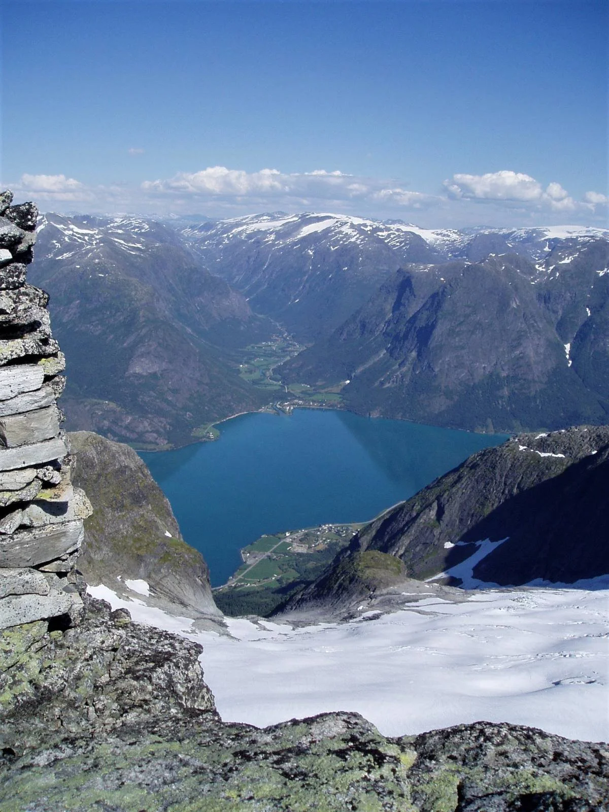
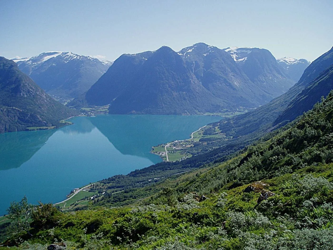
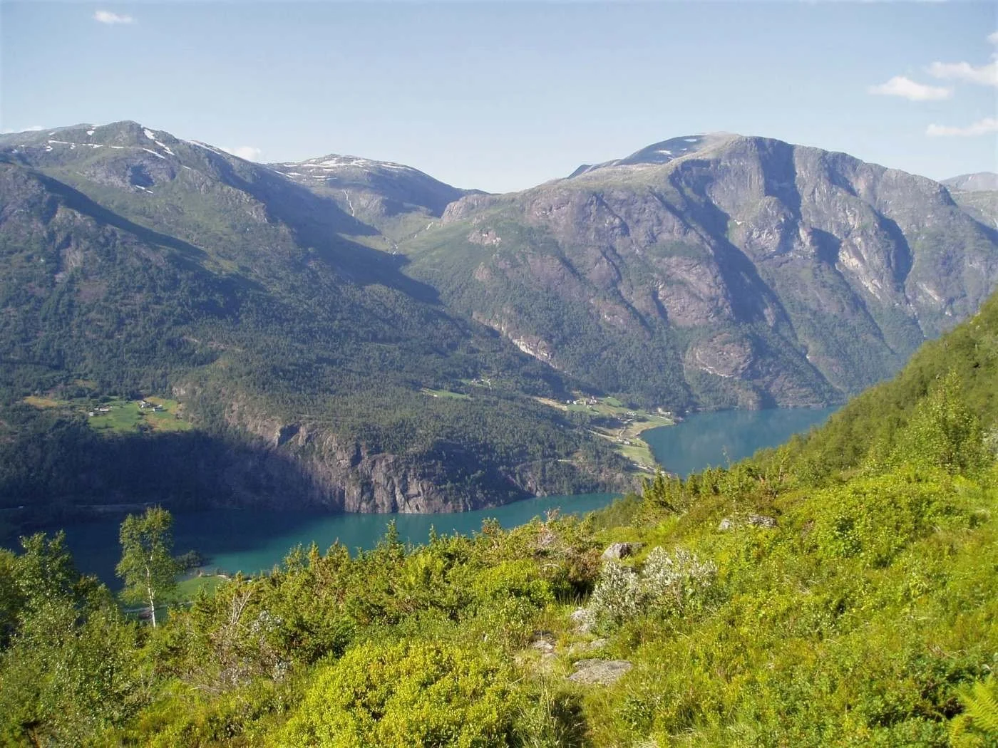
The view from Storskredfjellet.
A hike to Storskredfjellet is a great nature experience. Towering mountains and glaciers surround you on all sides. The route to the summit is fairly straightforward, but the hike is physically demanding.
Difficulty: Very demanding. A hike that requires good physical fitness and experience in steep terrain.
Distance: 5.5 km one way from Åning.
Elevation gain: 1,565 m
Duration: 11 hours round trip
Season: Summer and autumn
Parking: You can park at Åning. Remember to pay the fee!
Note: There is a cleared trail up to the tree line, both from Åning and Meland.
There is no mobile coverage on the hike.
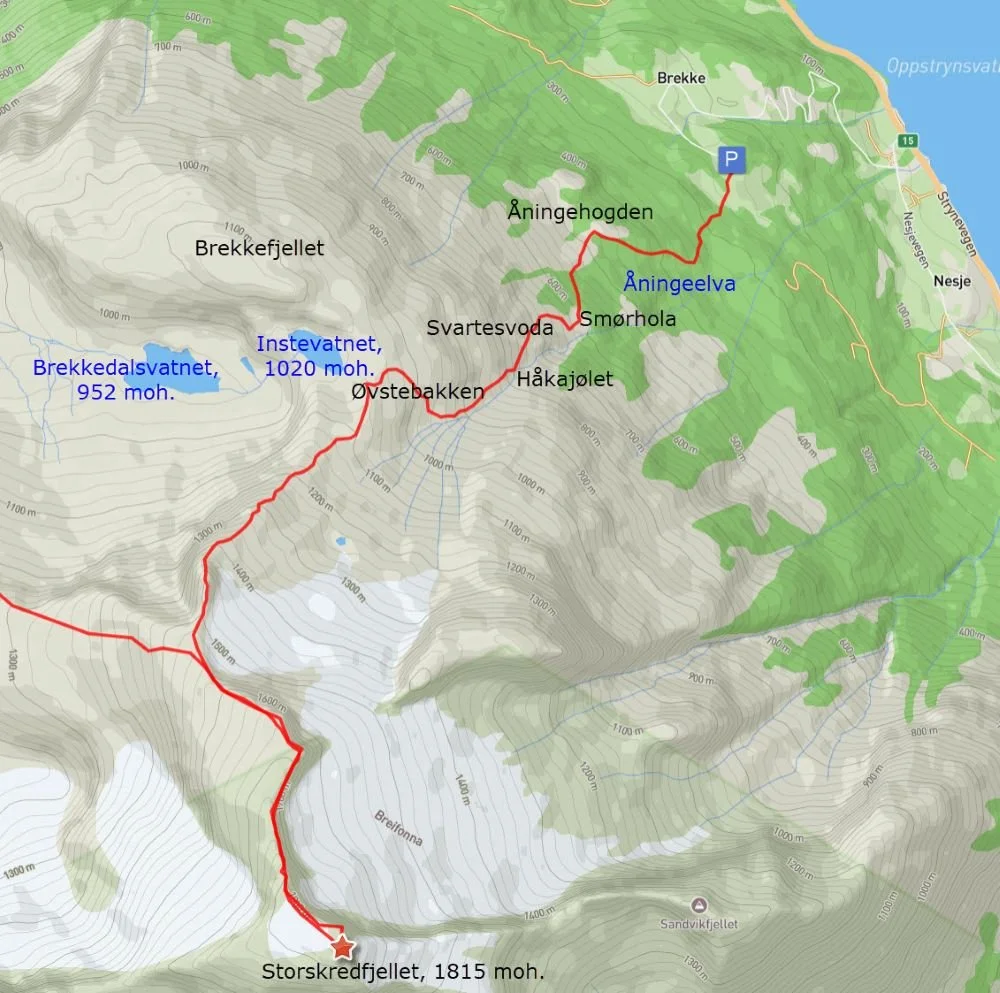
The route from Åning to Storskredfjellet
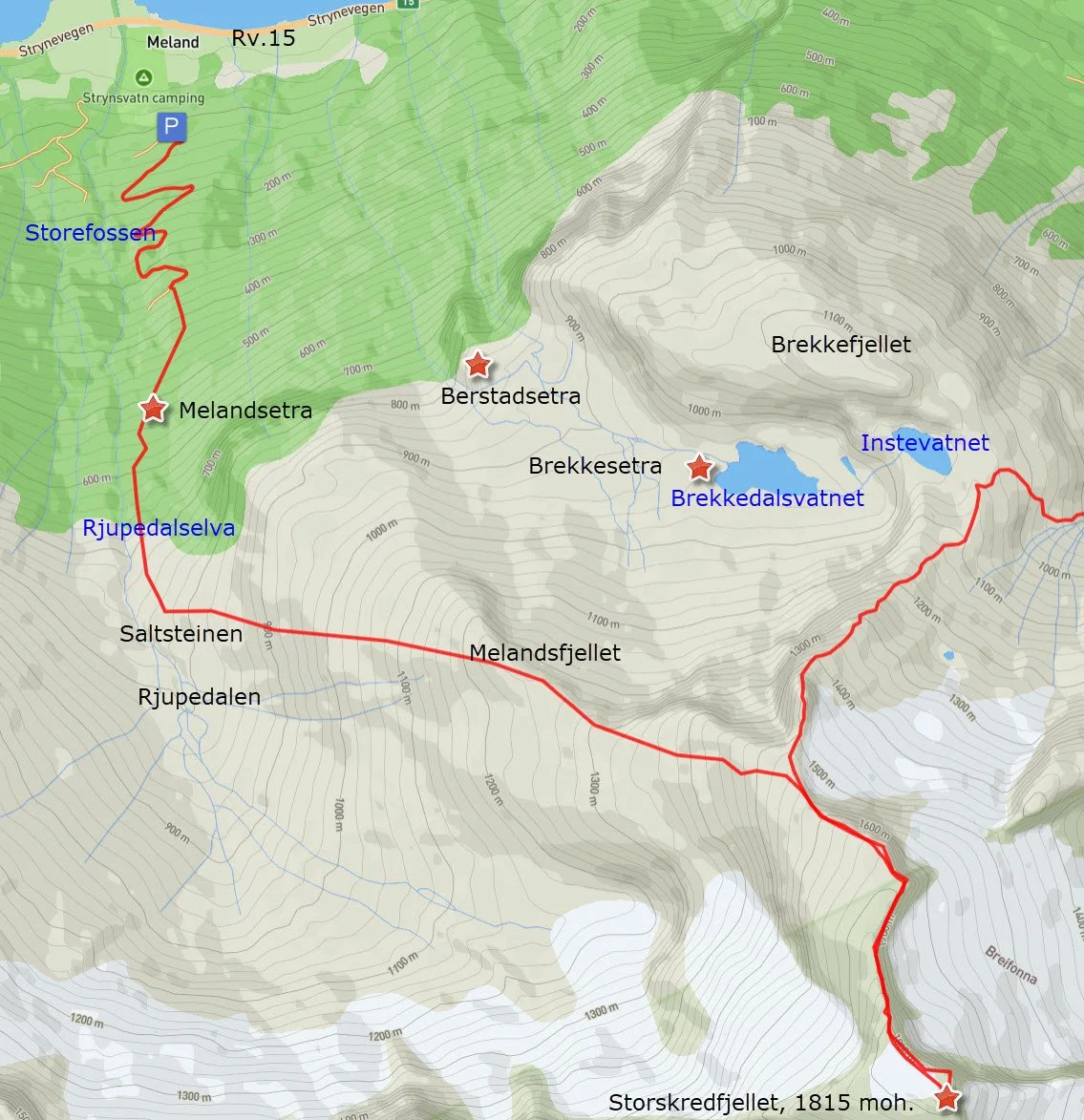
The route from Meland to Storskredfjellet. We can see that the final part of the route to the summit is shared by both starting points.
Turskildring
Du kan parkere på Åning og gå til Storskredfjellet med retur til Meland, eller du kan parkere på Meland og gå til Storskredfjellet med retur til Åning. Du kan sjølvsagt gå frå Åning tur-retur eller frå Meland tur-retur.
Her er turen skildra med Åning som utgangspunkt.
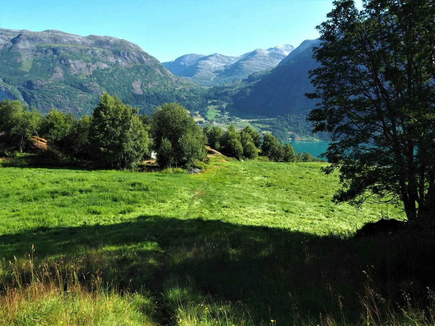
The image shows the trail crossing a meadow at Åning. Åning lies at 260 metres above sea level and is the highest farm with permanent residents in Oppstryn.
This is the starting point for the hike towards Brekkedalen from the eastern side. You can just as well start from Meland and walk through Brekkedalen to Åning.
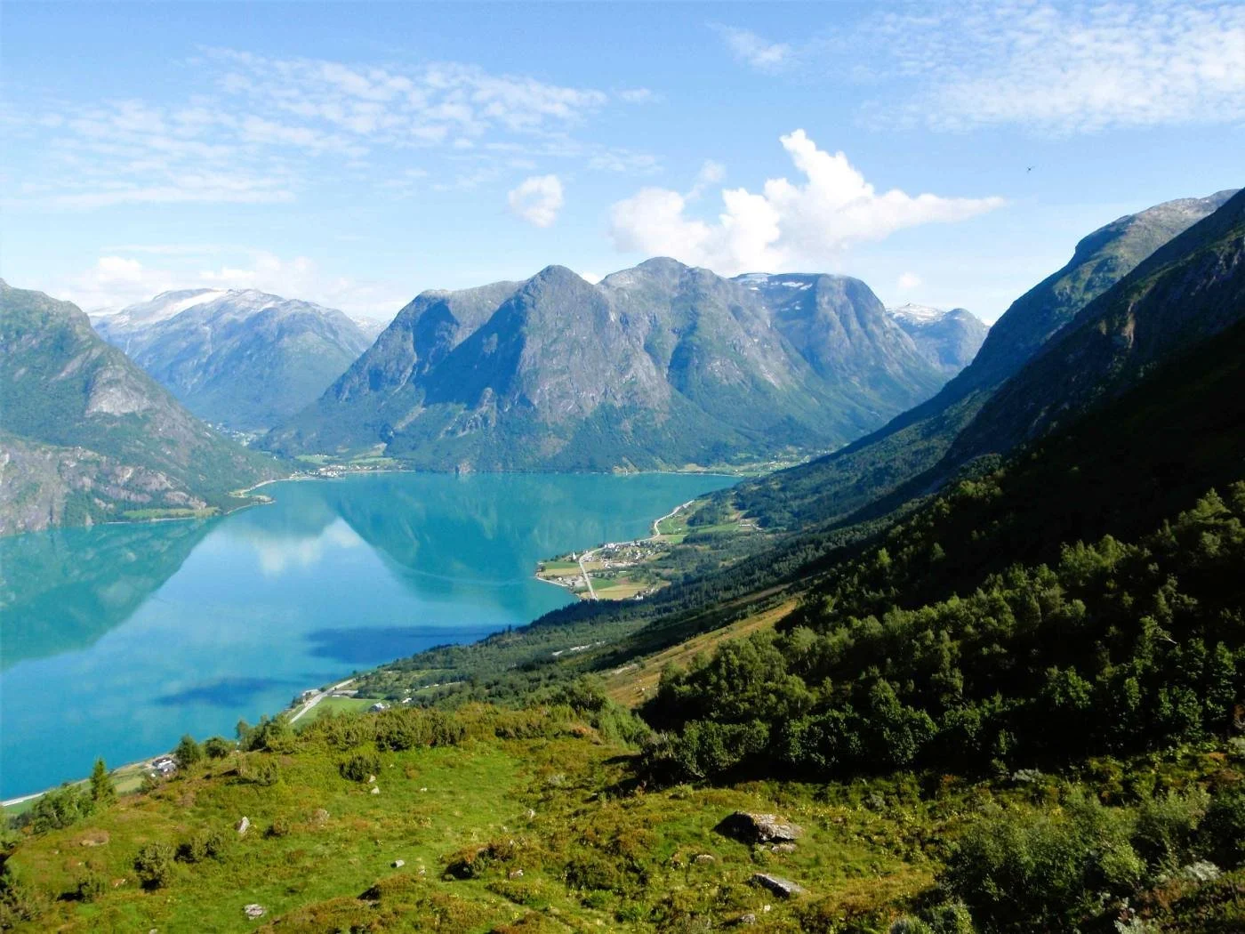
After crossing the meadow, you enter the outlying fields at Åning. The path winds through a forested area and eventually reaches the top of a ridge, Åningehogden. Here, the landscape opens up, and you get a fine view of Oppstrynsvatnet and the surrounding villages.
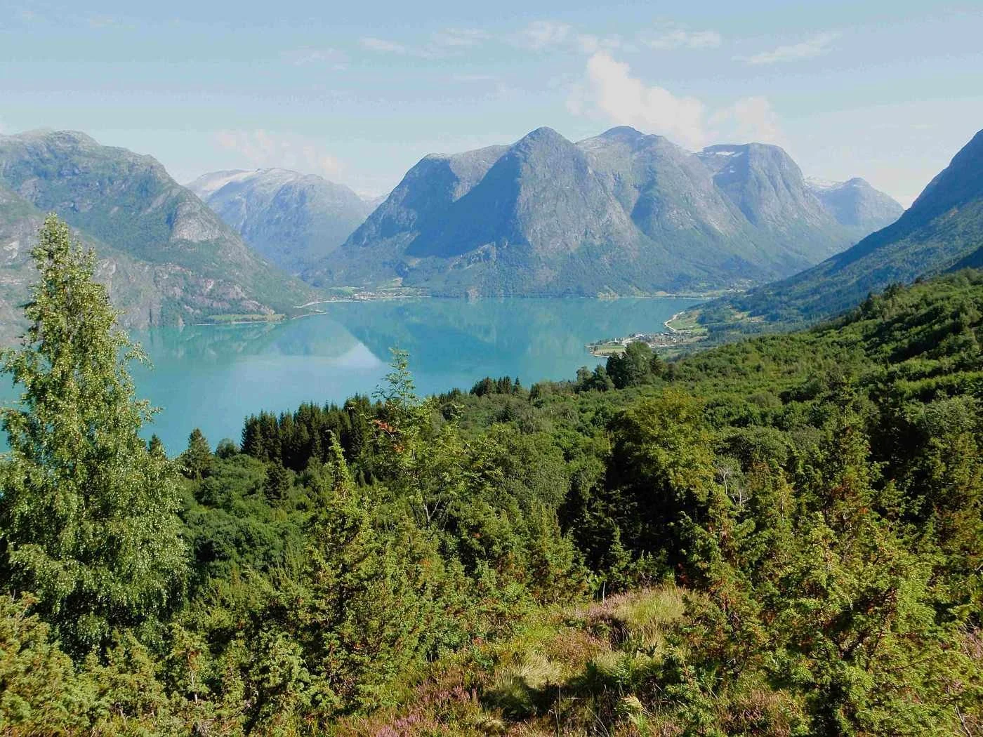
View from Åningehogden. We can see Erdalen to the right and Hjelledalen to the left in the background.
View from Åningehogden towards Flo and Flofjellet.
The high mountain against the skyline on the right side of the image is Stolshyrna (1,852 m a.s.l.).
The valley on the right side of Stolshyrna is called Rinddalen. On the left side lies Vesledalen. The valley furthest to the left leads down to Vollset in Sunnylven.
From Åningehogden, the path climbs up a scree slope before turning left towards a small flat area called Smørhola. The flat section you see at the upper left of the photo is Smørhola.
The path has partly washed away due to a flood that occurred here some time ago.
This is Smørhola. The terrain here is flat and pleasant, providing good grazing for cattle. A lot of meadow buttercups grow up here, which might explain the name.
Cattle avoid eating buttercups because they contain the toxin protoanemonin, which can cause diarrhea.
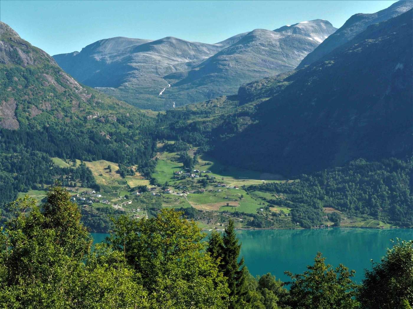
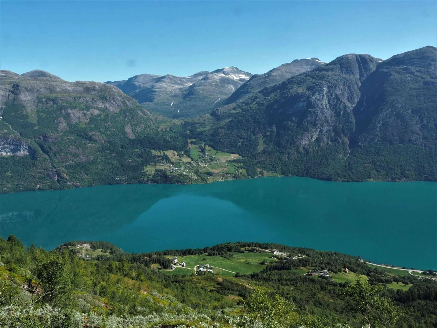
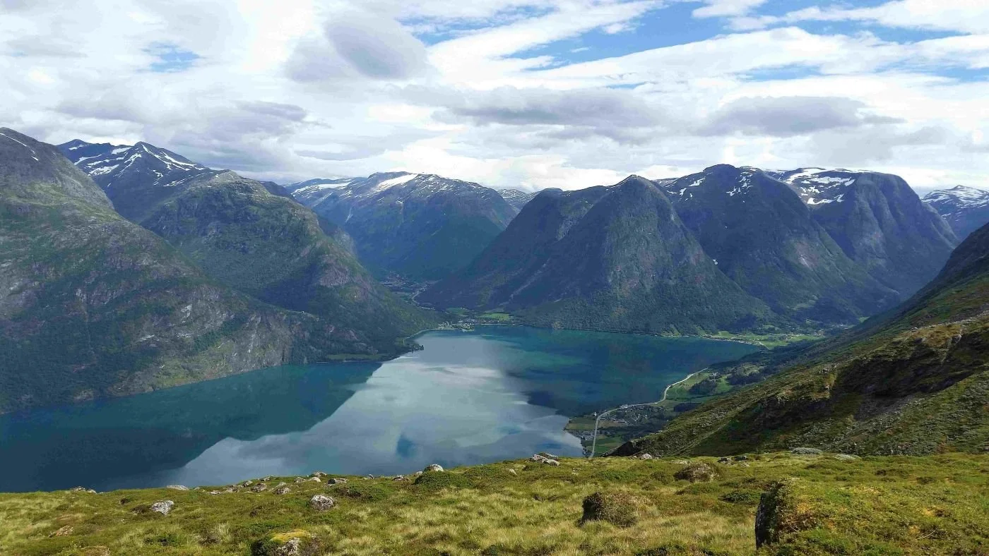
From Smørhola, there is an open view of the villages around Lake Oppstrynsvatnet. Here we can see Strandsida, with part of the Nesje farm closest to us. Further on, you can see Fosnes, and parts of the Erdalen and Hjelledalen valleys.
The steep mountain in the center of the image is Hjellehyrna (1,368 m above sea level)
Smørhola in the foreground
View from Svartesvoda. In the foreground, we see the farms Åning, Brekke, and Tunold – from left to right. In the background, you can see Flo and Flofjellet.
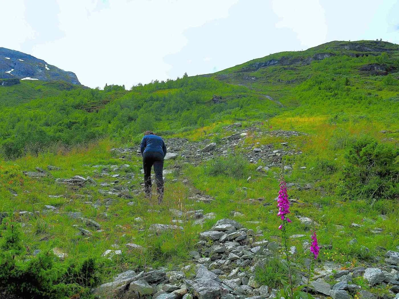
The path follows the Åningselva river for a long stretch before turning right across the ridge between Storskredfjellet and Brekkefjellet. The ridge is located approximately 1,040 meters above sea level.
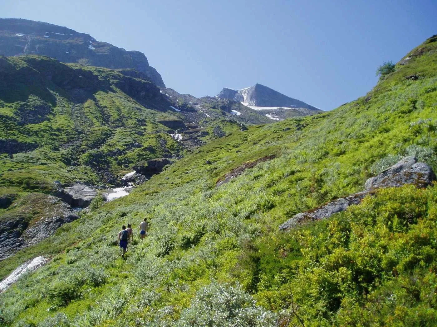
The first section towards the ridge is relatively gentle. In the final part before reaching the top, the path winds in many turns up a steep grassy slope called Øvstebakken.
The photo above shows the area where two men lost their lives during Easter 1947. They had spent the night in the cabin by Lake Instevatnet. A lot of snow fell during the night, and on their way down, they triggered an avalanche that swept them away. A third person was rescued alive from the snow, but he suffered severe injuries and likely died from them a few years later.
In some places, the Åningselva river runs through deep gorges. If you look closely at the photo above, you can see a small birch tree by the riverbank. This is a gorge called Håkajølet. Story goes that a man from the Håka farm at Brekke was riding his horse and went over the edge here. The man survived, but the horse perished. The gorge was named after this incident.
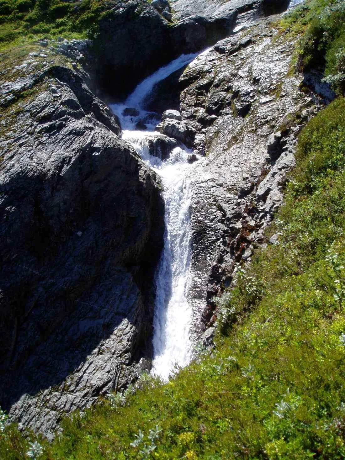
The photo shows a waterfall cascading into the Håkajølet (gorge)
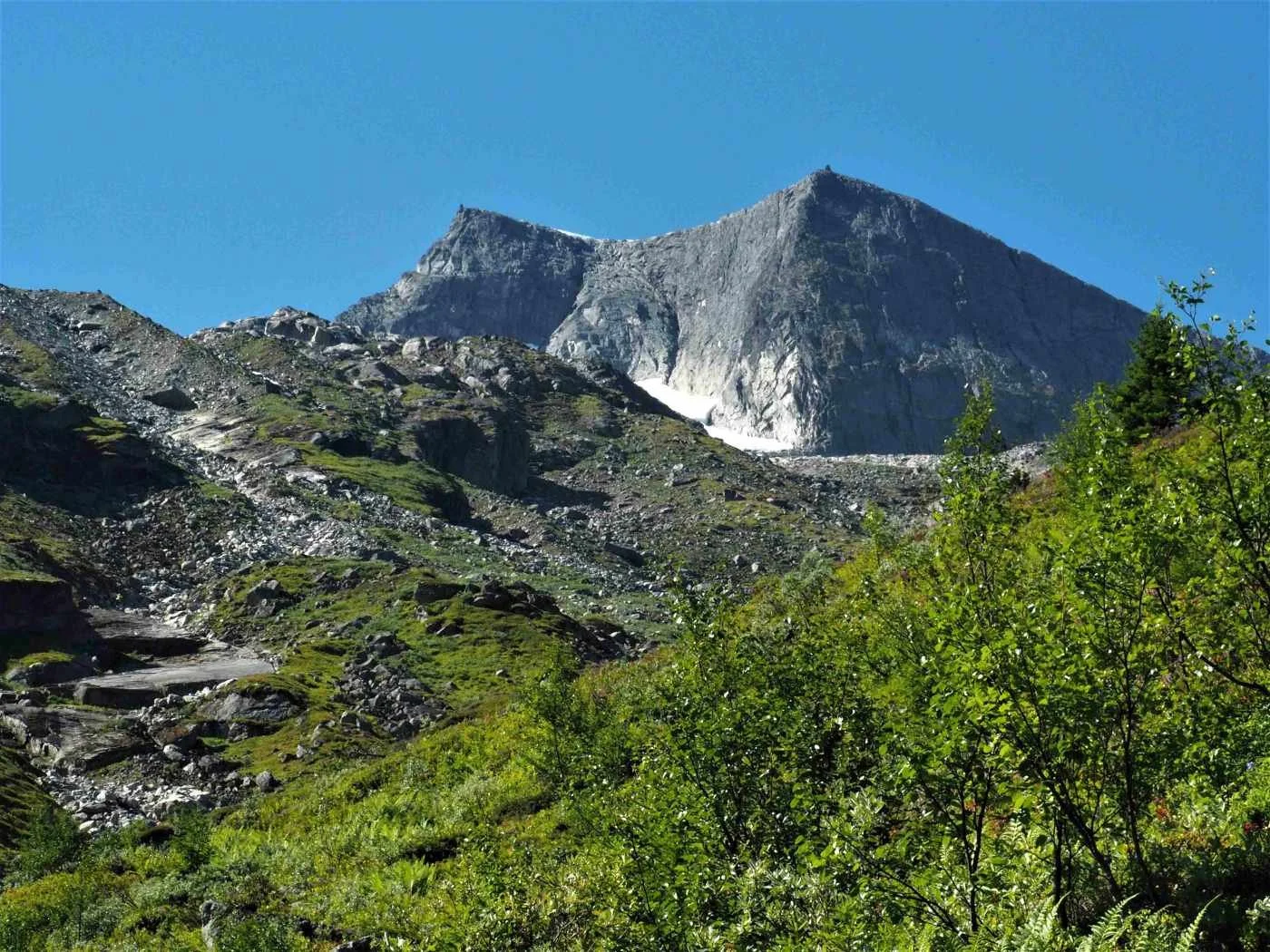
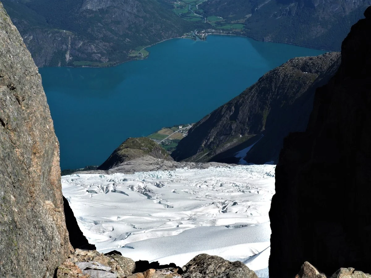
Åningselva (river) cascades in rapids down along the path. We can just barely catch a glimpse of Breifonna – the glacier in front of Mount Storskredfjellet. The light-colored 'belt' on the mountain in the background shows how much the glacier has retreated over the last few centuries. It is a dramatic development we are witnessing.
One wonders how much longer Breifonna will exist.
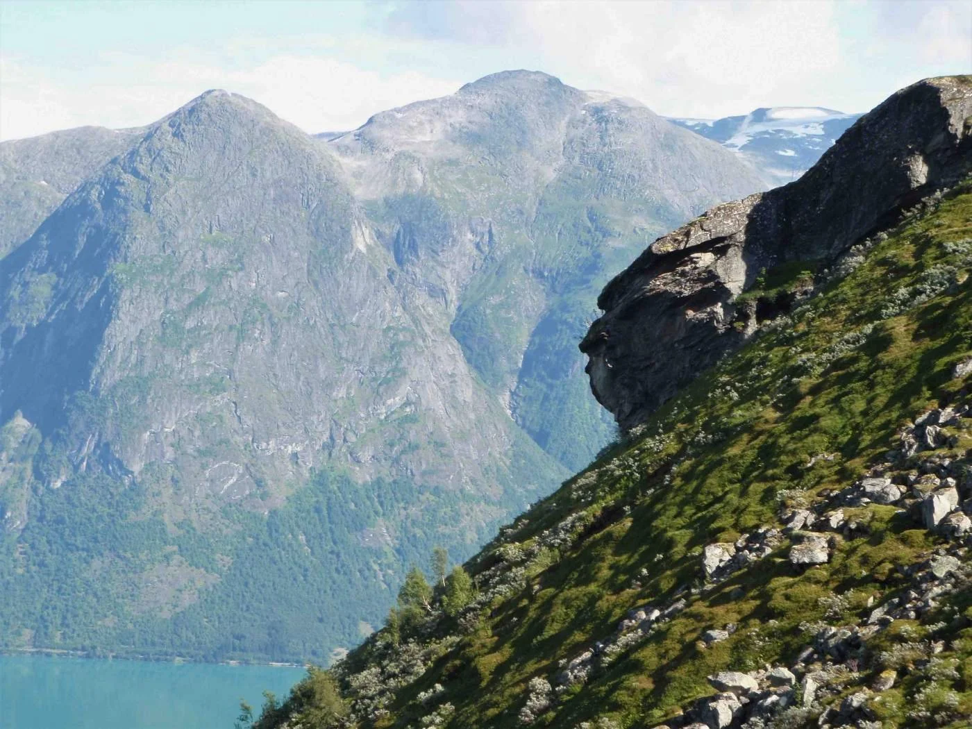
As you pass this rock formation, take a closer look. With a bit of imagination, you might spot several different shapes here.
This crag is called Skuten. It is common for a rocky outcrop that juts out from the landscape to be given this name.
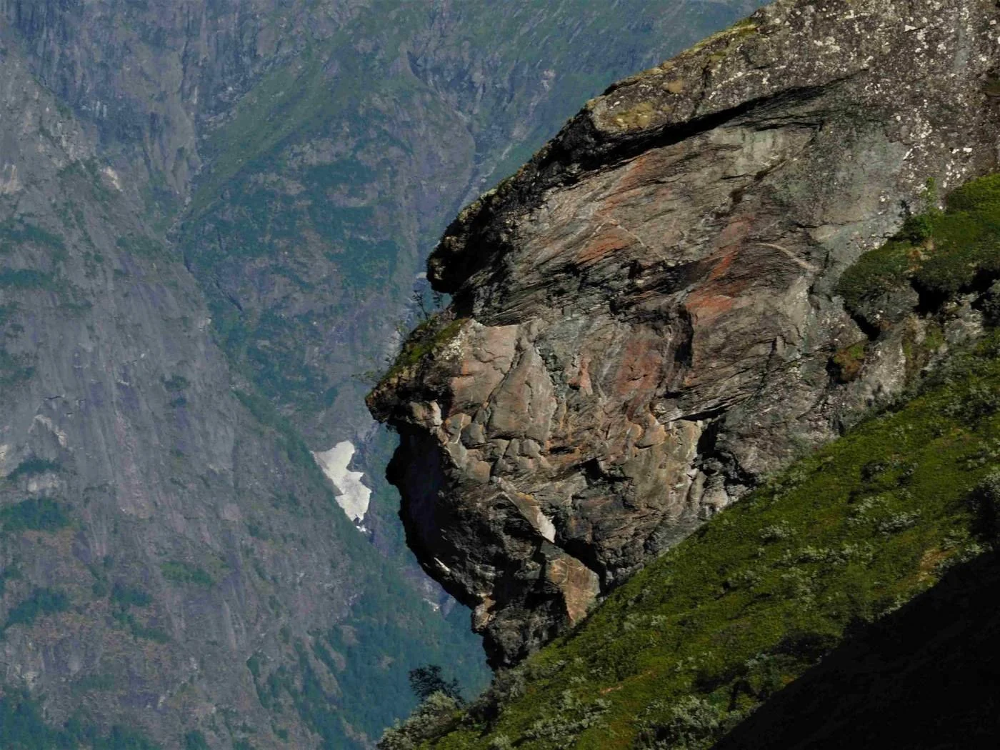
Here is a zoomed-in view of Skuten. What do you see?
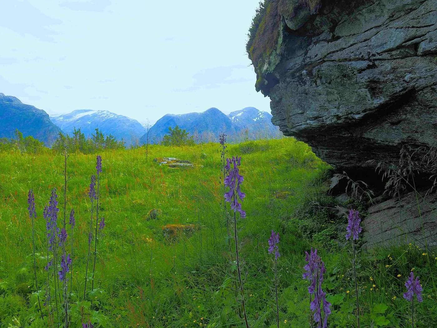
From Skuten and steeply down towards the Åningselva river, there is a depression in the terrain that fills with snow every winter. According to local lore, when this snow gully has melted away in three distinct places, it is safe to hike to Brekkedalen.
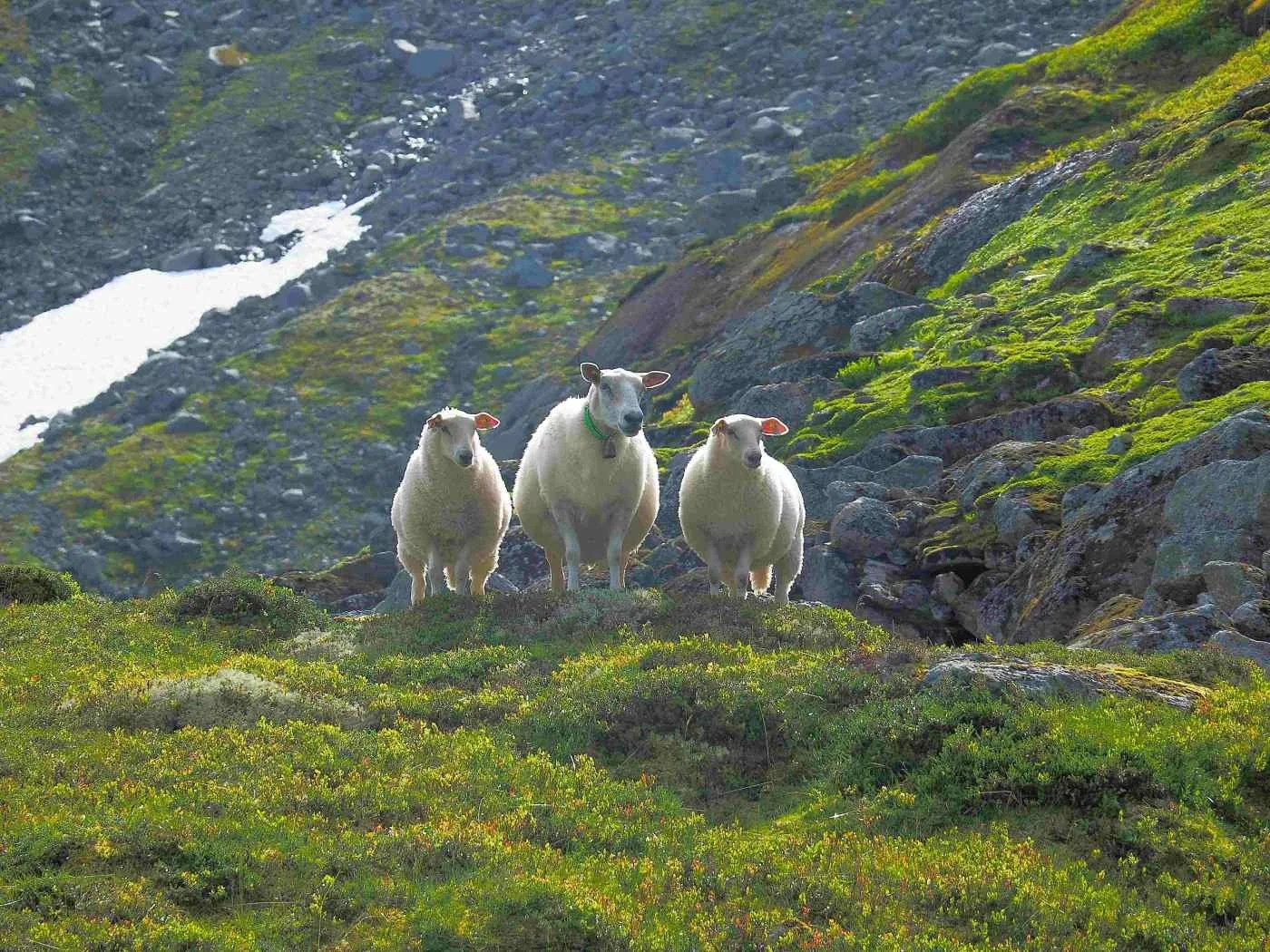
This little sheep family is enjoying life in Brekkedalen. As you can see, they are in good condition, with clean and healthy wool. The landscape in this area provides excellent grazing for sheep.
Unfortunately, the profitability of sheep farming is rather poor, and there are not many sheep farmers left in the village.
View from the ridge between Mount Storskredfjellet and Mount Brekkefjellet.
We see the ridge leading toward Mount Storskredfjellet. On the far right of the image, there is a mountain ridge that leads down to Rjupedalen and Meland.
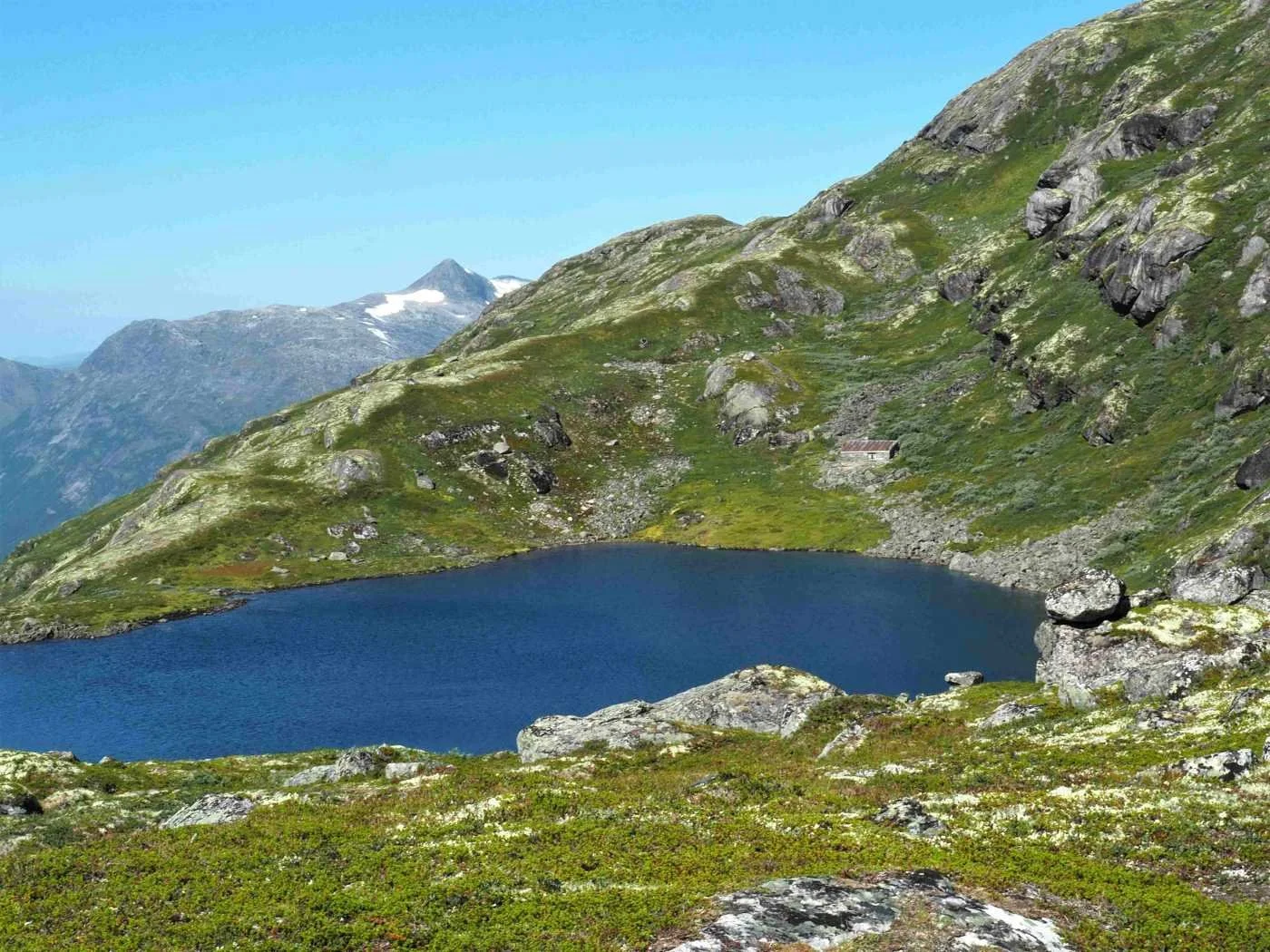
We are looking down towards Lake Instevatnet. Behind the lake, you can see a cabin that is well camouflaged in the terrain.
This was originally a hunting lodge for the Åning, Brekke, and Tunold farms. The cabin was completed in the early 1930s. In recent years, it has seen little use.
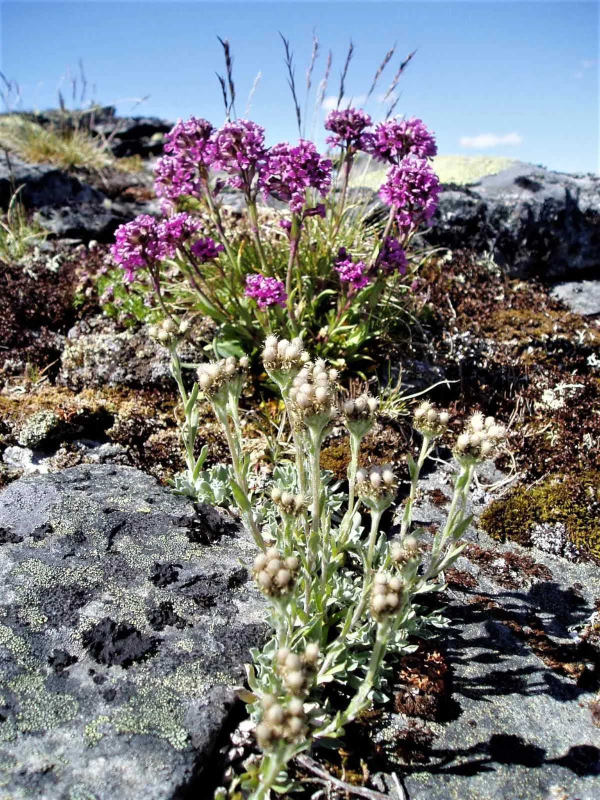
Along the ridge leading up toward Mount Storskredfjellet, you can find several different species of alpine plants.
The image above shows alpine catsfoot (Antennaria alpina) in the foreground and alpine catchfly (Viscaria alpina).
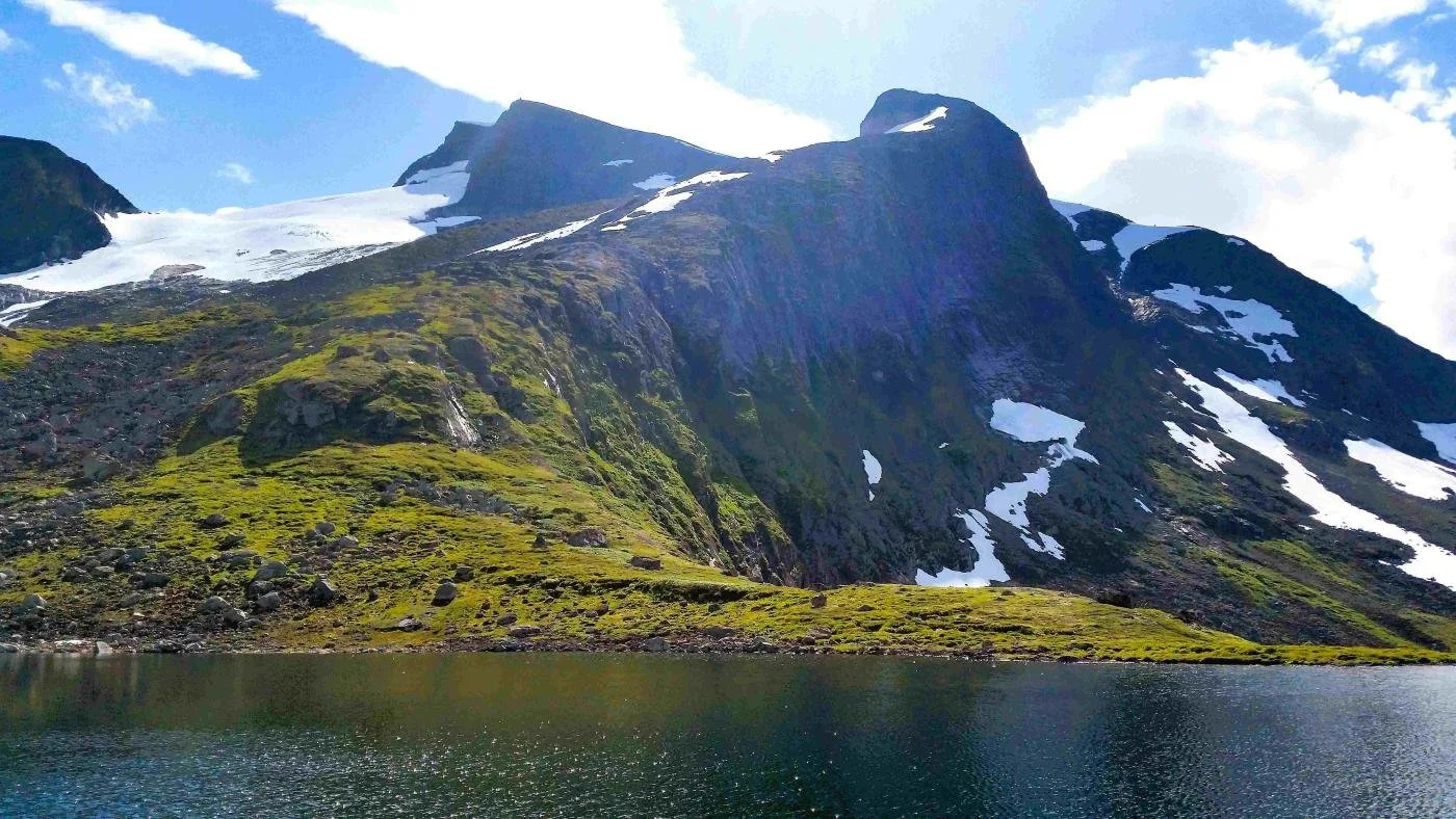
We are looking toward the western part of the Breifonna glacier and Mount Nesjehyrna (1,522 m above sea level). In the background, we can see Hjelle and the Hjelledalen valley.
The photo above shows how the glacier has left behind moraines that can collect large amounts of water during periods of heavy rain or rapid snowmelt. If the water forces its way through these dams of loose debris, it can lead to destructive flash floods.
On several occasions, Åningselva (river) has carried vast amounts of debris from this area, depositing it on both sides of the riverbank down at the Nesje farm.
Several large, impressive cairns have been built along the ridge leading up to Mount Storskredfjellet.
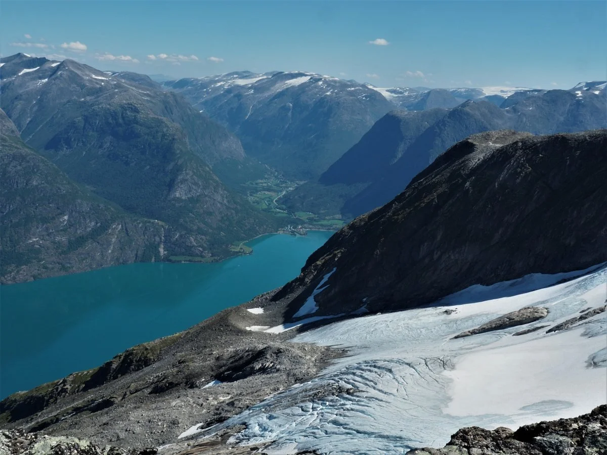
The view is magnificent; the Breifonna glacier with its massive crevasses beneath towering cliffs, the turquoise Lake Oppstrynsvatnet, and the surrounding mountains and villages.
We are looking towards Fosnes and Hjelle, with the Breifonna glacier in the foreground. The small peak rising just below the glacier is Veslehyrna (1,100 m above sea level).
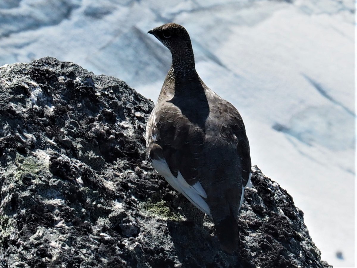
This ptarmigan has been thriving on Mount Storskredfjellet. Unfortunately, the ptarmigan population has declined significantly over the last few decades.
One reason may be that milder winters and later snowfall have made the birds easier prey for predators. Their white winter plumage is triggered by daylight hours, not by when the snow actually arrives.
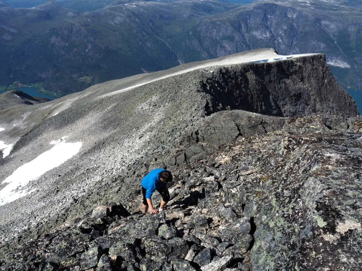
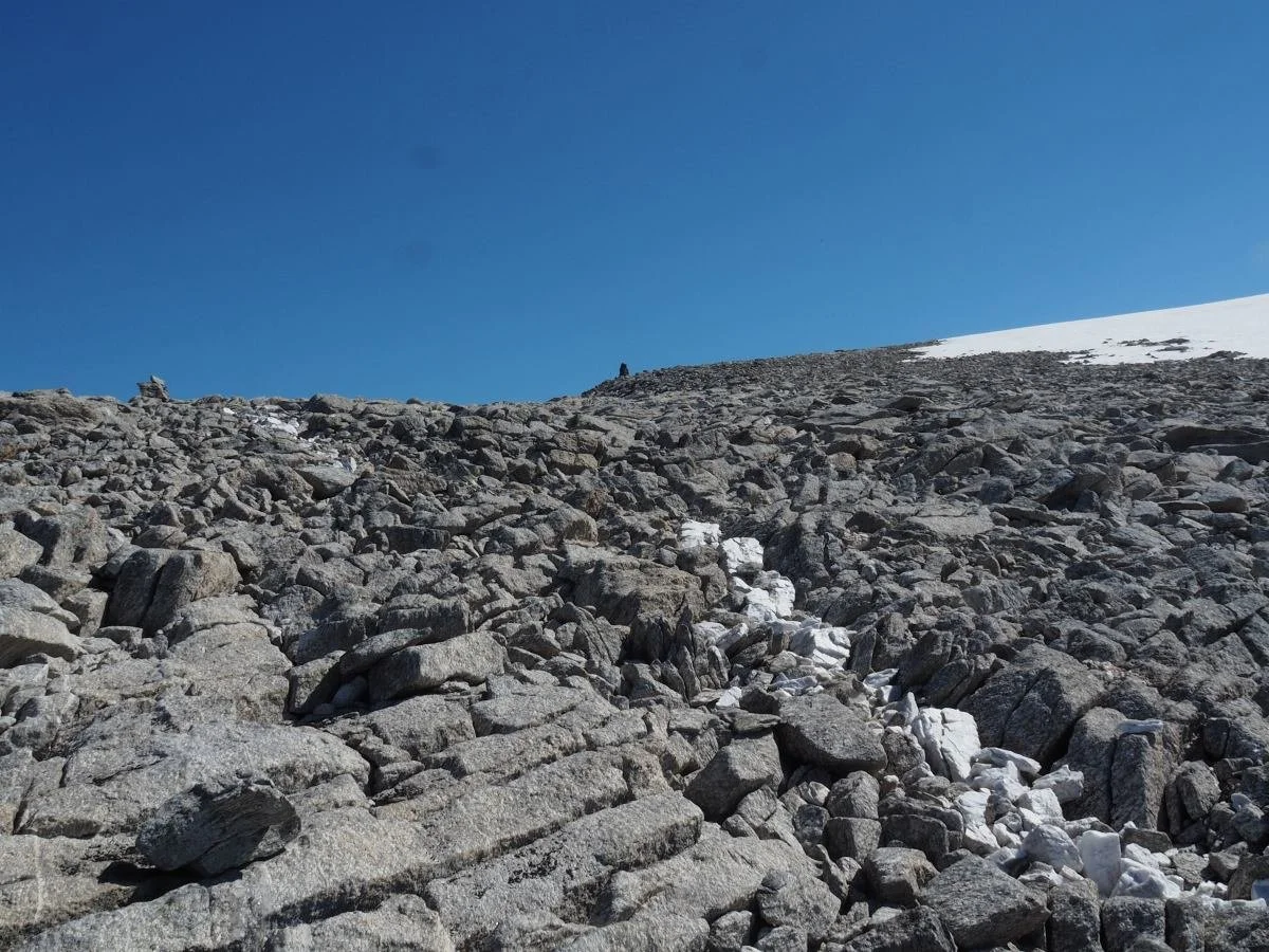
Before you reach the highest plateau, you must traverse a steep slope of large boulders. You need to tread carefully here.
Thousands of years of frost weathering have 'produced' all these rocks. This is known as a blockfield or felsenmeer. This area remained ice-free during the period when the valleys below were covered by the great inland ice sheet.
The white vein in the photo is quartz, a crack in the rock filled with the mineral quartz.
In the mountains around here, gneiss is the most common rock type. It is composed of light bands (quartz and feldspar) and dark bands (mica and amphibole).

You are not far from the highest point, 1,815 meters above sea level. The cairn on the edge of the mountain is the goal of the trip.
fter a long, steep, and strenuous hike, it feels good that the final stretch is across flat terrain.
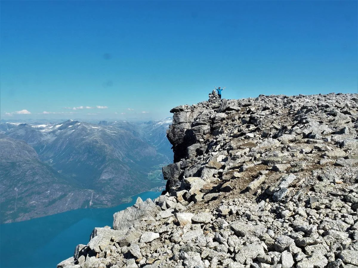
It’s a great feeling to reach the goal after a strenuous hike. The view from the summit is overwhelming.
Do not go too close to the edge of the cliff! There is a lot of loose rock along the precipice.
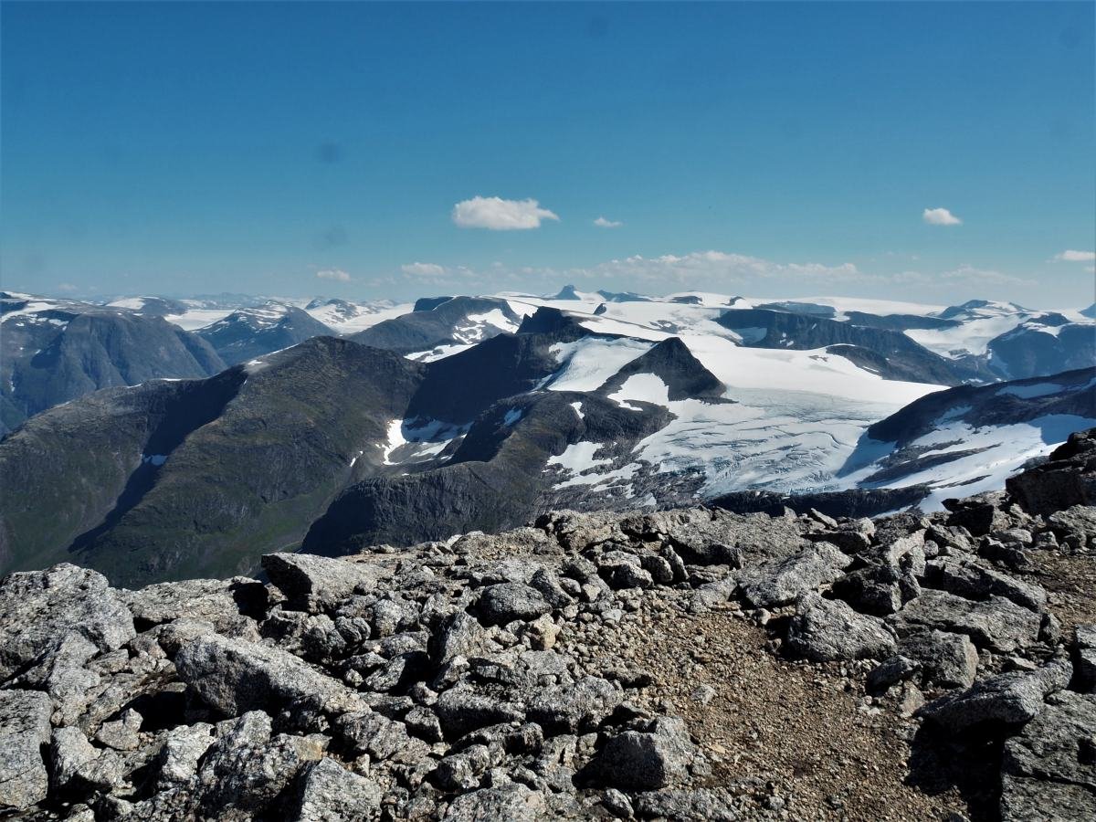
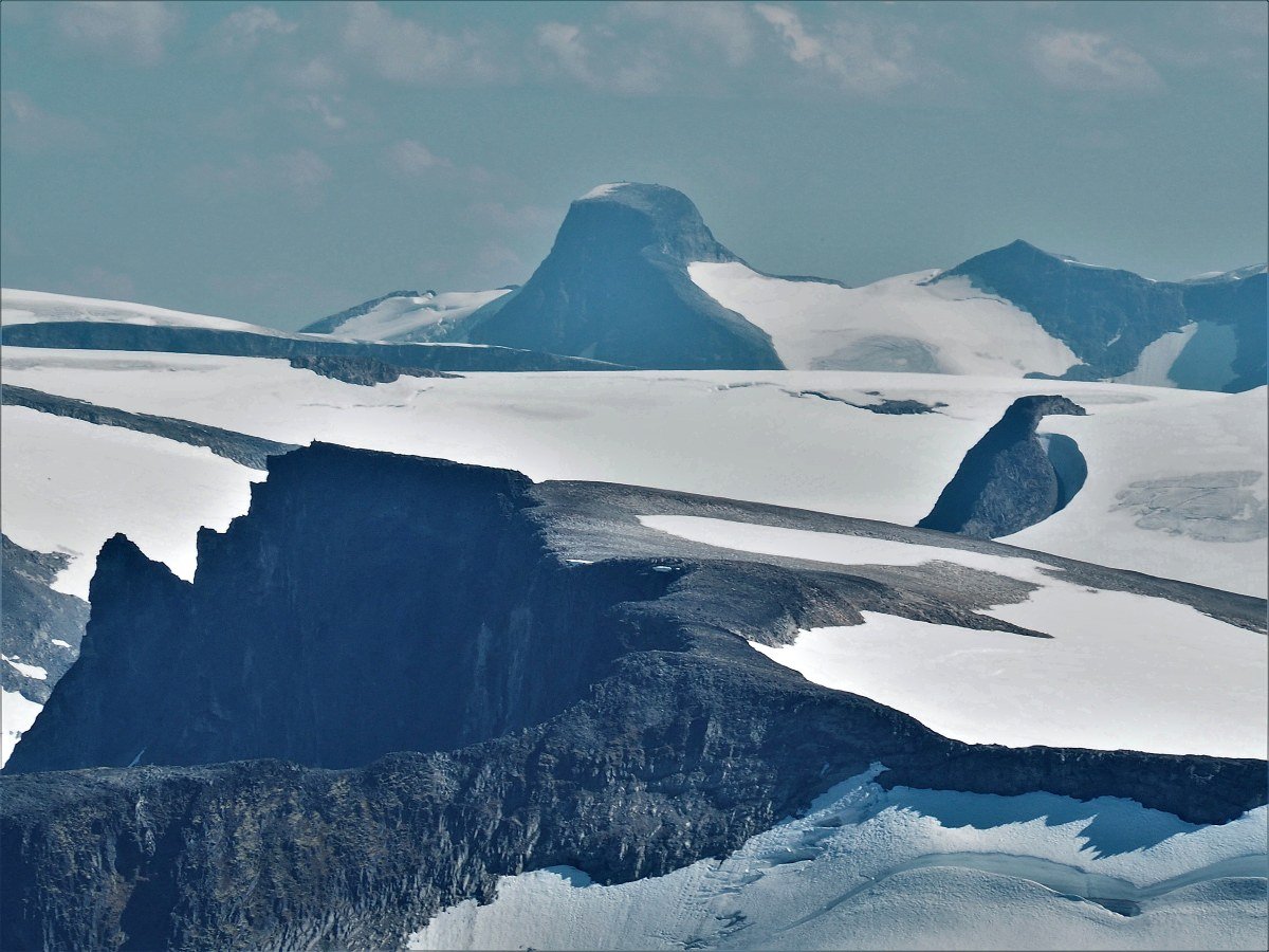
From the summit, you have a view of a vast mountain landscape. We can see Lodalskåpa (2,083 m above sea level) against the horizon in the center of the image. To the left of Lodalskåpa, both the Erdalsbreen and Vesledalsbreen glaciers are visible.
In the foreground, we see the Skålabreen glacier and Tafsehyrna, with Tindefjell appearing further back in the distance.
The photo was taken with a powerful zoom. We can see Lodalskåpa (2,083 m above sea level) in the center against the sky, with Veslekåpa (1,988 m above sea level) to its right.
Tindefjell (1,775 m above sea level) is on the left side of the image.
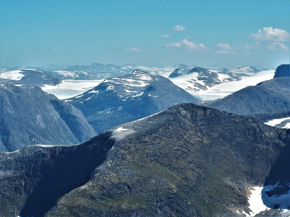
In the foreground, we see Kampen (1,648 m above sea level). To the rear left, the Vesledalsbreen glacier is visible, and to the right, Erdalsbreen. On the left skyline, you can see Tverrådalskyrkja (2,088 m above sea level) – the highest mountain in the Breheimen range.
Further to the right, we can catch a glimpse of the Smørstabbreen glacier with the Smørstabbtindan peaks behind it. This means we can see all the way to Sognefjellet and Jotunheimen.
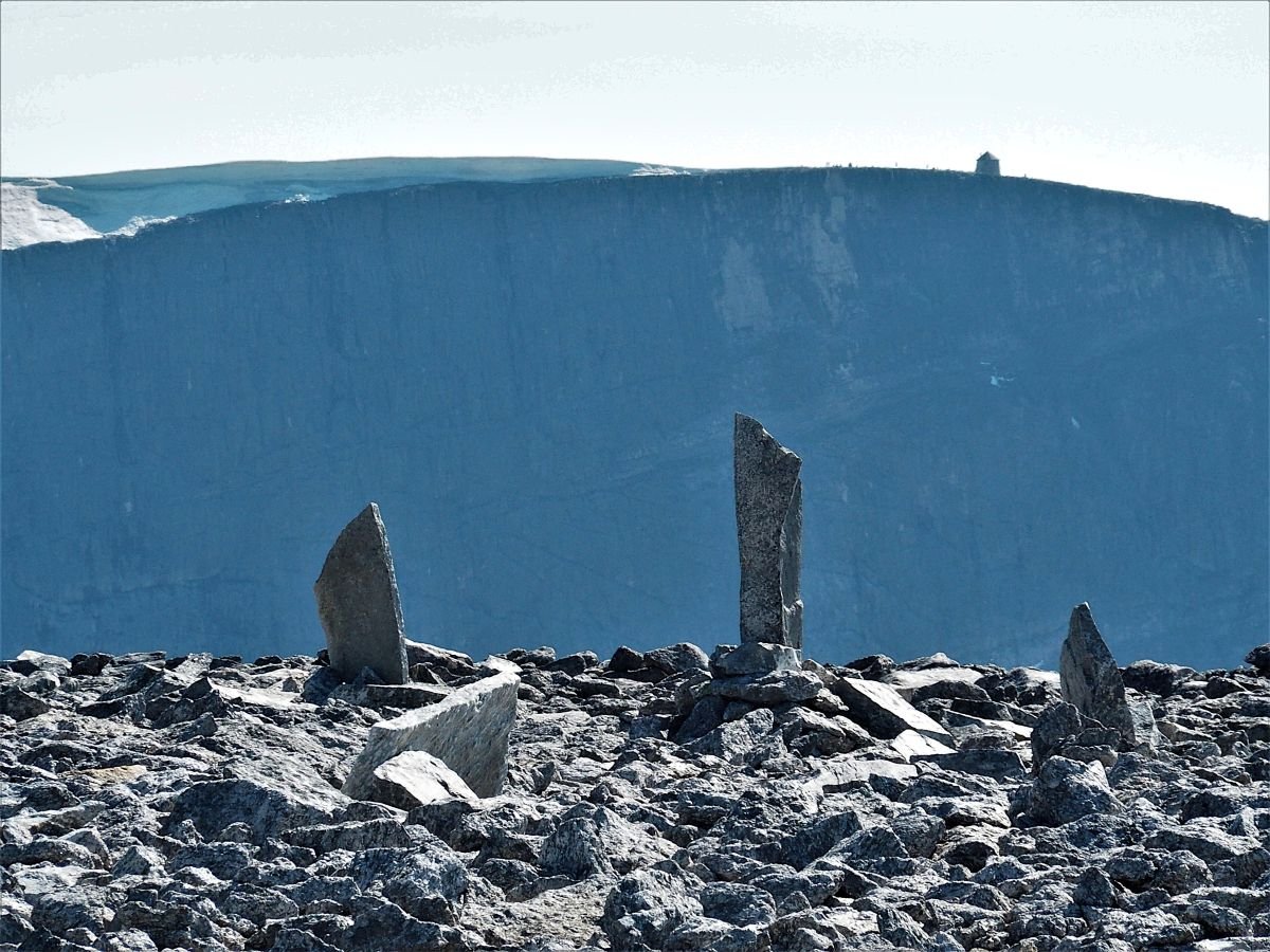
Many people visit the summit of Storskredfjellet, and several have left memorials behind. We can look across to Mount Skåla (1,843 m above sea level) with the famous Kloumann Tower at its peak.
It was Doctor Kloumann who took the initiative to build this tower, which was completed in 1891.
If you arrange to be picked up at Meland, you can choose to take the return trip via Melandsfjellet and the Rjupedalen valley. The terrain here consists mostly of heather and grasslands, making for easy walking.
In the background, we can see Geitafjellshyrna (1,628 m above sea level).
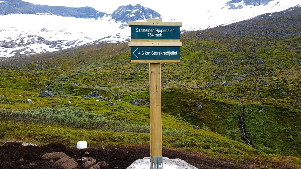
Photo: John Roger Meland
You should aim for Saltsteinen and avoid descending toward the Strynedalen valley too early. From Saltsteinen, there is a cleared and marked path down to Meland.
The path winds its way down through the forest. In the photo, we look across toward Oppstrynskår on the left – and Veslebygda with the Furedalen valley on the right.
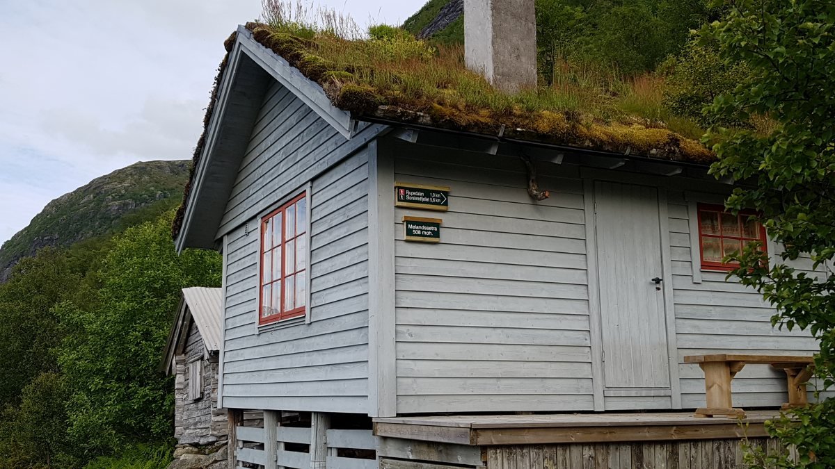
Photo: John Roger Meland
The path passes right by the Melandsetra mountain farm, located 510 meters above sea level. There are very few grazing animals in the area now, and forest and scrub are steadily encroaching on the farm buildings.
Traditional farming at Melandsetra ended in 1949. At that time, there were two small huts (sel) and two barns.
The hut in the foreground belongs to farm unit no. 2. It was built in 1986 on the site of the old barn. The older hut behind it belongs to farm unit no. 1. Farm unit no. 3 also had a hut, but it has since rotted away.
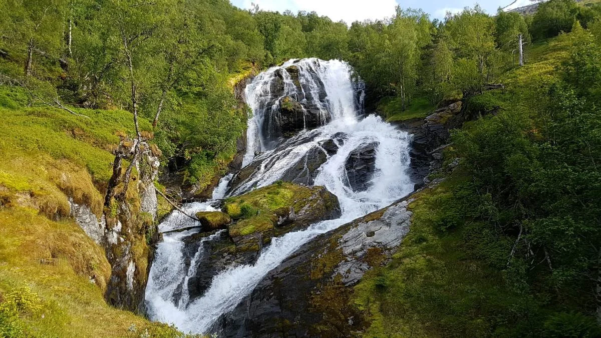
Photo: John Roger Meland
When you reach the forest road, you will see a sign pointing toward Storefossen. It is a powerful waterfall when the water levels are high.
Just before you reach the uppermost caravans at Strynsvatn Camping, there is a parking area. You can arrange to be picked up here.
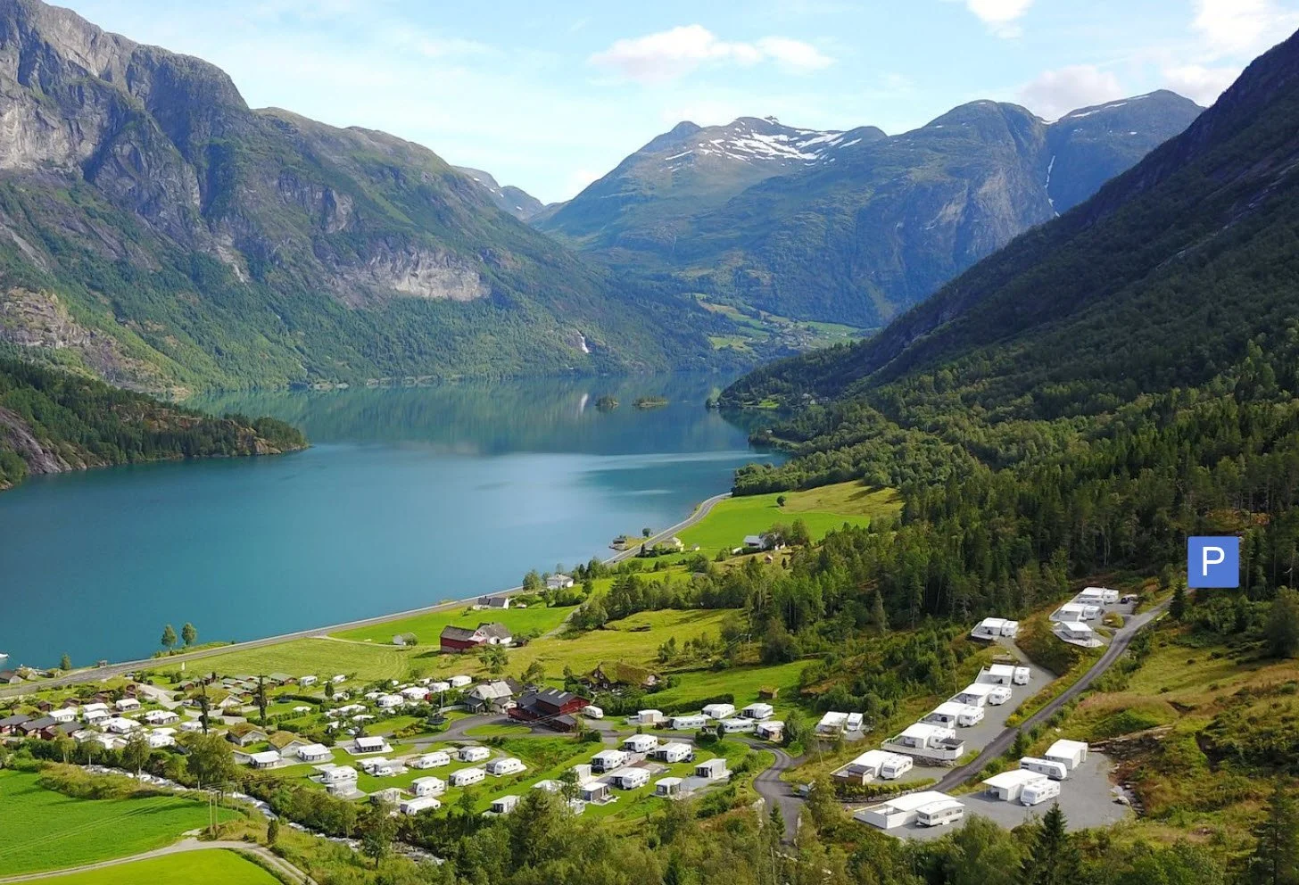
Photo: Strynsvatn Camping website
Strynsvatn Camping is a large, modern, and well-managed campsite located on Rv 15, 12 km east of Stryn town center.
You can park at the end of the road – past the final permanent caravan structure.
Text and photos: Asbjørn Berge 2026